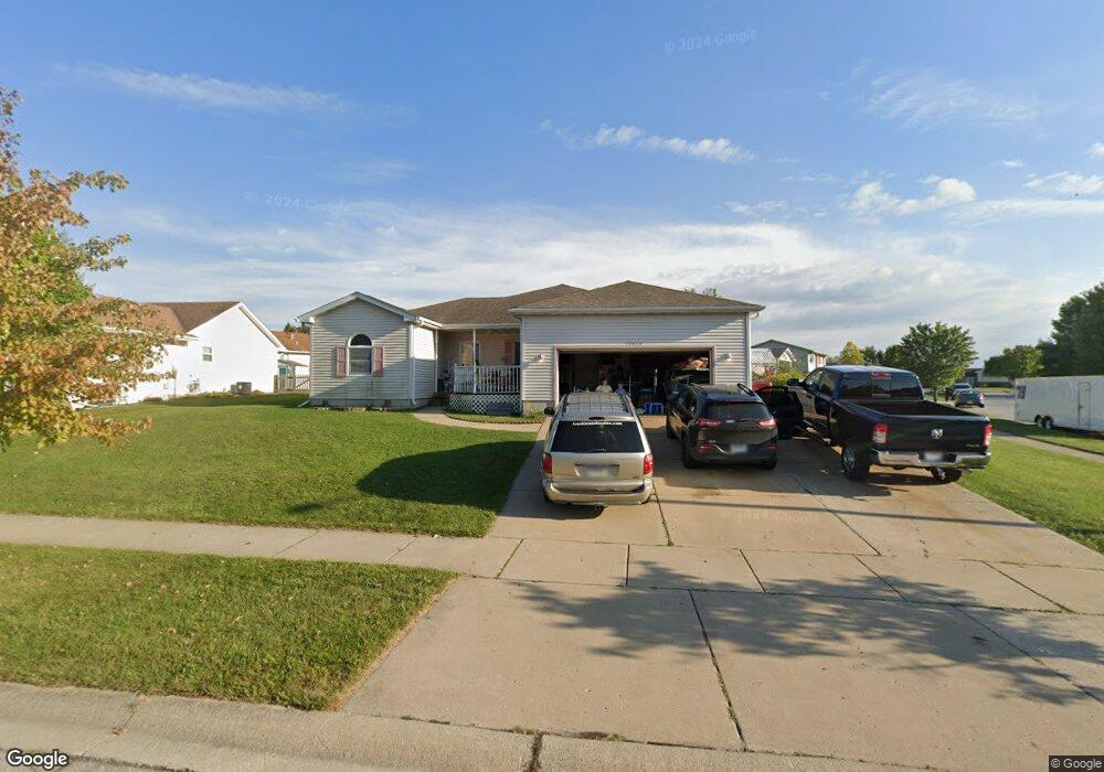
13423 Robin Dr Cedar Lake, IN 46303
Estimated Value: $356,125 - $474,000
3
Beds
2
Baths
1,948
Sq Ft
$204/Sq Ft
Est. Value
About This Home
This home is located at 13423 Robin Dr, Cedar Lake, IN 46303 and is currently estimated at $397,781, approximately $204 per square foot. 13423 Robin Dr is a home located in Lake County with nearby schools including Douglas MacArthur Elementary School, Robert Taft Middle School, and Crown Point High School.
Ownership History
Date
Name
Owned For
Owner Type
Purchase Details
Closed on
Oct 6, 2021
Sold by
Foster Andrea C
Bought by
Foster Andrea C and Gabriel Melissa S
Current Estimated Value
Home Financials for this Owner
Home Financials are based on the most recent Mortgage that was taken out on this home.
Original Mortgage
$166,100
Outstanding Balance
$151,468
Interest Rate
2.8%
Mortgage Type
New Conventional
Estimated Equity
$246,313
Purchase Details
Closed on
Sep 30, 2021
Sold by
Foster Andrea C
Bought by
Foster Andrea C and Gabriel Melissa S
Home Financials for this Owner
Home Financials are based on the most recent Mortgage that was taken out on this home.
Original Mortgage
$166,100
Outstanding Balance
$151,468
Interest Rate
2.8%
Mortgage Type
New Conventional
Estimated Equity
$246,313
Create a Home Valuation Report for This Property
The Home Valuation Report is an in-depth analysis detailing your home's value as well as a comparison with similar homes in the area
Home Values in the Area
Average Home Value in this Area
Purchase History
| Date | Buyer | Sale Price | Title Company |
|---|---|---|---|
| Foster Andrea C | -- | Northwest Indiana Title | |
| Foster Andrea C | -- | Northwest Indiana Title |
Source: Public Records
Mortgage History
| Date | Status | Borrower | Loan Amount |
|---|---|---|---|
| Open | Foster Andrea C | $166,100 | |
| Closed | Foster Andrea C | $166,100 |
Source: Public Records
Tax History Compared to Growth
Tax History
| Year | Tax Paid | Tax Assessment Tax Assessment Total Assessment is a certain percentage of the fair market value that is determined by local assessors to be the total taxable value of land and additions on the property. | Land | Improvement |
|---|---|---|---|---|
| 2024 | $8,651 | $334,400 | $52,200 | $282,200 |
| 2023 | $3,283 | $310,900 | $52,200 | $258,700 |
| 2022 | $3,283 | $296,400 | $52,200 | $244,200 |
| 2021 | $3,130 | $282,800 | $37,400 | $245,400 |
| 2020 | $2,983 | $266,100 | $37,400 | $228,700 |
| 2019 | $2,916 | $260,100 | $37,400 | $222,700 |
| 2018 | $3,252 | $255,000 | $37,400 | $217,600 |
| 2017 | $3,106 | $239,100 | $37,400 | $201,700 |
| 2016 | $3,627 | $235,600 | $37,400 | $198,200 |
| 2014 | $2,911 | $233,300 | $37,400 | $195,900 |
| 2013 | $2,989 | $232,700 | $37,400 | $195,300 |
Source: Public Records
Map
Nearby Homes
- 13443 Superior Ln
- 6101 W 135th Place
- 13526 Superior Ln
- The Powell II Plan at Lakeside
- The Alverstone Plan at Lakeside
- The Monarch Plan at Lakeside
- The Capital Plan at Lakeside
- The Hayes Plan at Lakeside
- The Bennett Plan at Lakeside
- The Princeton Plan at Lakeside
- The Elbert Plan at Lakeside
- The Rainier Plan at Lakeside
- The Torbet Plan at Lakeside
- The Sopris Plan at Lakeside
- The Belford Plan at Lakeside
- The Jacque Plan at Lakeside
- The Huxley Plan at Lakeside
- The Harper Plan at Lakeside
- The Lincoln Plan at Lakeside
- The Harvard Plan at Lakeside
- 13419 Robin Dr
- 13437 Finch Ct
- 13427 Robin Dr
- 13430 Bluebird Ln
- 13417 Robin Dr
- 13443 Finch Ct
- 13436 Bluebird Ln
- 13420 Robin Dr
- 13433 Robin Dr
- 13442 Finch Ct
- 13416 Robin Dr
- 13424 Robin Dr
- 13442 Bluebird Ln
- 13449 Finch Ct
- 13412 Robin Dr
- 13437 Robin Dr
- 13448 Finch Ct
- 13448 Bluebird Ln
- 13428 Robin Dr
- 13408 Robin Dr