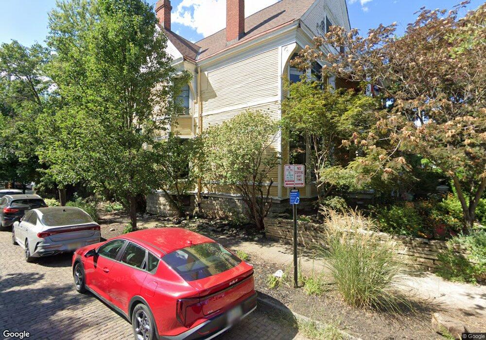
1343 Forsythe Ave Unit 345 Columbus, OH 43201
Dennison Place NeighborhoodEstimated Value: $651,000 - $826,000
4
Beds
3
Baths
3,563
Sq Ft
$211/Sq Ft
Est. Value
About This Home
This home is located at 1343 Forsythe Ave Unit 345, Columbus, OH 43201 and is currently estimated at $750,862, approximately $210 per square foot. 1343 Forsythe Ave Unit 345 is a home located in Franklin County with nearby schools including Hubbard Elementary School, Dominion Middle School, and Whetstone High School.
Ownership History
Date
Name
Owned For
Owner Type
Purchase Details
Closed on
May 5, 1992
Bought by
Ryan Timothy J and Ryan Jean C
Current Estimated Value
Purchase Details
Closed on
May 1, 1985
Purchase Details
Closed on
Jun 1, 1978
Create a Home Valuation Report for This Property
The Home Valuation Report is an in-depth analysis detailing your home's value as well as a comparison with similar homes in the area
Home Values in the Area
Average Home Value in this Area
Purchase History
| Date | Buyer | Sale Price | Title Company |
|---|---|---|---|
| Ryan Timothy J | $110,000 | -- | |
| -- | $78,000 | -- | |
| -- | $46,200 | -- |
Source: Public Records
Tax History Compared to Growth
Tax History
| Year | Tax Paid | Tax Assessment Tax Assessment Total Assessment is a certain percentage of the fair market value that is determined by local assessors to be the total taxable value of land and additions on the property. | Land | Improvement |
|---|---|---|---|---|
| 2024 | $9,441 | $210,360 | $71,790 | $138,570 |
| 2023 | $9,320 | $210,350 | $71,785 | $138,565 |
| 2022 | $10,868 | $209,550 | $55,410 | $154,140 |
| 2021 | $10,888 | $209,550 | $55,410 | $154,140 |
| 2020 | $10,902 | $209,550 | $55,410 | $154,140 |
| 2019 | $9,498 | $156,560 | $42,630 | $113,930 |
| 2018 | $7,992 | $156,560 | $42,630 | $113,930 |
| 2017 | $8,329 | $156,560 | $42,630 | $113,930 |
| 2016 | $7,167 | $108,190 | $29,610 | $78,580 |
| 2015 | $6,506 | $108,190 | $29,610 | $78,580 |
| 2014 | $6,522 | $108,190 | $29,610 | $78,580 |
| 2013 | $2,924 | $98,350 | $26,915 | $71,435 |
Source: Public Records
Map
Nearby Homes
- 154-156 W 6th Ave
- 1298 Hunter Ave
- 343 King Ave Unit 345
- 93 King Ave Unit 95
- 1438-1440 Hunter Ave
- 398 W 5th Ave
- 1245 Pennsylvania Ave
- 396 W 7th Ave
- 422 W 6th Ave
- 63 Smith Place
- 42 King Ave
- 6 1/2 Clark Place
- 1276 N High St Unit 206
- 1276 N High St Unit 402
- 477 W 4th Ave
- 30 W 4th Ave
- 506 Riverfront Ln
- 49 Euclid Ave
- 512 Riverfront Ln
- 18 W 4th Ave
- 1347 Forsythe Ave
- 339 E 4th Ave Unit 1337
- 1351 Forsythe Ave
- 1329 Forsythe Ave
- 1357 Forsythe Ave Unit 359
- 243 W 6th Ave
- 241 W 6th Ave Unit 243
- 1340 Forsythe Ave
- 1361 Forsythe Ave
- 1323 Forsythe Ave
- 1321 Forsythe Ave
- 1350 Neil Ave
- 329 E 4th Ave Unit 1327
- 1352 Neil Ave Unit 354
- 1342 Forsythe Ave Unit 342
- 1330 Forsythe Ave Unit TWENTY
- 1330 Forsythe Ave
- 1315 Forsythe Ave
- 1356 Neil Ave Unit 358
- 1346 Forsythe Ave