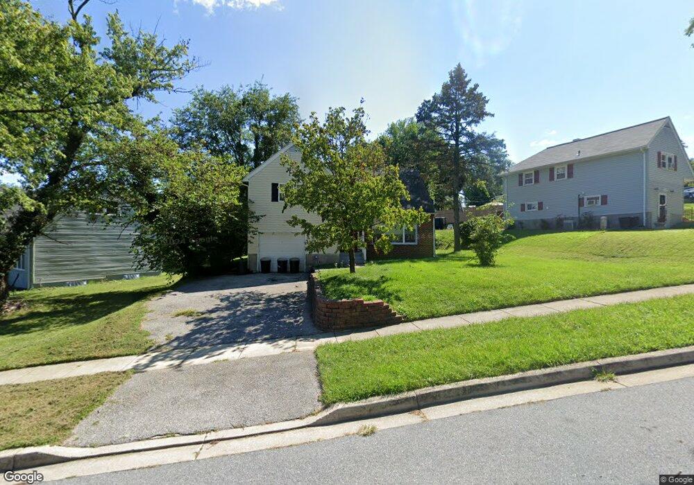
1343 Martin Dr Baltimore, MD 21229
Estimated Value: $264,000 - $334,000
--
Bed
1
Bath
1,512
Sq Ft
$198/Sq Ft
Est. Value
About This Home
This home is located at 1343 Martin Dr, Baltimore, MD 21229 and is currently estimated at $299,210, approximately $197 per square foot. 1343 Martin Dr is a home located in Baltimore County with nearby schools including Edmondson Heights Elementary School, Southwest Academy, and Woodlawn High School.
Ownership History
Date
Name
Owned For
Owner Type
Purchase Details
Closed on
Nov 5, 2010
Sold by
Collick Yvette
Bought by
Clea Raydel and Collick Yvette
Current Estimated Value
Home Financials for this Owner
Home Financials are based on the most recent Mortgage that was taken out on this home.
Original Mortgage
$208,000
Outstanding Balance
$136,446
Interest Rate
6.43%
Mortgage Type
New Conventional
Estimated Equity
$162,764
Purchase Details
Closed on
Aug 30, 2002
Sold by
Morrow Ray A
Bought by
Collick Yvette
Purchase Details
Closed on
Nov 19, 1998
Sold by
Morrow Ray Alton
Bought by
Morrow Ray A and Morrow Evelyn G
Create a Home Valuation Report for This Property
The Home Valuation Report is an in-depth analysis detailing your home's value as well as a comparison with similar homes in the area
Home Values in the Area
Average Home Value in this Area
Purchase History
| Date | Buyer | Sale Price | Title Company |
|---|---|---|---|
| Clea Raydel | -- | -- | |
| Collick Yvette | $125,000 | -- | |
| Morrow Ray A | -- | -- |
Source: Public Records
Mortgage History
| Date | Status | Borrower | Loan Amount |
|---|---|---|---|
| Open | Clea Raydel | $208,000 |
Source: Public Records
Tax History Compared to Growth
Tax History
| Year | Tax Paid | Tax Assessment Tax Assessment Total Assessment is a certain percentage of the fair market value that is determined by local assessors to be the total taxable value of land and additions on the property. | Land | Improvement |
|---|---|---|---|---|
| 2025 | $2,901 | $198,667 | -- | -- |
| 2024 | $2,901 | $180,700 | $56,100 | $124,600 |
| 2023 | $1,359 | $174,100 | $0 | $0 |
| 2022 | $2,637 | $167,500 | $0 | $0 |
| 2021 | $2,451 | $160,900 | $56,100 | $104,800 |
| 2020 | $2,106 | $158,700 | $0 | $0 |
| 2019 | $1,897 | $156,500 | $0 | $0 |
| 2018 | $2,470 | $154,300 | $56,100 | $98,200 |
| 2017 | $1,948 | $151,967 | $0 | $0 |
| 2016 | $2,838 | $149,633 | $0 | $0 |
| 2015 | $2,838 | $147,300 | $0 | $0 |
| 2014 | $2,838 | $147,300 | $0 | $0 |
Source: Public Records
Map
Nearby Homes
- 1024 Wedgewood Rd
- 1638 N Forest Park Ave
- 1143 Granville Rd
- 1715 Langford Rd
- 1201 Saint Agnes Ln
- 905 Cooks Ln
- 813 Wedgewood Rd
- 5427 Channing Rd
- 1515 Langford Rd
- 720 N Chapel Gate Ln
- 1525 Clairidge Rd
- 961 Saint Agnes Ln
- 1523 Clairidge Rd
- 5408 Addington Rd
- 5201 Old Frederick Rd
- 5903 Hilltop Ave
- 0 Franklintown Subdivision Unit MDBA2166112
- 1719 N Forest Park Ave
- 1422 N Forest Park Ave
- 5901 Sunset Ave
- 1345 Martin Dr
- 1347 Martin Dr
- 1109 Sedgewood Rd
- 1110 Stamford Rd
- 1108 Stamford Rd
- 1346 Martin Dr
- 1344 Martin Dr
- 1107 Sedgewood Rd
- 1348 Martin Dr
- 1342 Martin Dr
- 1350 Martin Dr
- 1106 Stamford Rd
- 1106 Sedgewood Rd
- 1340 Martin Dr
- 1105 Sedgewood Rd
- 1401 Martin Dr
- 1123 Stamford Rd
- 1112 Stamford Rd
- 1104 Sedgewood Rd
- 1121 Stamford Rd