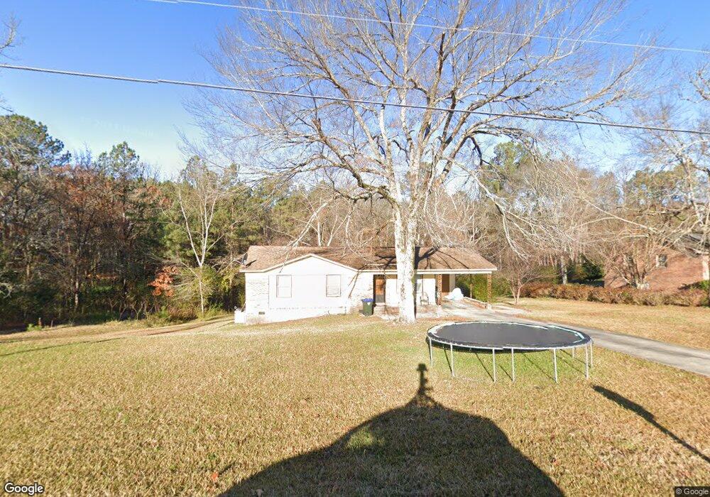
1344 Locustwood Ave Lancaster, SC 29720
Estimated Value: $106,000 - $237,000
--
Bed
2
Baths
1,188
Sq Ft
$123/Sq Ft
Est. Value
About This Home
This home is located at 1344 Locustwood Ave, Lancaster, SC 29720 and is currently estimated at $146,231, approximately $123 per square foot. 1344 Locustwood Ave is a home located in Lancaster County with nearby schools including Erwin Elementary School, South Middle School, and Lancaster High School.
Ownership History
Date
Name
Owned For
Owner Type
Purchase Details
Closed on
Mar 23, 2021
Sold by
Farino Marcella H
Bought by
Jamas 1 Lancaster Llc
Current Estimated Value
Create a Home Valuation Report for This Property
The Home Valuation Report is an in-depth analysis detailing your home's value as well as a comparison with similar homes in the area
Home Values in the Area
Average Home Value in this Area
Purchase History
| Date | Buyer | Sale Price | Title Company |
|---|---|---|---|
| Jamas 1 Lancaster Llc | $62,000 | None Available |
Source: Public Records
Tax History Compared to Growth
Tax History
| Year | Tax Paid | Tax Assessment Tax Assessment Total Assessment is a certain percentage of the fair market value that is determined by local assessors to be the total taxable value of land and additions on the property. | Land | Improvement |
|---|---|---|---|---|
| 2024 | $1,110 | $3,354 | $588 | $2,766 |
| 2023 | $1,109 | $3,354 | $588 | $2,766 |
| 2022 | $1,105 | $3,354 | $588 | $2,766 |
| 2021 | $1,088 | $3,354 | $588 | $2,766 |
| 2020 | $1,043 | $3,216 | $588 | $2,628 |
| 2019 | $1,089 | $3,216 | $588 | $2,628 |
| 2018 | $1,048 | $3,216 | $588 | $2,628 |
| 2017 | $983 | $0 | $0 | $0 |
| 2016 | $970 | $0 | $0 | $0 |
| 2015 | $890 | $0 | $0 | $0 |
| 2014 | $890 | $0 | $0 | $0 |
| 2013 | $890 | $0 | $0 | $0 |
Source: Public Records
Map
Nearby Homes
- 1447 Carmel Rd
- 1324 Jefferson St
- 1530 Danlee Dr
- 5.45 acres Memorial Park Rd
- 3.04 acres Memorial Park Rd
- 1428 Boxwood Ave
- 1795 Grace Ave
- 1324 Mason St
- 1746 Grace Ave Unit 1
- 1499 Old Landsford Rd
- 1631 Oakdale Dr
- TBD Old Landsford Rd
- 1801 Grace Ave
- 1500 Victoria St Unit 4
- 1501 Victoria St Unit 11
- 1453 Old Landsford Rd
- 1503 Victoria St
- 1250 Hampton Grace Ave
- 1509 Victoria St Unit 13
- 1817 Grace Ave
- 1336 Locustwood Ave
- 4 Old Greenbriar Cir
- 0000 Old Greenbriar Dr
- 11 Carmel Rd
- 0000 Carmel Rd
- 1324 Carmel Rd
- 1357 Locustwood Ave
- 1373 Locustwood Ave
- 102 Westminister Dr
- 106 Westminister Dr
- 96 Westminister Dr
- 1386 Locustwood Ave
- 1341 Carmel Rd
- 101 Westminister Dr
- 95 Westminister Dr
- 0000 Old Greenbriar Cir
- 0000 Old Greenbriar Cir Unit 7
- 0000 Old Greenbriar Cir Unit 4
- 0000 Old Greenbriar Cir Unit 49
- 0000 Westminister Dr