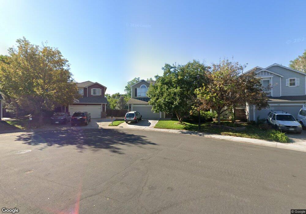
13445 Vine St Thornton, CO 80241
Hunters Glen NeighborhoodEstimated Value: $488,324 - $529,000
3
Beds
3
Baths
1,450
Sq Ft
$353/Sq Ft
Est. Value
About This Home
This home is located at 13445 Vine St, Thornton, CO 80241 and is currently estimated at $511,581, approximately $352 per square foot. 13445 Vine St is a home located in Adams County with nearby schools including Hunters Glen Elementary School, Century Middle School, and Mountain Range High School.
Ownership History
Date
Name
Owned For
Owner Type
Purchase Details
Closed on
Apr 29, 2004
Sold by
Feeney Michael F
Bought by
Dumas Bryan Paul Gabriel and Dumas Jennifer Michelle
Current Estimated Value
Home Financials for this Owner
Home Financials are based on the most recent Mortgage that was taken out on this home.
Original Mortgage
$186,400
Outstanding Balance
$89,851
Interest Rate
6.12%
Mortgage Type
Unknown
Estimated Equity
$421,730
Purchase Details
Closed on
Jun 7, 2002
Sold by
Apuan Michael and Apuan Andrea S
Bought by
Feeney Michael F
Home Financials for this Owner
Home Financials are based on the most recent Mortgage that was taken out on this home.
Original Mortgage
$184,000
Interest Rate
6.77%
Purchase Details
Closed on
Nov 21, 1995
Sold by
Kaufman & Broad Of Colorado Inc
Bought by
Apuan Michael and Apuan Andra S
Home Financials for this Owner
Home Financials are based on the most recent Mortgage that was taken out on this home.
Original Mortgage
$137,350
Interest Rate
7.36%
Create a Home Valuation Report for This Property
The Home Valuation Report is an in-depth analysis detailing your home's value as well as a comparison with similar homes in the area
Home Values in the Area
Average Home Value in this Area
Purchase History
| Date | Buyer | Sale Price | Title Company |
|---|---|---|---|
| Dumas Bryan Paul Gabriel | $233,000 | Guardian Title Agency Llc | |
| Feeney Michael F | $230,000 | -- | |
| Apuan Michael | $144,594 | -- |
Source: Public Records
Mortgage History
| Date | Status | Borrower | Loan Amount |
|---|---|---|---|
| Open | Dumas Bryan Paul Gabriel | $186,400 | |
| Previous Owner | Feeney Michael F | $184,000 | |
| Previous Owner | Apuan Michael | $137,350 |
Source: Public Records
Tax History
| Year | Tax Paid | Tax Assessment Tax Assessment Total Assessment is a certain percentage of the fair market value that is determined by local assessors to be the total taxable value of land and additions on the property. | Land | Improvement |
|---|---|---|---|---|
| 2025 | $3,193 | $32,640 | $7,210 | $25,430 |
| 2024 | $3,193 | $30,010 | $6,630 | $23,380 |
| 2023 | $3,161 | $34,570 | $6,970 | $27,600 |
| 2022 | $2,808 | $25,490 | $7,160 | $18,330 |
| 2021 | $2,900 | $25,490 | $7,160 | $18,330 |
| 2020 | $2,666 | $23,900 | $7,360 | $16,540 |
| 2019 | $2,672 | $23,900 | $7,360 | $16,540 |
| 2018 | $2,572 | $22,350 | $7,490 | $14,860 |
| 2017 | $2,338 | $22,350 | $7,490 | $14,860 |
| 2016 | $1,996 | $18,570 | $4,300 | $14,270 |
| 2015 | $1,993 | $18,570 | $4,300 | $14,270 |
| 2014 | -- | $16,820 | $3,820 | $13,000 |
Source: Public Records
Map
Nearby Homes
- 13508 Vine St
- 1960 E 135th Place
- 1672 E 131st Ct
- 58 Blue Heron Dr
- 13337 Elizabeth Ct
- 7 Sandpiper Cir
- 2942 E 135th Place
- 2066 E 129th Ave
- 13486 Clayton St
- 2746 E 132nd Place
- 1162 E 130th Ave Unit B
- 2275 E 129th Ave
- 1174 E 130th Dr
- 2615 Signal Creek Dr
- 2973 E 133rd Ln
- 12885 Vine St
- 12905 Lafayette St Unit H
- 2297 E 128th Ave
- 13550 Washington St Unit 7C
- 13262 Pearl Cir
Your Personal Tour Guide
Ask me questions while you tour the home.