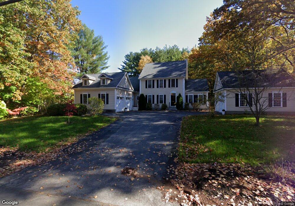
1345 Union St Manchester, NH 03104
Estimated Value: $904,000 - $1,007,000
4
Beds
4
Baths
3,887
Sq Ft
$250/Sq Ft
Est. Value
About This Home
This home is located at 1345 Union St, Manchester, NH 03104 and is currently estimated at $973,000, approximately $250 per square foot. 1345 Union St is a home located in Hillsborough County with nearby schools including Webster School, Hillside Middle School, and Manchester Central High School.
Ownership History
Date
Name
Owned For
Owner Type
Purchase Details
Closed on
Jun 12, 2025
Sold by
Monteith Richard and Monteith Melanie
Bought by
Monteith Ft and Monteith
Current Estimated Value
Purchase Details
Closed on
Feb 24, 2022
Sold by
1345 Union Rt
Bought by
Monteith Richard and Monteith Melanie
Home Financials for this Owner
Home Financials are based on the most recent Mortgage that was taken out on this home.
Original Mortgage
$628,000
Interest Rate
3.55%
Mortgage Type
Purchase Money Mortgage
Purchase Details
Closed on
Dec 11, 2019
Sold by
Coppola Dawn M
Bought by
1345 Union Street Rt
Purchase Details
Closed on
Mar 6, 2008
Sold by
Kenney Wayne and Kenney Elaine
Bought by
Coppola Dawn M
Create a Home Valuation Report for This Property
The Home Valuation Report is an in-depth analysis detailing your home's value as well as a comparison with similar homes in the area
Home Values in the Area
Average Home Value in this Area
Purchase History
| Date | Buyer | Sale Price | Title Company |
|---|---|---|---|
| Monteith Ft | -- | None Available | |
| Monteith Ft | -- | None Available | |
| Monteith Richard | $785,000 | None Available | |
| Monteith Richard | $785,000 | None Available | |
| 1345 Union Street Rt | -- | None Available | |
| 1345 Union Street Rt | -- | None Available | |
| Coppola Dawn M | $600,000 | -- | |
| Coppola Dawn M | $600,000 | -- |
Source: Public Records
Mortgage History
| Date | Status | Borrower | Loan Amount |
|---|---|---|---|
| Previous Owner | Monteith Richard | $628,000 | |
| Previous Owner | Coppola Dawn M | $400,000 | |
| Previous Owner | Coppola Dawn M | $250,000 |
Source: Public Records
Tax History Compared to Growth
Tax History
| Year | Tax Paid | Tax Assessment Tax Assessment Total Assessment is a certain percentage of the fair market value that is determined by local assessors to be the total taxable value of land and additions on the property. | Land | Improvement |
|---|---|---|---|---|
| 2024 | $13,966 | $713,300 | $138,700 | $574,600 |
| 2023 | $13,453 | $713,300 | $138,700 | $574,600 |
| 2022 | $13,011 | $713,300 | $138,700 | $574,600 |
| 2021 | $12,611 | $713,300 | $138,700 | $574,600 |
| 2020 | $13,289 | $538,900 | $107,200 | $431,700 |
| 2019 | $13,106 | $538,900 | $107,200 | $431,700 |
| 2018 | $18,646 | $538,900 | $107,200 | $431,700 |
| 2017 | $18,549 | $538,900 | $107,200 | $431,700 |
| 2016 | $12,470 | $538,900 | $107,200 | $431,700 |
| 2015 | $12,158 | $518,700 | $95,700 | $423,000 |
| 2014 | $12,189 | $518,700 | $95,700 | $423,000 |
| 2013 | $11,759 | $518,700 | $95,700 | $423,000 |
Source: Public Records
Map
Nearby Homes
- 1366 Beech St
- 106 Walnut Hill Ave
- 120 Ledgewood Rd
- 191 Whitford St
- 1060 Ray St
- 2434 Elm St
- 55 Trenton St
- 351 Straw Hill Rd
- 203 Straw Hill Rd
- 37 Michael St
- 24 Charles Chase Way
- 2143 Elm St
- 144 Whitney Ave
- 190 Chase Way
- 552 Oak St
- 65 Victoria St Unit 42
- 506 Oak St
- 887 Chestnut St
- 490 River Rd Unit 13
- 490 River Rd Unit 30