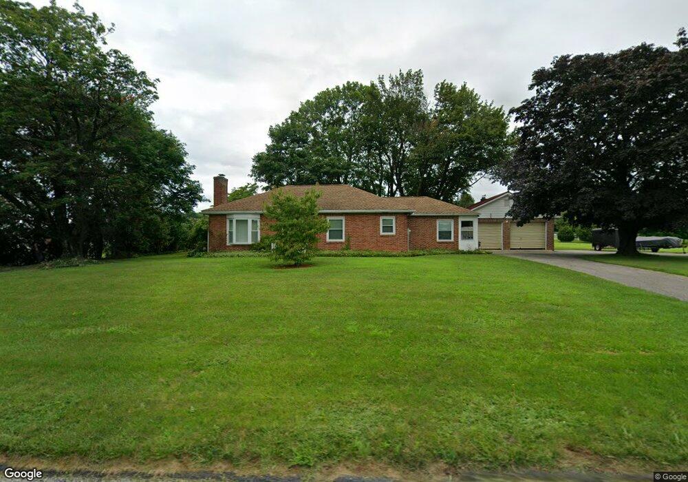
13469 Winterstown Rd Felton, PA 17322
Estimated Value: $262,000 - $317,000
3
Beds
1
Bath
1,232
Sq Ft
$237/Sq Ft
Est. Value
About This Home
This home is located at 13469 Winterstown Rd, Felton, PA 17322 and is currently estimated at $291,886, approximately $236 per square foot. 13469 Winterstown Rd is a home located in York County with nearby schools including North Hopewell-Winterstown Elementary School, Red Lion Area Junior High School, and Red Lion Area Senior High School.
Ownership History
Date
Name
Owned For
Owner Type
Purchase Details
Closed on
May 29, 1998
Sold by
Gemmill Bruce E and Gemmill June J
Bought by
Martin Randy S and Martin Betty J
Current Estimated Value
Home Financials for this Owner
Home Financials are based on the most recent Mortgage that was taken out on this home.
Original Mortgage
$102,950
Outstanding Balance
$20,721
Interest Rate
7.12%
Estimated Equity
$271,165
Create a Home Valuation Report for This Property
The Home Valuation Report is an in-depth analysis detailing your home's value as well as a comparison with similar homes in the area
Home Values in the Area
Average Home Value in this Area
Purchase History
| Date | Buyer | Sale Price | Title Company |
|---|---|---|---|
| Martin Randy S | $108,400 | -- |
Source: Public Records
Mortgage History
| Date | Status | Borrower | Loan Amount |
|---|---|---|---|
| Open | Martin Randy S | $102,950 |
Source: Public Records
Tax History Compared to Growth
Tax History
| Year | Tax Paid | Tax Assessment Tax Assessment Total Assessment is a certain percentage of the fair market value that is determined by local assessors to be the total taxable value of land and additions on the property. | Land | Improvement |
|---|---|---|---|---|
| 2025 | $4,150 | $131,710 | $48,030 | $83,680 |
| 2024 | $4,021 | $131,710 | $48,030 | $83,680 |
| 2023 | $4,021 | $131,710 | $48,030 | $83,680 |
| 2022 | $4,021 | $131,710 | $48,030 | $83,680 |
| 2021 | $3,889 | $131,710 | $48,030 | $83,680 |
| 2020 | $3,889 | $131,710 | $48,030 | $83,680 |
| 2019 | $3,876 | $131,710 | $48,030 | $83,680 |
| 2018 | $3,876 | $131,710 | $48,030 | $83,680 |
| 2017 | $3,876 | $131,710 | $48,030 | $83,680 |
| 2016 | $0 | $131,710 | $48,030 | $83,680 |
| 2015 | -- | $131,710 | $48,030 | $83,680 |
| 2014 | -- | $131,710 | $48,030 | $83,680 |
Source: Public Records
Map
Nearby Homes
- 12706 High Point Rd
- 11983 Tree Ln
- 0 Oak Ridge Ave
- 16434 Cross Roads Ave
- 4389 Hess Rd
- 13846 Ridge Rd
- 13859 Ebaugh Rd
- 0 Seitz Rd
- 1680 Wood Crest Ln
- 290 Neff Rd
- Lot #1 Bowman School Rd
- 7923 Hickory Rd
- 180 Patterson Dr Unit 50
- 160 Patterson Dr Unit 48
- 150 Patterson Dr Unit 47
- 10 Black Oak Ct
- 15792 Cross Mill Rd
- 786 Arbor Dr
- 276 Oakbrook Dr
- 1059 Main Street Extension
- 13437 Winterstown Rd
- 13478 Winterstown Rd
- 4460 Evergreen Rd
- 13397 Winterstown Rd
- 4344 Evergreen Rd
- 4834 Church Rd
- 13590 Winterstown Rd
- 4852 Church Rd
- 4341 Evergreen Rd
- 4272 Evergreen Rd
- 4311 Evergreen Rd
- 13329 Winterstown Rd
- 13292 Winterstown Rd
- 13579 Winterstown Rd
- 4769 Church Rd
- 4739 Church Rd
- 4240 Evergreen Rd
- 4275 Evergreen Rd
- 13661 Winterstown Rd
- 4947 Church Rd