13470 Highway 503 Decatur, MS 39327
Estimated payment $2,968/month
About This Lot
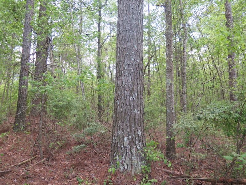
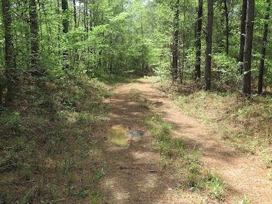
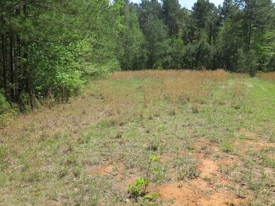
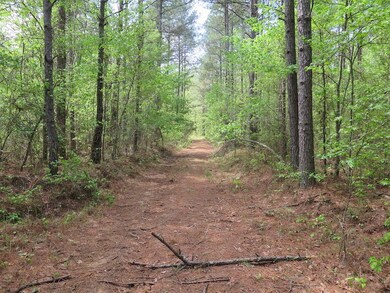
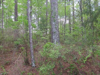
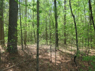
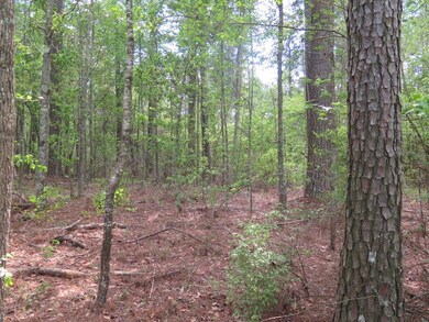
Discover this remarkable property featuring approximately 570 feet of direct frontage on State Highway 503. Spanning beautiful countryside, this land is predominantly covered with mature pine timber-a recent timber valuation indicates an excellent return on your investment. Walker Branch winds through the southwest corner providing a natural water source that supports the abundant wildlife population. Lots of deer and turkey tracts were visible on the initial walk-through of the property. Interior logging roads and ATV trails crisscross the property making it easy to explore and enjoy. Ideally situated between Decatur and Interstate 20 this tract offers both seclusion and convenience. Whether you’re looking to subdivide for future development, invest in timber, or create a private hunting retreat this property checks every box. The adjoining 15 acres and home are available for purchase if you prefer a move-in-ready residence or this property has many sites to build your forever home. Don’t miss this unique opportunity to own a versatile piece of land in a highly desirable location! Contact us today for more details or to schedule your showing.

Property Details
Property Type
- Land
Est. Annual Taxes
- $2,774
Year Built
- 1996
Lot Details
- Current uses include hunting/fishing, timber
- Potential uses include for development
Map
Home Values in the Area
Average Home Value in this Area
Tax History
| Year | Tax Paid | Tax Assessment Tax Assessment Total Assessment is a certain percentage of the fair market value that is determined by local assessors to be the total taxable value of land and additions on the property. | Land | Improvement |
|---|---|---|---|---|
| 2024 | $2,774 | $32,292 | $0 | $0 |
| 2023 | $2,743 | $32,394 | $0 | $0 |
| 2022 | $2,718 | $32,493 | $0 | $0 |
| 2021 | $2,751 | $30,641 | $0 | $0 |
| 2020 | $2,729 | $30,458 | $0 | $0 |
| 2019 | $2,752 | $30,511 | $0 | $0 |
| 2018 | $2,664 | $30,625 | $0 | $0 |
| 2017 | $2,469 | $29,090 | $0 | $0 |
| 2016 | $2,413 | $28,827 | $0 | $0 |
| 2015 | -- | $28,567 | $0 | $0 |
| 2014 | -- | $28,337 | $0 | $0 |
Property History
| Date | Event | Price | Change | Sq Ft Price |
|---|---|---|---|---|
| 04/22/2025 04/22/25 | For Sale | $895,000 | +83.0% | -- |
| 04/15/2025 04/15/25 | For Sale | $489,000 | +15.1% | -- |
| 04/10/2025 04/10/25 | For Sale | $425,000 | -- | $133 / Sq Ft |
- 625 Midway Rd
- 16785 Highway 503
- 0 10th ( Lot 2) St Unit 24-711
- 0 10th (Lot 1) St Unit 24-709
- 0 Eastside Dr
- 7749 Hickory Little Rock Rd
- 0 Congregate Rd
- 0000 Pleasant Ridge Rd
- 0 Airport Rd
- 266 Smede St
- 65 Martin Luther King St
- 506 N Pilate Ave
- 4074 Pleasant Ridge Rd
- 517 6th St
- 18159 Mississippi 15
- 0 High St
- Lot 3 Triple Ridge Blvd
- 0 1st Ave
- 103 Rew St
- 0 Wickware Rd