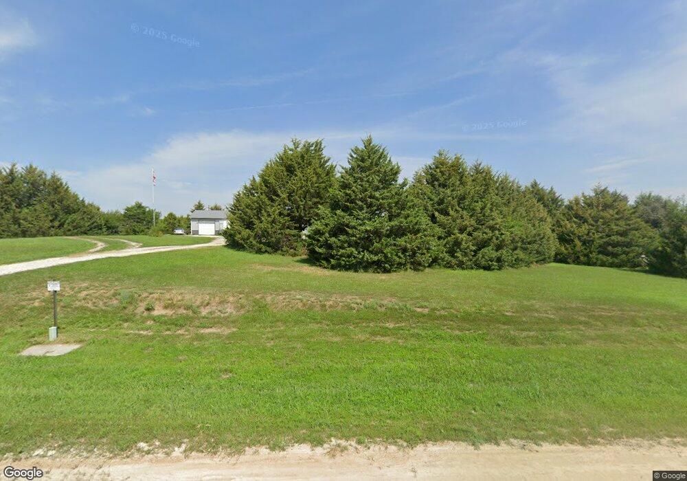
13477 Curtis Cir Wamego, KS 66547
Estimated Value: $342,000 - $426,000
3
Beds
3
Baths
2,482
Sq Ft
$157/Sq Ft
Est. Value
About This Home
This home is located at 13477 Curtis Cir, Wamego, KS 66547 and is currently estimated at $389,948, approximately $157 per square foot. 13477 Curtis Cir is a home located in Pottawatomie County with nearby schools including Rock Creek Junior/Senior High School.
Ownership History
Date
Name
Owned For
Owner Type
Purchase Details
Closed on
Jul 7, 2012
Sold by
Henke Klint L and Henke Darcey R
Bought by
Lewis Ricky A and Lewis Rosalind L
Current Estimated Value
Home Financials for this Owner
Home Financials are based on the most recent Mortgage that was taken out on this home.
Original Mortgage
$235,000
Outstanding Balance
$161,910
Interest Rate
3.63%
Estimated Equity
$228,038
Purchase Details
Closed on
Aug 14, 2008
Sold by
Henne Janice Lynne
Bought by
Henke Klint L and Henke Darcy R
Home Financials for this Owner
Home Financials are based on the most recent Mortgage that was taken out on this home.
Original Mortgage
$70,500
Interest Rate
6.54%
Purchase Details
Closed on
Feb 15, 2006
Sold by
Reid Anthony J and Reid Dawn M
Bought by
Henne Janice Lynne
Create a Home Valuation Report for This Property
The Home Valuation Report is an in-depth analysis detailing your home's value as well as a comparison with similar homes in the area
Home Values in the Area
Average Home Value in this Area
Purchase History
| Date | Buyer | Sale Price | Title Company |
|---|---|---|---|
| Lewis Ricky A | -- | None Available | |
| Henke Klint L | -- | Kansas Secured Title Manhatt | |
| Henne Janice Lynne | -- | None Available |
Source: Public Records
Mortgage History
| Date | Status | Borrower | Loan Amount |
|---|---|---|---|
| Open | Lewis Ricky A | $235,000 | |
| Previous Owner | Henke Klint L | $70,500 |
Source: Public Records
Tax History Compared to Growth
Tax History
| Year | Tax Paid | Tax Assessment Tax Assessment Total Assessment is a certain percentage of the fair market value that is determined by local assessors to be the total taxable value of land and additions on the property. | Land | Improvement |
|---|---|---|---|---|
| 2025 | $3,539 | $37,866 | $5,106 | $32,760 |
| 2024 | $35 | $36,789 | $4,914 | $31,875 |
| 2023 | $3,584 | $35,637 | $4,953 | $30,684 |
| 2022 | $2,967 | $31,341 | $4,808 | $26,533 |
| 2021 | $2,967 | $29,434 | $4,463 | $24,971 |
| 2020 | $2,967 | $29,258 | $4,463 | $24,795 |
| 2019 | $3,062 | $29,794 | $4,463 | $25,331 |
| 2018 | $3,149 | $29,764 | $4,494 | $25,270 |
| 2017 | $2,726 | $29,074 | $4,494 | $24,580 |
| 2016 | $2,595 | $28,628 | $4,322 | $24,306 |
| 2015 | -- | $28,149 | $4,281 | $23,868 |
| 2014 | -- | $27,749 | $4,188 | $23,561 |
Source: Public Records
Map
Nearby Homes
- 13000 Anthony Dr
- 4225 Rockenham Rd
- 4075 Rockenham Cir
- 14362 Prairie W
- 14344 Prairie W
- 00000 Prairie Trail (Lot #3)
- 00000 Wildwood Cir
- 14226 Prairie W
- 00000 Prairie Trail
- 14205 Prairie Trail
- 14409 Wildwood Cir
- 14416 Wildwood Cir
- 14391 Prairie Trail
- 14380 Prairie Trail
- 14373 Prairie Trail
- 13318 Woodland Dr
- 14434 Wildwood Cir
- 14470 Wildwood Cir
- 13880 Berry Ln
- 14578 Wildwood Cir
- 13450 Curtis Cir
- 13485 Curtis Cir
- 13580 Vineyard Cir
- 13520 Curtis Cir
- 5454 Vineyard Rd
- 13555 Curtis Cir
- 13532 Vineyard Cir
- 13525 Wildridge Dr
- 13495 Wildridge Rd
- 13525 Wildridge Dr
- 13575 Wildridge Rd
- 13508 Vineyard Rd
- 13445 Wildridge Rd
- 13575 Wildridge Dr
- 5522 Vineyard Rd
- 13520 Wildridge Rd
- 13395 Wildridge Dr
- 13460 Wildridge Rd
- 13383 Wildridge Dr
- 13482 Wildridge Rd
