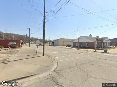
1348 County Highway 216 Chaffee, MO 63740
Estimated Value: $244,000 - $649,325
3
Beds
3
Baths
1,740
Sq Ft
$216/Sq Ft
Est. Value
About This Home
This home is located at 1348 County Highway 216, Chaffee, MO 63740 and is currently estimated at $376,081, approximately $216 per square foot. 1348 County Highway 216 is a home located in Scott County with nearby schools including Chaffee Elementary School and Chaffee Junior/Senior High School.
Ownership History
Date
Name
Owned For
Owner Type
Purchase Details
Closed on
Oct 12, 2021
Sold by
Westrich Joint Revocable Trust
Bought by
Randolph David T and Randolph Caitlin M
Current Estimated Value
Home Financials for this Owner
Home Financials are based on the most recent Mortgage that was taken out on this home.
Original Mortgage
$191,820
Outstanding Balance
$178,303
Interest Rate
2.8%
Mortgage Type
Future Advance Clause Open End Mortgage
Estimated Equity
$220,244
Create a Home Valuation Report for This Property
The Home Valuation Report is an in-depth analysis detailing your home's value as well as a comparison with similar homes in the area
Home Values in the Area
Average Home Value in this Area
Purchase History
| Date | Buyer | Sale Price | Title Company |
|---|---|---|---|
| Randolph David T | -- | Guardian Land Title | |
| Randolph David | -- | Guardian Land Title | |
| Kester Lucas D | -- | Guardian Land Title |
Source: Public Records
Mortgage History
| Date | Status | Borrower | Loan Amount |
|---|---|---|---|
| Closed | Randolph David | -- | |
| Open | Kester Lucas D | $191,820 | |
| Closed | Randolph David | $115,130 | |
| Closed | Randolph David T | $168,512 |
Source: Public Records
Tax History Compared to Growth
Tax History
| Year | Tax Paid | Tax Assessment Tax Assessment Total Assessment is a certain percentage of the fair market value that is determined by local assessors to be the total taxable value of land and additions on the property. | Land | Improvement |
|---|---|---|---|---|
| 2024 | $1,089 | $21,370 | $0 | $0 |
| 2023 | $1,047 | $21,370 | $0 | $0 |
| 2022 | $1,047 | $20,530 | $0 | $0 |
| 2021 | $1,205 | $23,050 | $0 | $0 |
| 2020 | $1,106 | $22,090 | $0 | $0 |
| 2019 | -- | $22,090 | $0 | $0 |
| 2018 | -- | $21,390 | $0 | $0 |
| 2017 | -- | $21,390 | $0 | $0 |
| 2014 | -- | $21,130 | $0 | $0 |
| 2011 | -- | $21,060 | $0 | $0 |
Source: Public Records
Map
Nearby Homes
- 115 Cook Ave
- 122 W Parker Ave
- 130 Gray Ave
- 429 W Parker Ave
- 415 Gray Ave
- 614 Hubbard Dr
- 10912 Missouri 77
- 301 Kimberly Dr
- 52 State Highway Pp
- 309 Steck St
- 2501 Ellis St
- 2514 James St
- 6042 Cardrona Dr
- 112 Highlands at Dalhousie
- 109 Highlands at Dalhousie
- 108 Highlands at Dalhousie
- 107 Highlands at Dalhousie
- 106 Highlands at Dalhousie
- 104 Highlands at Dalhousie
- 101 Highlands at Dalhousie
