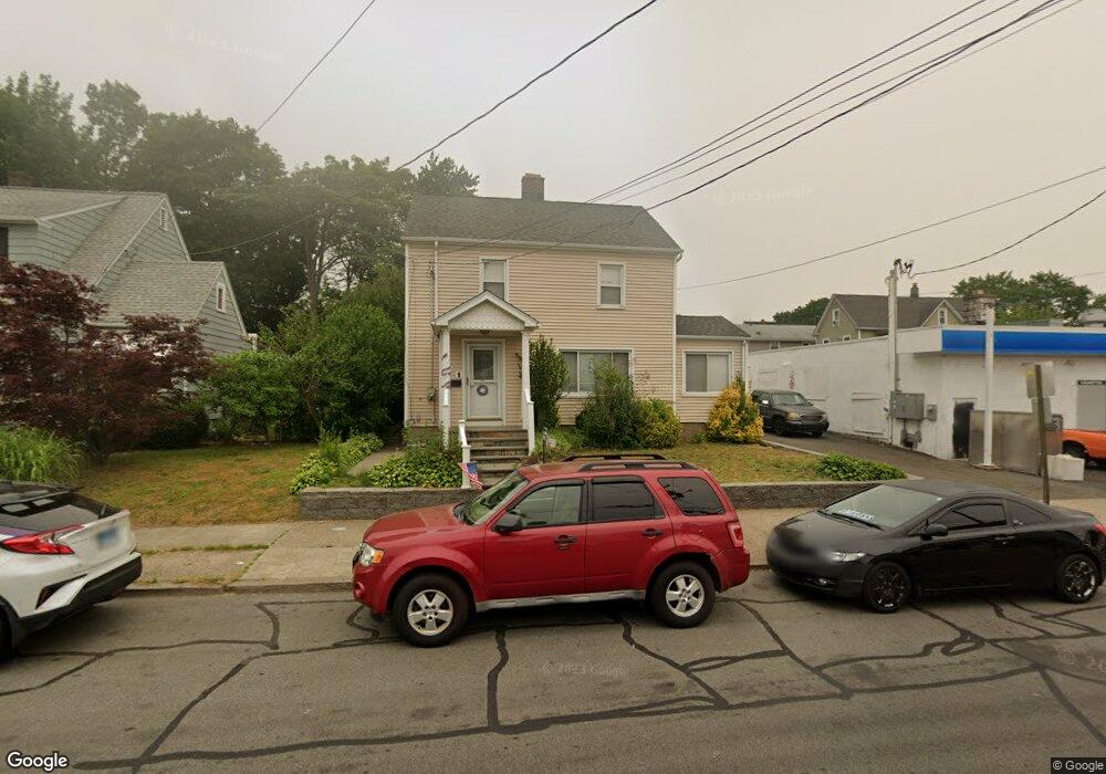
1348 Wood Ave Bridgeport, CT 06604
Brooklawn-Saint Vincent NeighborhoodEstimated Value: $344,000 - $447,308
3
Beds
2
Baths
1,760
Sq Ft
$225/Sq Ft
Est. Value
About This Home
This home is located at 1348 Wood Ave, Bridgeport, CT 06604 and is currently estimated at $396,827, approximately $225 per square foot. 1348 Wood Ave is a home located in Fairfield County with nearby schools including Blackham School, Central High School, and Assumption Catholic School.
Ownership History
Date
Name
Owned For
Owner Type
Purchase Details
Closed on
Feb 16, 2021
Sold by
Griffith Barbara
Bought by
Vazquez Krysti and Vazquez Pedro
Current Estimated Value
Home Financials for this Owner
Home Financials are based on the most recent Mortgage that was taken out on this home.
Original Mortgage
$214,700
Outstanding Balance
$191,859
Interest Rate
2.65%
Mortgage Type
Purchase Money Mortgage
Estimated Equity
$204,968
Create a Home Valuation Report for This Property
The Home Valuation Report is an in-depth analysis detailing your home's value as well as a comparison with similar homes in the area
Home Values in the Area
Average Home Value in this Area
Purchase History
| Date | Buyer | Sale Price | Title Company |
|---|---|---|---|
| Vazquez Krysti | $226,000 | None Available | |
| Vazquez Krysti | $226,000 | None Available |
Source: Public Records
Mortgage History
| Date | Status | Borrower | Loan Amount |
|---|---|---|---|
| Open | Vazquez Krysti | $214,700 | |
| Closed | Vazquez Krysti | $214,700 |
Source: Public Records
Tax History Compared to Growth
Tax History
| Year | Tax Paid | Tax Assessment Tax Assessment Total Assessment is a certain percentage of the fair market value that is determined by local assessors to be the total taxable value of land and additions on the property. | Land | Improvement |
|---|---|---|---|---|
| 2025 | $7,529 | $173,282 | $67,732 | $105,550 |
| 2024 | $7,529 | $173,282 | $67,732 | $105,550 |
| 2023 | $7,529 | $173,282 | $67,732 | $105,550 |
| 2022 | $7,529 | $173,282 | $67,732 | $105,550 |
| 2021 | $7,529 | $173,282 | $67,732 | $105,550 |
| 2020 | $6,965 | $129,000 | $41,040 | $87,960 |
| 2019 | $6,965 | $129,000 | $41,040 | $87,960 |
| 2018 | $7,014 | $129,000 | $41,040 | $87,960 |
| 2017 | $7,014 | $129,000 | $41,040 | $87,960 |
| 2016 | $7,014 | $129,000 | $41,040 | $87,960 |
| 2015 | $6,679 | $158,280 | $43,480 | $114,800 |
| 2014 | $6,679 | $158,280 | $43,480 | $114,800 |
Source: Public Records
Map
Nearby Homes
- 1213 Wood Ave
- 1480 Capitol Ave Unit 811
- 1473 Wood Ave
- 2445 Park Ave Unit 23
- 605 Brooklawn Ave
- 2345 Park Ave
- 665 W Taft Ave
- 2625 Park Ave Unit 12L
- 2625 Park Ave Unit 12H
- 2625 Park Ave Unit 5S
- 2625 Park Ave Unit 6M
- 2625 Park Ave Unit 5N
- 1275 Capitol Ave
- 2675 Park Ave Unit 3
- 2675 Park Ave Unit 22
- 366 Brooklawn Ave
- 125 Alexander Dr
- 150 Alexander Dr
- 11 Myron Ave
- 184 Pacific St
- 1590 Capitol Ave
- 41 Hillside Ave
- 1372 Wood Ave
- 45 Hillside Ave
- 39 Hillside Ave
- 1568 Capitol Ave
- 1560 Capitol Ave
- 15 Adolph Place
- 49 Hillside Ave Unit 51
- 1325 Wood Ave Unit lower
- 1325 Wood Ave
- 61 Hillside Ave Unit 63
- 1369 Wood Ave
- 1392 Wood Ave
- 1563 Capitol Ave Unit 2/3
- 1385 Wood Ave
- 1575 Capitol Ave
- 1379 Wood Ave
- 1558 Capitol Ave
- 1638 Capitol Ave