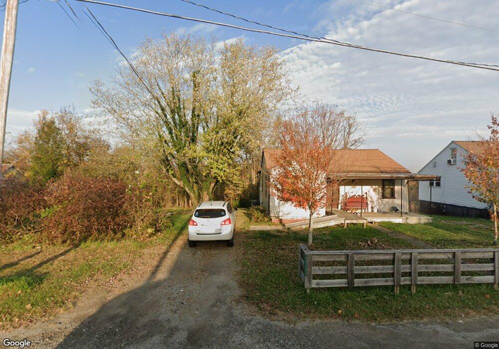
13493 State Route 41 West Union, OH 45693
Estimated Value: $71,000 - $138,000
3
Beds
1
Bath
1,532
Sq Ft
$70/Sq Ft
Est. Value
About This Home
This home is located at 13493 State Route 41, West Union, OH 45693 and is currently estimated at $106,980, approximately $69 per square foot. 13493 State Route 41 is a home located in Adams County with nearby schools including West Union Elementary School, West Union High School, and Adams County Christian School.
Ownership History
Date
Name
Owned For
Owner Type
Purchase Details
Closed on
Jun 20, 2024
Sold by
West Union Hoow Llc
Bought by
Church Tyler and Church Sarrah
Current Estimated Value
Home Financials for this Owner
Home Financials are based on the most recent Mortgage that was taken out on this home.
Original Mortgage
$110,000
Outstanding Balance
$108,615
Interest Rate
7.09%
Mortgage Type
Credit Line Revolving
Estimated Equity
-$1,635
Purchase Details
Closed on
Nov 21, 2023
Sold by
Ward Angela M and Green Bethany M
Bought by
West Union Hoow Llc
Purchase Details
Closed on
Aug 28, 2018
Sold by
Ward Angela M and Green Bethany M
Bought by
Ward Angela M and Green Bethany M
Purchase Details
Closed on
Jan 1, 1978
Bought by
Gaffin Delbert
Create a Home Valuation Report for This Property
The Home Valuation Report is an in-depth analysis detailing your home's value as well as a comparison with similar homes in the area
Home Values in the Area
Average Home Value in this Area
Purchase History
| Date | Buyer | Sale Price | Title Company |
|---|---|---|---|
| Church Tyler | -- | None Listed On Document | |
| West Union Hoow Llc | $63,000 | None Listed On Document | |
| Ward Angela M | -- | None Available | |
| Gaffin Delbert | $22,000 | -- |
Source: Public Records
Mortgage History
| Date | Status | Borrower | Loan Amount |
|---|---|---|---|
| Open | Church Tyler | $110,000 |
Source: Public Records
Tax History Compared to Growth
Tax History
| Year | Tax Paid | Tax Assessment Tax Assessment Total Assessment is a certain percentage of the fair market value that is determined by local assessors to be the total taxable value of land and additions on the property. | Land | Improvement |
|---|---|---|---|---|
| 2024 | $799 | $20,300 | $6,090 | $14,210 |
| 2023 | $1,187 | $24,360 | $6,090 | $18,270 |
| 2022 | $839 | $19,780 | $4,550 | $15,230 |
| 2021 | $401 | $19,780 | $4,550 | $15,230 |
| 2020 | $410 | $19,780 | $4,550 | $15,230 |
| 2019 | $410 | $19,780 | $4,550 | $15,230 |
| 2018 | $349 | $17,780 | $4,550 | $13,230 |
| 2017 | $344 | $17,780 | $4,550 | $13,230 |
| 2016 | $343 | $17,780 | $4,550 | $13,230 |
| 2015 | $332 | $17,780 | $4,550 | $13,230 |
| 2014 | $333 | $17,780 | $4,550 | $13,230 |
Source: Public Records
Map
Nearby Homes
- 13465 State Route 41
- 108 Chirsdon Ln
- 292 Larry Baynum Rd
- 3460 Logans Ln
- 0 State Route 41 Unit 1830107
- 260 Randy St
- 216 Kurt St
- 1478 Robinson Hollow Rd
- 120 Randy St
- 917 Logans Ln
- 410 Owens Rd
- 618 Maple St
- 3188 Ohio 125
- 1082 E Walnut St
- 363 Crystal Rd
- 601 E Main St
- 70 Logans Ln
- 501 E Mulberry St
- 725 E Walnut St
- 526 E Walnut St
- 13437 State Route 41
- 13455 State Route 41
- 13496 State Route 41
- 13503 State Route 41
- 13521 State Route 41
- 13628 State Route 41
- 13646 State Route 41
- 13655 State Route 41
- 13521 State Route 41
- 13388 State Route 41
- 13361 State Route 41
- 13375 State Route 41
- 13397 State Route 41
- 13361 State Route 41
- 13361 State Route 41
- 13361 State Route 41
- 13706 State Route 41
- 13701 State Route 41
- 13738 State Route 41
- 13775 State Route 41