Estimated Value: $139,000 - $169,000
6
Beds
1
Bath
2,378
Sq Ft
$65/Sq Ft
Est. Value
About This Home
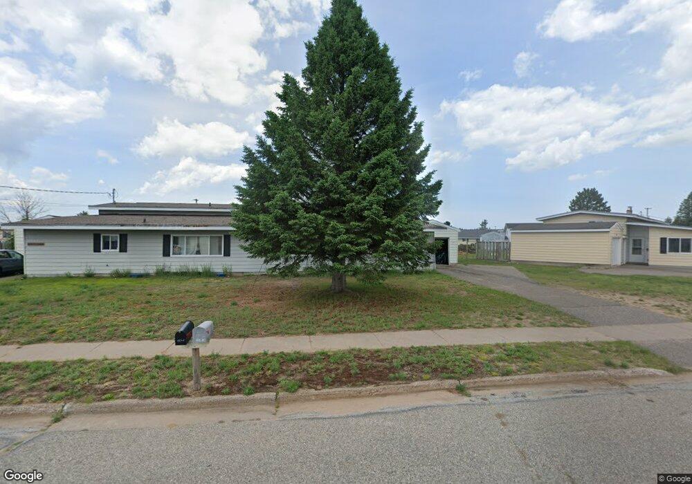
This home is located at 135 Albatross St Unit 137, Gwinn, MI 49841 and is currently estimated at $153,893, approximately $64 per square foot. 135 Albatross St Unit 137 is a home located in Marquette County with nearby schools including K.I. Sawyer Elementary School and Gwinn Middle/High School.
Ownership History
Date
Name
Owned For
Owner Type
Purchase Details
Closed on
Aug 7, 2023
Sold by
Mayerwick Properties Llc
Bought by
Guter Marguerite and Mashue Haley
Current Estimated Value
Home Financials for this Owner
Home Financials are based on the most recent Mortgage that was taken out on this home.
Original Mortgage
$103,700
Outstanding Balance
$101,275
Interest Rate
6.67%
Mortgage Type
New Conventional
Estimated Equity
$52,618
Purchase Details
Closed on
May 17, 2022
Sold by
Sorensen Development Inc
Bought by
Mayerwick Properties Llc
Create a Home Valuation Report for This Property
The Home Valuation Report is an in-depth analysis detailing your home's value as well as a comparison with similar homes in the area
Home Values in the Area
Average Home Value in this Area
Purchase History
| Date | Buyer | Sale Price | Title Company |
|---|---|---|---|
| Guter Marguerite | $122,000 | None Listed On Document | |
| Mayerwick Properties Llc | $105,000 | None Listed On Document |
Source: Public Records
Mortgage History
| Date | Status | Borrower | Loan Amount |
|---|---|---|---|
| Open | Guter Marguerite | $103,700 |
Source: Public Records
Tax History Compared to Growth
Tax History
| Year | Tax Paid | Tax Assessment Tax Assessment Total Assessment is a certain percentage of the fair market value that is determined by local assessors to be the total taxable value of land and additions on the property. | Land | Improvement |
|---|---|---|---|---|
| 2025 | $8 | $62,700 | $0 | $0 |
| 2024 | $8 | $50,700 | $0 | $0 |
| 2023 | $688 | $45,600 | $0 | $0 |
| 2022 | $1,127 | $31,000 | $0 | $0 |
| 2021 | $1,092 | $35,600 | $0 | $0 |
| 2020 | $1,076 | $31,000 | $0 | $0 |
| 2019 | $1,029 | $25,200 | $0 | $0 |
| 2018 | $1,003 | $20,850 | $0 | $0 |
| 2017 | $957 | $20,850 | $0 | $0 |
| 2016 | $952 | $20,400 | $0 | $0 |
| 2015 | -- | $20,400 | $0 | $0 |
| 2014 | -- | $20,700 | $0 | $0 |
| 2012 | -- | $22,100 | $0 | $0 |
Source: Public Records
Map
Nearby Homes
- 117 Provider St
- 102 Caribou St
- 136 Crusader Ave
- 317 319 Skybolt St
- TBD E Martin Lake Rd
- TBD E Provost Lake Rd
- 1591 Millyard Rd
- 1687 E M35
- 1681 E M35
- 1400 Setter Rd
- 115 N Marshall Dr
- 1882 1st St
- 171 E Sands St
- 148 E Sands St
- 115 N M553
- TBD Co Rd Eeb Pohlman Rd
- 215 Driftwood Dr
- 71 E Stephenson Ave
- TBD Ln
- Lot F Maple Wood Ln
- 135/137 Albatross
- 131/133 Albatross
- 139 Albatross St Unit 141
- 131 Albatross St Unit 133
- 136 Albatross St Unit 138
- 140 Albatross St Unit 142
- 168 Albatross St Unit 170
- 132 Albatross St Unit 134
- 169 Albatross St
- 164 Albatross St
- 172 Albatross St
- 176 Albatross St
- 165 Albatross St
- 169 Albatross St
- 168 Albatross St
- 157 Albatross St
- 144 Albatross St Unit 146
- 158 Albatross St
- 101 Destroyer St Unit 103
- 101 Destroyer St