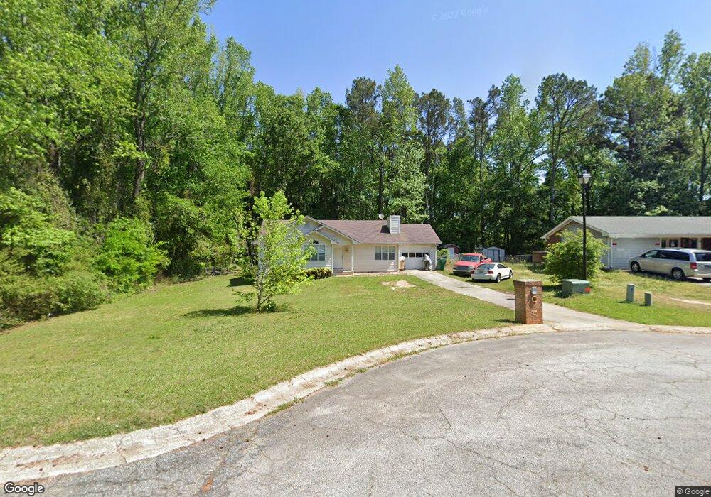
135 Ashwood Way Winder, GA 30680
Estimated Value: $252,000 - $298,000
3
Beds
2
Baths
1,104
Sq Ft
$250/Sq Ft
Est. Value
About This Home
This home is located at 135 Ashwood Way, Winder, GA 30680 and is currently estimated at $276,518, approximately $250 per square foot. 135 Ashwood Way is a home located in Barrow County with nearby schools including County Line Elementary School, Russell Middle School, and Winder-Barrow High School.
Ownership History
Date
Name
Owned For
Owner Type
Purchase Details
Closed on
Oct 28, 2010
Sold by
Veterans Admn
Bought by
Seeley Michael R
Current Estimated Value
Home Financials for this Owner
Home Financials are based on the most recent Mortgage that was taken out on this home.
Original Mortgage
$54,580
Outstanding Balance
$35,974
Interest Rate
4.25%
Mortgage Type
FHA
Estimated Equity
$240,544
Purchase Details
Closed on
Jul 6, 2010
Sold by
Us Bk National Assn
Bought by
Veterans Admn
Purchase Details
Closed on
Sep 5, 2008
Sold by
Fannie Mae
Bought by
Kapa Derek
Home Financials for this Owner
Home Financials are based on the most recent Mortgage that was taken out on this home.
Original Mortgage
$101,128
Interest Rate
6.34%
Mortgage Type
VA
Purchase Details
Closed on
Mar 4, 2008
Sold by
Wells Fargo Bk Na
Bought by
Federal National Mortgage Association
Purchase Details
Closed on
Jul 20, 2006
Sold by
Miller Dale
Bought by
Miller Dale And
Purchase Details
Closed on
Mar 28, 2005
Sold by
Household Rlty Corp
Bought by
Miller Dale
Home Financials for this Owner
Home Financials are based on the most recent Mortgage that was taken out on this home.
Original Mortgage
$86,400
Interest Rate
5.79%
Mortgage Type
New Conventional
Purchase Details
Closed on
Sep 7, 2004
Sold by
Reiding Jamie Mp
Bought by
Household Rlty Corp
Purchase Details
Closed on
Dec 14, 1995
Bought by
Profitt Jamie M
Purchase Details
Closed on
Aug 18, 1992
Bought by
Profitt Shephen C
Create a Home Valuation Report for This Property
The Home Valuation Report is an in-depth analysis detailing your home's value as well as a comparison with similar homes in the area
Home Values in the Area
Average Home Value in this Area
Purchase History
| Date | Buyer | Sale Price | Title Company |
|---|---|---|---|
| Seeley Michael R | -- | -- | |
| Veterans Admn | -- | -- | |
| Us Bk National Assn | $83,723 | -- | |
| Kapa Derek | -- | -- | |
| Federal National Mortgage Association | -- | -- | |
| Wells Fargo Bk Na | $98,347 | -- | |
| Miller Dale And | -- | -- | |
| Miller Dale | $82,000 | -- | |
| Household Rlty Corp | $28,633 | -- | |
| Profitt Jamie M | -- | -- | |
| Profitt Shephen C | $61,500 | -- |
Source: Public Records
Mortgage History
| Date | Status | Borrower | Loan Amount |
|---|---|---|---|
| Open | Seeley Michael R | $54,580 | |
| Previous Owner | Kapa Derek | $101,128 | |
| Previous Owner | Miller Dale | $86,400 |
Source: Public Records
Tax History Compared to Growth
Tax History
| Year | Tax Paid | Tax Assessment Tax Assessment Total Assessment is a certain percentage of the fair market value that is determined by local assessors to be the total taxable value of land and additions on the property. | Land | Improvement |
|---|---|---|---|---|
| 2024 | $2,252 | $82,389 | $20,800 | $61,589 |
| 2023 | $1,769 | $82,389 | $20,800 | $61,589 |
| 2022 | $2,003 | $61,011 | $17,200 | $43,811 |
| 2021 | $1,791 | $53,330 | $12,000 | $41,330 |
| 2020 | $1,554 | $47,129 | $12,000 | $35,129 |
| 2019 | $1,303 | $38,927 | $10,000 | $28,927 |
| 2018 | $1,297 | $38,927 | $10,000 | $28,927 |
| 2017 | $912 | $30,568 | $8,800 | $21,768 |
| 2016 | $860 | $29,137 | $8,800 | $20,337 |
| 2015 | $870 | $29,392 | $8,800 | $20,592 |
| 2014 | $742 | $26,336 | $5,488 | $20,848 |
| 2013 | -- | $25,380 | $5,488 | $19,892 |
Source: Public Records
Map
Nearby Homes
- 926 Live Oak Ct Unit 2
- 980 Lake Rockwell Way
- 615 Wellington Dr
- 469 Plantation Dr
- 0 E Northcrest Dr Unit 10648147
- 623 Teal Dr
- 412 Regan Dr
- 746 Baskins Cir
- 436 Northcrest Dr
- 401 N 5th Ave
- 27 Creekside Dr
- 713 Mallard Dr
- 381 W Candler St
- 300 Hyde Park
- 290 Hyde Park
- 642 Teal Dr
- The Paisley Plan at Rockwell Farms
- The Rockwell Plan at Rockwell Farms
- The Barnes Plan at Rockwell Farms
- 133 Ashwood Way Unit 3
- 137 Ashwood Way
- 139 Ashwood Way
- 134 Ashwood Way
- 131 Ashwood Way
- 131 Ashwood Way Unit 6
- 131 Ashwood Ct Unit 3
- 144 Ashwood Way
- 144 Ashwood Way Unit 16 UNIT4
- 0 Ashwood Way Unit 8776939
- 0 Ashwood Way Unit 8814721
- 0 Ashwood Way Unit 8870709
- 0 Ashwood Way Unit 7337603
- 0 Ashwood Way Unit 7347034
- 0 Ashwood Way Unit 7349929
- 0 Ashwood Way Unit 7382524
- 0 Ashwood Way Unit 7410833
- 0 Ashwood Way Unit 8031643
- 0 Ashwood Way Unit 8165892
- 141 Ashwood Way Unit 4