Estimated Value: $586,000 - $695,000
--
Bed
--
Bath
1,927
Sq Ft
$336/Sq Ft
Est. Value
About This Home
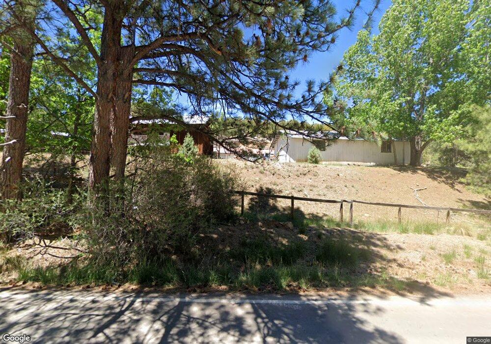
This home is located at 135 Fort Stanton Rd, Alto, NM 88312 and is currently estimated at $646,829, approximately $335 per square foot. 135 Fort Stanton Rd is a home with nearby schools including Capitan Elementary School, Capitan Middle School, and Capitan High School.
Ownership History
Date
Name
Owned For
Owner Type
Purchase Details
Closed on
Oct 26, 2023
Sold by
Commander John E and Commander Catherine D
Bought by
Smith Michael Scott
Current Estimated Value
Home Financials for this Owner
Home Financials are based on the most recent Mortgage that was taken out on this home.
Original Mortgage
$149,000
Outstanding Balance
$146,237
Interest Rate
7.18%
Mortgage Type
VA
Estimated Equity
$500,592
Purchase Details
Closed on
Aug 15, 2017
Sold by
Commander John E and Hopkins Catherine D
Bought by
Coburn Kari M and Coburn Curtis J
Purchase Details
Closed on
Mar 30, 2015
Sold by
Parker Milford
Bought by
Commander John E and Hopkins Catherine D
Home Financials for this Owner
Home Financials are based on the most recent Mortgage that was taken out on this home.
Original Mortgage
$184,000
Interest Rate
3.73%
Mortgage Type
New Conventional
Create a Home Valuation Report for This Property
The Home Valuation Report is an in-depth analysis detailing your home's value as well as a comparison with similar homes in the area
Home Values in the Area
Average Home Value in this Area
Purchase History
| Date | Buyer | Sale Price | Title Company |
|---|---|---|---|
| Smith Michael Scott | -- | None Listed On Document | |
| Coburn Kari M | -- | None Available | |
| Commander John E | -- | None Available |
Source: Public Records
Mortgage History
| Date | Status | Borrower | Loan Amount |
|---|---|---|---|
| Open | Smith Michael Scott | $149,000 | |
| Previous Owner | Commander John E | $184,000 |
Source: Public Records
Tax History Compared to Growth
Tax History
| Year | Tax Paid | Tax Assessment Tax Assessment Total Assessment is a certain percentage of the fair market value that is determined by local assessors to be the total taxable value of land and additions on the property. | Land | Improvement |
|---|---|---|---|---|
| 2025 | $2,445 | $145,015 | $17,146 | $127,869 |
| 2024 | $2,445 | $145,015 | $17,146 | $127,869 |
| 2023 | $2,445 | $85,338 | $17,146 | $68,192 |
| 2022 | $1,268 | $82,853 | $16,647 | $66,206 |
| 2021 | $1,205 | $80,432 | $16,160 | $64,272 |
| 2020 | $1,337 | $78,089 | $15,689 | $62,400 |
| 2019 | $1,307 | $76,557 | $15,381 | $61,176 |
| 2018 | $1,265 | $74,328 | $14,934 | $59,394 |
| 2017 | $1,182 | $72,163 | $14,499 | $57,664 |
| 2015 | $1,241 | $78,958 | $6,456 | $72,502 |
| 2014 | -- | $76,658 | $6,268 | $70,390 |
Source: Public Records
Map
Nearby Homes
- 103 Woodpine Ct Unit 2
- Lot 31E Flicker Ct
- 112 Woodpine Ct
- 202 Deer Park Dr
- 217 Deer Park Dr
- 102 Quail Run Ln
- Lot 91 Deer Park Dr Unit 3
- 243 Deer Park Dr
- 213 Fawn Dr
- T1, 2 & 4 New Mexico 220
- Lot 88 Stable Rd Unit 3
- Lot 10A Stable Rd
- T15B Partridge Ct
- 375 New Mexico 220
- 102 Doe Ct
- 121 Stable Rd Unit 2
- 104 Doe Ct
- Lot T24D Chickadee Ct Unit 4
- Lot 3 Block 8
- Lot 9 Ute Ct
- 135 Stag Loop
- 135 Stag Loop
- 460 Fort Stanton Rd
- 460 Fort Stanton Rd
- 456 Fort Stanton Rd
- 474 Fort Stanton Rd
- 474 Fort Stanton Rd
- 129 Stag Loop
- 129 Stag Loop
- 125 Stag Loop
- 128 Stag Loop
- 491 Fort Stanton Rd
- L 1 L 1 Fort Stanton Rd
- 464 Nm 220 Airport Rd St Hwy
- 244 Nm 220 Airport Rd St Hwy
- 244 Nm 220 Airport Rd St Hwy
- 244 New Mexico 220
- 120 Stag Loop
- 425 Alto Pines Trail
- 124 Stag Ct Unit 2