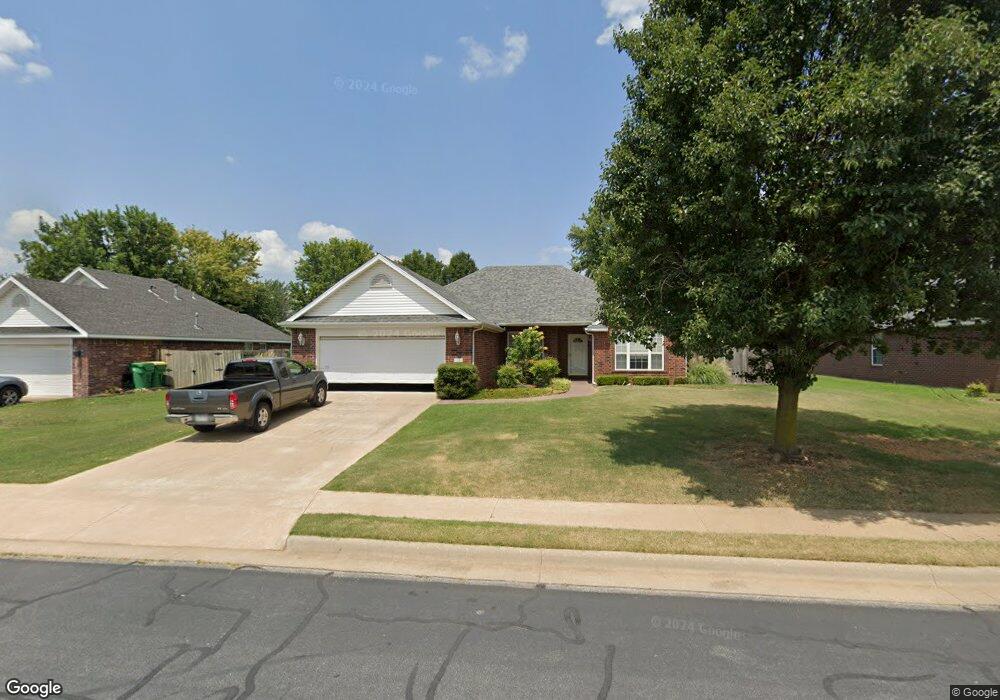
135 Fox Run Cir Centerton, AR 72719
Estimated Value: $341,000 - $377,000
--
Bed
2
Baths
1,802
Sq Ft
$195/Sq Ft
Est. Value
About This Home
This home is located at 135 Fox Run Cir, Centerton, AR 72719 and is currently estimated at $352,058, approximately $195 per square foot. 135 Fox Run Cir is a home located in Benton County with nearby schools including Centerton Gamble Elementary School, Grimsley Junior High School, and Creekside Middle School.
Ownership History
Date
Name
Owned For
Owner Type
Purchase Details
Closed on
Sep 12, 2006
Sold by
Edwards Randy L
Bought by
Lee Roger B and Lee Judy C
Current Estimated Value
Home Financials for this Owner
Home Financials are based on the most recent Mortgage that was taken out on this home.
Original Mortgage
$124,000
Outstanding Balance
$73,815
Interest Rate
6.51%
Mortgage Type
Purchase Money Mortgage
Estimated Equity
$278,243
Purchase Details
Closed on
Jan 9, 2004
Bought by
Edwards
Purchase Details
Closed on
Oct 3, 2002
Bought by
Edwards
Purchase Details
Closed on
Feb 19, 2002
Bought by
Taylor
Create a Home Valuation Report for This Property
The Home Valuation Report is an in-depth analysis detailing your home's value as well as a comparison with similar homes in the area
Home Values in the Area
Average Home Value in this Area
Purchase History
| Date | Buyer | Sale Price | Title Company |
|---|---|---|---|
| Lee Roger B | $155,000 | None Available | |
| Edwards | -- | -- | |
| Edwards | $131,000 | -- | |
| Taylor | $37,000 | -- |
Source: Public Records
Mortgage History
| Date | Status | Borrower | Loan Amount |
|---|---|---|---|
| Open | Lee Roger B | $124,000 |
Source: Public Records
Tax History Compared to Growth
Tax History
| Year | Tax Paid | Tax Assessment Tax Assessment Total Assessment is a certain percentage of the fair market value that is determined by local assessors to be the total taxable value of land and additions on the property. | Land | Improvement |
|---|---|---|---|---|
| 2025 | $1,606 | $56,650 | $15,000 | $41,650 |
| 2024 | $1,622 | $56,650 | $15,000 | $41,650 |
| 2023 | $1,622 | $37,110 | $7,600 | $29,510 |
| 2022 | $1,287 | $37,110 | $7,600 | $29,510 |
| 2021 | $1,273 | $37,110 | $7,600 | $29,510 |
| 2020 | $1,297 | $29,870 | $4,000 | $25,870 |
| 2019 | $1,297 | $29,870 | $4,000 | $25,870 |
| 2018 | $1,322 | $29,870 | $4,000 | $25,870 |
| 2017 | $1,264 | $29,870 | $4,000 | $25,870 |
| 2016 | $1,264 | $29,870 | $4,000 | $25,870 |
| 2015 | $1,622 | $26,290 | $4,000 | $22,290 |
| 2014 | $1,272 | $26,290 | $4,000 | $22,290 |
Source: Public Records
Map
Nearby Homes
- 2131 Periwinkle Place
- 2121 Periwinkle Place
- 2041 Tallgrass Terrace
- 571 Stoneseed St
- 107 Birch St
- 107 Fox Run Cir
- 8800 Anise Dr
- 230 Kristen Ln
- 210 Kristen Ln
- 2440 Longfellow Dr
- 2411 Longfellow Dr
- 2421 Longfellow Dr
- 2431 Longfellow Dr
- 2420 Longfellow Dr
- 2461 Longfellow Dr
- 221 Beasley Dr
- 2090 Wildflower Dr
- Single Family Portfo Group 4
- Single Family Portfo Group 5
- 241 Cisterna Dr