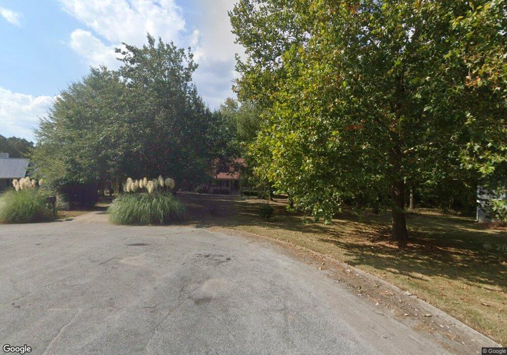
135 Long Point Dr Unit 1 Carrollton, GA 30117
Estimated Value: $362,636 - $413,000
3
Beds
3
Baths
1,950
Sq Ft
$199/Sq Ft
Est. Value
About This Home
This home is located at 135 Long Point Dr Unit 1, Carrollton, GA 30117 and is currently estimated at $388,159, approximately $199 per square foot. 135 Long Point Dr Unit 1 is a home located in Carroll County with nearby schools including Central Elementary School, Central Middle School, and Central High School.
Ownership History
Date
Name
Owned For
Owner Type
Purchase Details
Closed on
Feb 9, 2021
Sold by
Grizzard Molly
Bought by
Engel Molly and Engel Michael Trey
Current Estimated Value
Purchase Details
Closed on
Feb 24, 2012
Bought by
Grizzard Molly
Home Financials for this Owner
Home Financials are based on the most recent Mortgage that was taken out on this home.
Original Mortgage
$90,443
Interest Rate
4.37%
Mortgage Type
FHA
Purchase Details
Closed on
Dec 7, 2010
Sold by
Flagstar Bank Fsb
Bought by
Secretary Of Housing
Purchase Details
Closed on
Oct 11, 1991
Bought by
Anderson Donald
Purchase Details
Closed on
May 26, 1989
Bought by
Angsten
Create a Home Valuation Report for This Property
The Home Valuation Report is an in-depth analysis detailing your home's value as well as a comparison with similar homes in the area
Home Values in the Area
Average Home Value in this Area
Purchase History
| Date | Buyer | Sale Price | Title Company |
|---|---|---|---|
| Engel Molly | -- | -- | |
| Grizzard Molly | $80,900 | -- | |
| Secretary Of Housing | $124,434 | -- | |
| Flagstar Bank Fsb | -- | -- | |
| Anderson Donald | $94,500 | -- | |
| Angsten | $85,000 | -- |
Source: Public Records
Mortgage History
| Date | Status | Borrower | Loan Amount |
|---|---|---|---|
| Previous Owner | Flagstar Bank Fsb | $90,443 |
Source: Public Records
Tax History Compared to Growth
Tax History
| Year | Tax Paid | Tax Assessment Tax Assessment Total Assessment is a certain percentage of the fair market value that is determined by local assessors to be the total taxable value of land and additions on the property. | Land | Improvement |
|---|---|---|---|---|
| 2024 | $2,602 | $146,480 | $12,000 | $134,480 |
| 2023 | $2,602 | $134,761 | $12,000 | $122,761 |
| 2022 | $2,204 | $110,505 | $12,000 | $98,505 |
| 2021 | $2,018 | $97,092 | $12,000 | $85,092 |
| 2020 | $1,825 | $86,290 | $12,000 | $74,290 |
| 2019 | $1,691 | $78,316 | $12,000 | $66,316 |
| 2018 | $1,578 | $71,086 | $12,000 | $59,086 |
| 2017 | $1,581 | $71,086 | $12,000 | $59,086 |
| 2016 | $1,582 | $71,086 | $12,000 | $59,086 |
| 2015 | $1,254 | $48,837 | $5,000 | $43,837 |
| 2014 | $1,259 | $48,837 | $5,000 | $43,837 |
Source: Public Records
Map
Nearby Homes
- 1531 Tyus Carrollton Rd
- 20 Camp Ct
- 95 Camp Ln
- 399 Old Camp Church Rd
- 105 Woodbine Dr
- 345 Piney Grove Rd
- 3680 W Highway 166
- 0 Bonner Rd Unit 10635754
- 21 Crabapple Place
- The Coleman Plan at Summerfield Place
- The Pearson Plan at Summerfield Place
- The Piedmont Plan at Summerfield Place
- The Harrington Plan at Summerfield Place
- The McGinnis Plan at Summerfield Place
- The Telfair Plan at Summerfield Place
- 40 Red Holly Gap
- 102 Red Oak Dr
- 64 Twin Oak Dr
- 103 Red Oak Dr
- 135 Long Point Dr
- 129 Long Point Dr
- 121 Long Point Dr
- 120 Long Point Dr
- 105 Long Point Dr
- 110 Long Point Dr
- 89 Long Point Dr
- 86 Long Point Dr
- 73 Long Point Dr
- 0 Long Point Dr Unit 8042365
- 57 Long Point Dr
- 64 Long Point Dr
- 221 Grove Ct
- 350 Salem Church Rd
- 225 Grove Ct
- 39 Long Point Dr
- 1431 Tyus Carrollton Rd
- 1475 Tyus Carrollton Rd
- 217 Grove Ct
- 1074 Grice Rd
