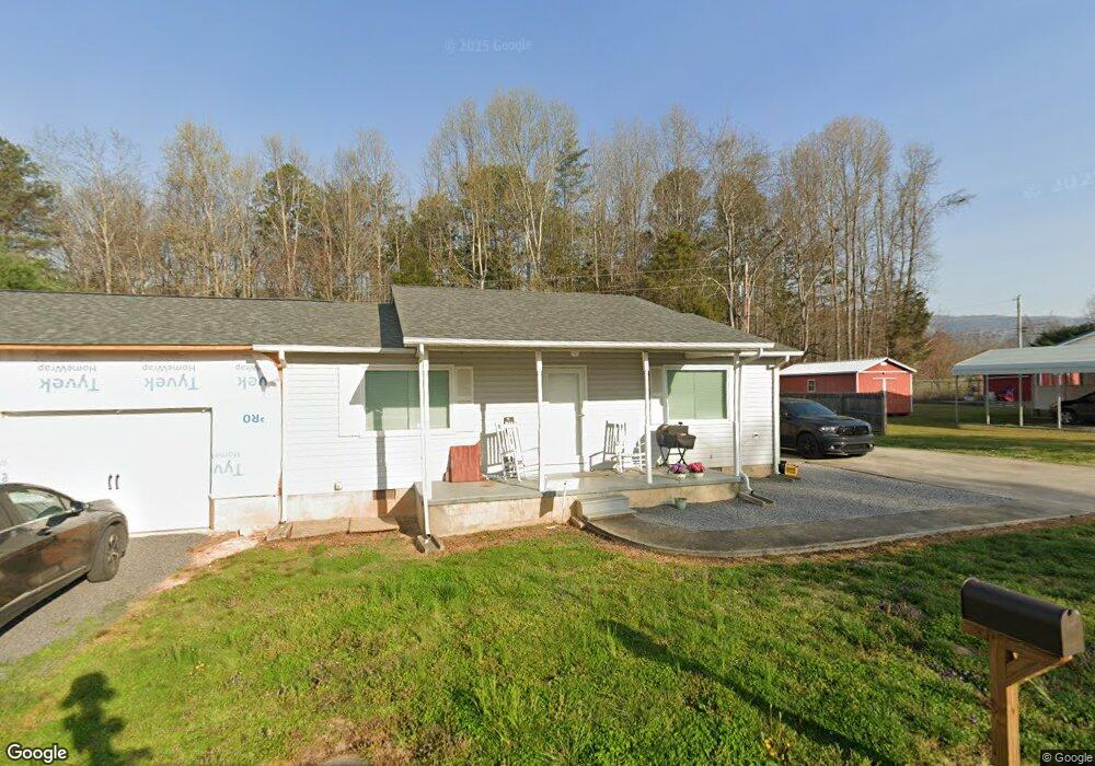
135 Magnolia Cir Dunlap, TN 37327
Estimated Value: $162,000 - $204,000
--
Bed
1
Bath
1,008
Sq Ft
$175/Sq Ft
Est. Value
About This Home
This home is located at 135 Magnolia Cir, Dunlap, TN 37327 and is currently estimated at $176,578, approximately $175 per square foot. 135 Magnolia Cir is a home located in Sequatchie County with nearby schools including Griffith Elementary School, Sequatchie County Middle School, and Sequatchie County High School.
Ownership History
Date
Name
Owned For
Owner Type
Purchase Details
Closed on
Dec 21, 2020
Sold by
Mcnabb Jane W and Mcnabb William L
Bought by
Louallen Jimmy
Current Estimated Value
Home Financials for this Owner
Home Financials are based on the most recent Mortgage that was taken out on this home.
Original Mortgage
$106,060
Outstanding Balance
$93,989
Interest Rate
2.7%
Mortgage Type
New Conventional
Estimated Equity
$82,589
Purchase Details
Closed on
Apr 28, 1999
Bought by
Mcnabb Jane W and Husband William L Dba
Purchase Details
Closed on
Jan 8, 1998
Bought by
Johnson Major
Purchase Details
Closed on
Aug 24, 1993
Bought by
Johnson Major
Purchase Details
Closed on
Jul 8, 1989
Bought by
Campbell Sutton and Wife Edith
Create a Home Valuation Report for This Property
The Home Valuation Report is an in-depth analysis detailing your home's value as well as a comparison with similar homes in the area
Home Values in the Area
Average Home Value in this Area
Purchase History
| Date | Buyer | Sale Price | Title Company |
|---|---|---|---|
| Louallen Jimmy | $105,000 | First American Mortgage Sln | |
| Mcnabb Jane W | $390,000 | -- | |
| Johnson Major | $8,000 | -- | |
| Johnson Major | $5,000 | -- | |
| Campbell Sutton | $8,200 | -- |
Source: Public Records
Mortgage History
| Date | Status | Borrower | Loan Amount |
|---|---|---|---|
| Open | Louallen Jimmy | $106,060 |
Source: Public Records
Tax History Compared to Growth
Tax History
| Year | Tax Paid | Tax Assessment Tax Assessment Total Assessment is a certain percentage of the fair market value that is determined by local assessors to be the total taxable value of land and additions on the property. | Land | Improvement |
|---|---|---|---|---|
| 2025 | $574 | $41,075 | $0 | $0 |
| 2024 | $574 | $31,250 | $3,250 | $28,000 |
| 2023 | $540 | $31,250 | $3,250 | $28,000 |
| 2022 | $463 | $18,950 | $2,750 | $16,200 |
| 2021 | $428 | $17,525 | $2,750 | $14,775 |
| 2020 | $428 | $17,525 | $2,750 | $14,775 |
| 2019 | $428 | $17,525 | $2,750 | $14,775 |
| 2018 | $428 | $17,525 | $2,750 | $14,775 |
| 2017 | $428 | $17,525 | $2,750 | $14,775 |
| 2016 | $452 | $17,600 | $2,750 | $14,850 |
| 2015 | $452 | $17,600 | $2,750 | $14,850 |
| 2014 | $452 | $17,600 | $2,750 | $14,850 |
Source: Public Records
Map
Nearby Homes
- 2426 Old York Hwy
- 2496 Old York Hwy
- 0 U S 127 Unit RTC2821095
- 0 U S 127 Unit 21317616
- 0 U S 127 Unit 1509009
- 119 Cedar Ln
- 87 Happy Valley Rd
- 444 Smith Mountain Rd
- 62 River Dr
- 50 River Dr
- 48 River Dr
- 100 River Dr
- 121 River Dr
- 63 River Dr
- 125 River Dr
- 51 River Dr
- 696 Windridge Dr
- 01 Windridge Dr
- 120 River Ridge Dr
- 121 River Ridge Dr
- 161 Magnolia Cir
- 115 Magnolia Cir
- 136 Magnolia Cir
- 98 Magnolia Cir
- 158 Magnolia Cir
- 105 Magnolia Cir
- 66 Magnolia Cir
- 124 Austin Rd
- 93 Magnolia Cir
- 73 Austin Rd
- 0 Magnolia Cir
- 237 Austin Rd
- 65 Magnolia Cir
- 42 Magnolia Cir
- 39 Magnolia Cir
- 33 Austin Rd
- 33 Austin Rd
- 33 Austin Rd
- 72 Austin Rd
- 249 Austin Rd