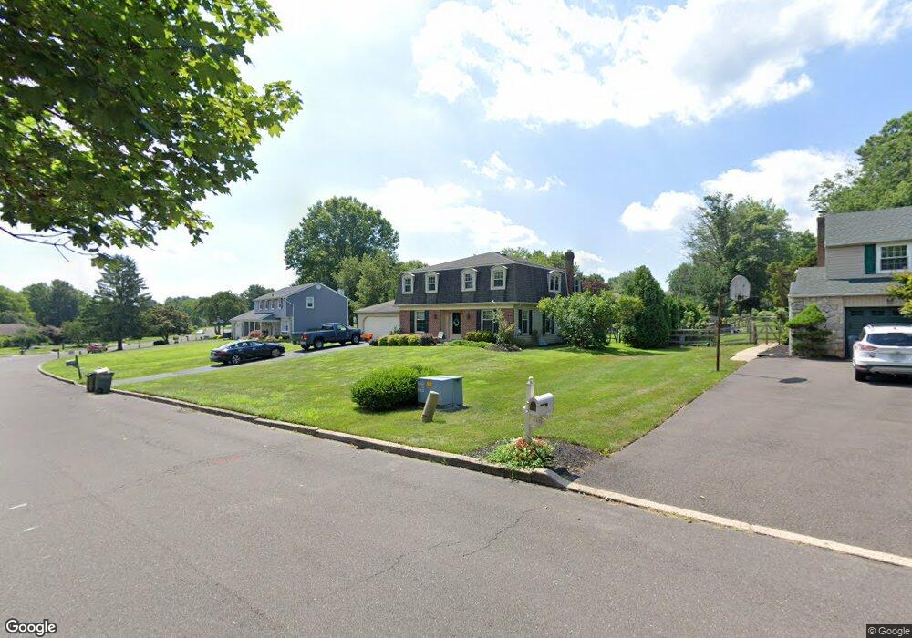
135 Merry Dell Dr Southampton, PA 18966
Estimated Value: $608,000 - $709,000
3
Beds
3
Baths
1,498
Sq Ft
$435/Sq Ft
Est. Value
About This Home
This home is located at 135 Merry Dell Dr, Southampton, PA 18966 and is currently estimated at $651,822, approximately $435 per square foot. 135 Merry Dell Dr is a home located in Bucks County with nearby schools including Maureen M. Welch Elementary School, Richboro Middle School, and Council Rock High School - South.
Ownership History
Date
Name
Owned For
Owner Type
Purchase Details
Closed on
Apr 5, 2021
Sold by
Mccarthy Kenneth and Mccarthy1 Sandy Q
Bought by
Allbrook Christopher S and Allbrook Mia
Current Estimated Value
Home Financials for this Owner
Home Financials are based on the most recent Mortgage that was taken out on this home.
Original Mortgage
$441,750
Outstanding Balance
$399,484
Interest Rate
3.1%
Mortgage Type
New Conventional
Estimated Equity
$252,338
Purchase Details
Closed on
Dec 20, 2002
Sold by
Reed Charles F and Reed Kathleen A
Bought by
Capone Felix J and Capone Patricia Ann
Purchase Details
Closed on
Dec 29, 1997
Sold by
Capone Felix J and Capone Patricia Ann
Bought by
Reed Charles F and Reed Kathleen A
Home Financials for this Owner
Home Financials are based on the most recent Mortgage that was taken out on this home.
Original Mortgage
$145,000
Interest Rate
6.89%
Create a Home Valuation Report for This Property
The Home Valuation Report is an in-depth analysis detailing your home's value as well as a comparison with similar homes in the area
Home Values in the Area
Average Home Value in this Area
Purchase History
| Date | Buyer | Sale Price | Title Company |
|---|---|---|---|
| Allbrook Christopher S | $465,000 | Properties Abstract Inc | |
| Capone Felix J | -- | -- | |
| Reed Charles F | $190,000 | -- |
Source: Public Records
Mortgage History
| Date | Status | Borrower | Loan Amount |
|---|---|---|---|
| Open | Allbrook Christopher S | $441,750 | |
| Previous Owner | Reed Charles F | $145,000 |
Source: Public Records
Tax History Compared to Growth
Tax History
| Year | Tax Paid | Tax Assessment Tax Assessment Total Assessment is a certain percentage of the fair market value that is determined by local assessors to be the total taxable value of land and additions on the property. | Land | Improvement |
|---|---|---|---|---|
| 2025 | $7,242 | $37,600 | $5,600 | $32,000 |
| 2024 | $7,242 | $37,600 | $5,600 | $32,000 |
| 2023 | $6,825 | $37,600 | $5,600 | $32,000 |
| 2022 | $6,763 | $37,600 | $5,600 | $32,000 |
| 2021 | $6,549 | $37,600 | $5,600 | $32,000 |
| 2020 | $6,402 | $37,600 | $5,600 | $32,000 |
| 2019 | $6,128 | $37,600 | $5,600 | $32,000 |
| 2018 | $6,019 | $37,600 | $5,600 | $32,000 |
| 2017 | $5,787 | $37,600 | $5,600 | $32,000 |
| 2016 | $5,787 | $37,600 | $5,600 | $32,000 |
| 2015 | -- | $37,600 | $5,600 | $32,000 |
| 2014 | -- | $37,600 | $5,600 | $32,000 |
Source: Public Records
Map
Nearby Homes
- 371 N 2nd Street Pike
- 55 Mount Pleasant Dr
- 34 Acorn Dr
- 47 Creek Rd
- 29 Devon Rd
- 55 W Windrose Dr
- 249 New Rd
- 161 New Rd
- 56 Joshua Dr
- 148 Laurel Rd
- 534 Holly Knoll Dr
- 105 Edwards Dr
- 290 Hatboro Rd
- 61 Legacy Oaks Dr Unit 62
- 243 Green Dr
- 225 Green Dr
- 64 Legacy Oaks Dr Unit 81
- 54 Legacy Oaks Dr Unit 94
- 23 Oxford Dr
- 433 Wendy Rd
- 143 Merry Dell Dr
- 113 Merry Dell Dr
- 151 Merry Dell Dr
- 134 Merry Dell Dr
- 105 Merry Dell Dr
- 18 N Kitty Knight Dr
- 124 Merry Dell Dr
- 138 Merry Dell Dr
- 26 N Kitty Knight Dr
- 161 Merry Dell Dr
- 142 Merry Dell Dr
- 28 S Kitty Knight Dr
- 116 Merry Dell Dr
- 150 Merry Dell Dr
- 108 Merry Dell Dr
- 130 Merry Dell Dr
- 20 S Kitty Knight Dr
- 100 Merry Dell Dr
- 19 Kitty Knight Dr
- 27 Kitty Knight Dr