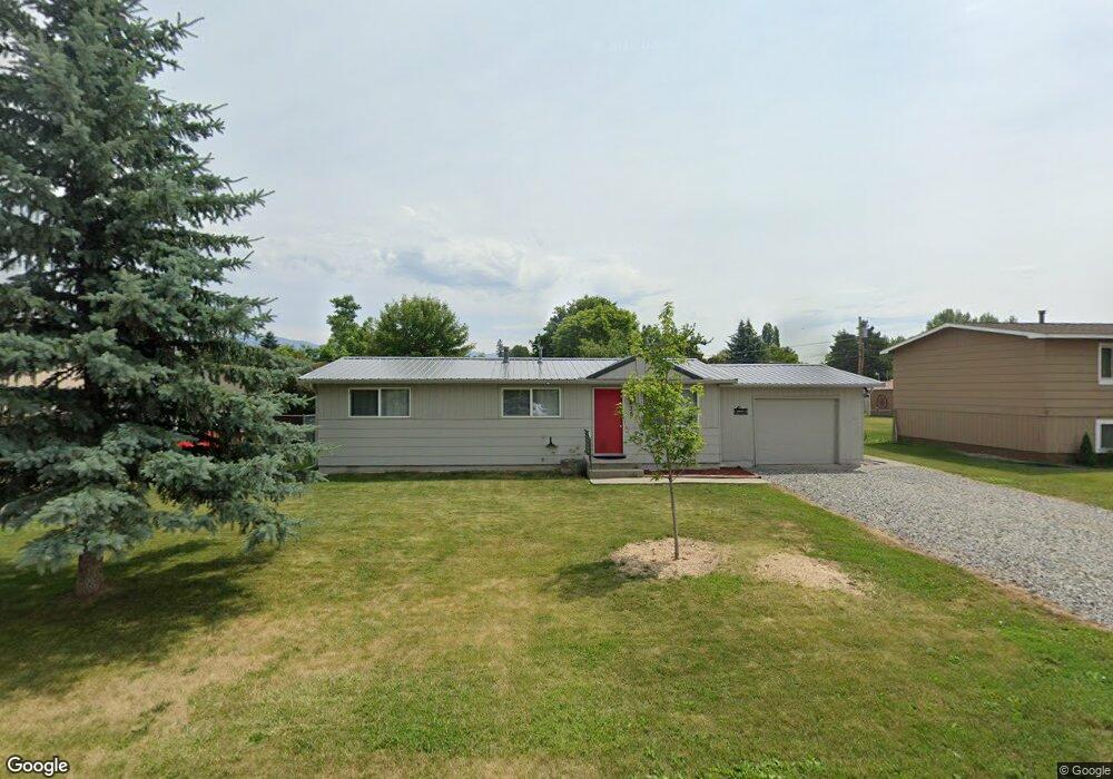
135 N Cedar Dr Kalispell, MT 59901
Estimated Value: $319,000 - $347,000
3
Beds
1
Bath
960
Sq Ft
$350/Sq Ft
Est. Value
About This Home
This home is located at 135 N Cedar Dr, Kalispell, MT 59901 and is currently estimated at $335,943, approximately $349 per square foot. 135 N Cedar Dr is a home located in Flathead County with nearby schools including East Evergreen School, Evergreen Junior High School (7-8), and Glacier High School.
Ownership History
Date
Name
Owned For
Owner Type
Purchase Details
Closed on
Jun 5, 2008
Sold by
Meyers Jeremy W
Bought by
Meyers Jeremy W and Meyers Tamara L
Current Estimated Value
Purchase Details
Closed on
Oct 17, 2007
Sold by
Meyers Tamara
Bought by
Meyers Jeremy W
Home Financials for this Owner
Home Financials are based on the most recent Mortgage that was taken out on this home.
Original Mortgage
$147,000
Outstanding Balance
$90,105
Interest Rate
5.87%
Mortgage Type
Assumption
Estimated Equity
$245,838
Purchase Details
Closed on
Feb 22, 2007
Sold by
Henbd Daniel L
Bought by
Meyers Jeremy W
Home Financials for this Owner
Home Financials are based on the most recent Mortgage that was taken out on this home.
Original Mortgage
$140,400
Interest Rate
6.21%
Mortgage Type
New Conventional
Create a Home Valuation Report for This Property
The Home Valuation Report is an in-depth analysis detailing your home's value as well as a comparison with similar homes in the area
Purchase History
| Date | Buyer | Sale Price | Title Company |
|---|---|---|---|
| Meyers Jeremy W | -- | None Available | |
| Meyers Jeremy W | -- | None Available | |
| Meyers Jeremy W | -- | Sterling Title Services Inc |
Source: Public Records
Mortgage History
| Date | Status | Borrower | Loan Amount |
|---|---|---|---|
| Open | Meyers Jeremy W | $147,000 | |
| Closed | Meyers Jeremy W | $140,400 |
Source: Public Records
Tax History
| Year | Tax Paid | Tax Assessment Tax Assessment Total Assessment is a certain percentage of the fair market value that is determined by local assessors to be the total taxable value of land and additions on the property. | Land | Improvement |
|---|---|---|---|---|
| 2025 | $1,256 | $320,500 | $0 | $0 |
| 2024 | $1,720 | $268,700 | $0 | $0 |
| 2023 | $1,763 | $268,700 | $0 | $0 |
| 2022 | $1,819 | $200,200 | $0 | $0 |
| 2021 | $1,884 | $200,200 | $0 | $0 |
| 2020 | $1,700 | $171,700 | $0 | $0 |
| 2019 | $1,678 | $171,700 | $0 | $0 |
| 2018 | $1,260 | $125,900 | $0 | $0 |
| 2017 | $1,128 | $125,900 | $0 | $0 |
| 2016 | $1,148 | $118,800 | $0 | $0 |
| 2015 | $1,124 | $118,800 | $0 | $0 |
| 2014 | $1,239 | $81,249 | $0 | $0 |
Source: Public Records
Map
Nearby Homes
- 128 E Evergreen Dr
- 11 W Cottonwood Dr
- 37 Mackin Ct
- 45 Mackin Ct
- 532 & 534 E Evergreen Dr
- 98 Mackin Ct
- 534 E Evergreen Dr
- 532 E Evergreen Dr
- 536 E Evergreen Dr
- 150 Shady Ln Unit 515
- 1063 Harmony Ct
- 142 Otter Place
- 198 Wolverine Dr
- 563 E Evergreen Dr
- 149 Wolverine Dr
- 103 Spring Creek Dr
- 164 River Rd
- 132 Wolverine Dr
- 518 Solberg Dr
- 1045 Conrad Dr Unit 103
- 137 N Cedar Dr
- 133 N Cedar Dr
- 136 Dogwood Ave
- 139 N Cedar Dr
- 131 N Cedar Dr
- 134 Dogwood Ave
- 136 N Cedar Dr
- 138 Dogwood Ave
- 134 N Cedar Dr
- 140 Dogwood Ave
- 129 N Cedar Dr
- 140 N Cedar Dr
- 132 N Cedar Dr
- 130 Dogwood Ave
- 130 N Cedar Dr
- 201 Springdale Dr
- 207 Springdale Dr
- 187 Springdale Dr
- 175 Springdale Dr
- 135 Dogwood Ave
Your Personal Tour Guide
Ask me questions while you tour the home.