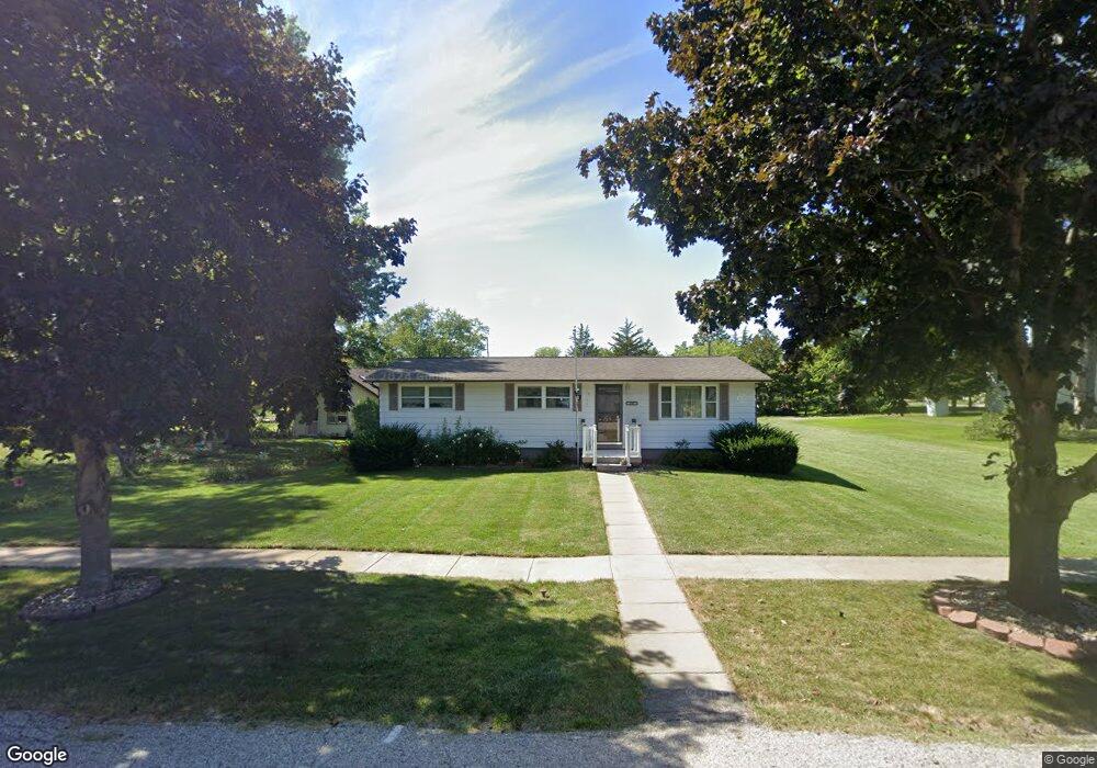
135 N George St North Liberty, IA 52317
Estimated Value: $195,863 - $236,000
3
Beds
1
Bath
1,008
Sq Ft
$213/Sq Ft
Est. Value
About This Home
This home is located at 135 N George St, North Liberty, IA 52317 and is currently estimated at $214,466, approximately $212 per square foot. 135 N George St is a home located in Johnson County with nearby schools including Penn Elementary School, North Central Junior High School, and Liberty High School.
Ownership History
Date
Name
Owned For
Owner Type
Purchase Details
Closed on
Nov 8, 2022
Sold by
Stoner Ella
Bought by
Stoner Ella and Haberer Lora L
Current Estimated Value
Purchase Details
Closed on
Sep 21, 2018
Sold by
Stunw Norman and Stunw Ella
Bought by
Stonw Ella
Purchase Details
Closed on
Aug 8, 2017
Sold by
Stoner Norman L and Stoner Ella L
Bought by
Stoner Norman L and Stoner Ella L
Create a Home Valuation Report for This Property
The Home Valuation Report is an in-depth analysis detailing your home's value as well as a comparison with similar homes in the area
Home Values in the Area
Average Home Value in this Area
Purchase History
| Date | Buyer | Sale Price | Title Company |
|---|---|---|---|
| Stoner Ella | -- | -- | |
| Stonw Ella | -- | None Available | |
| Stoner Norman L | -- | None Available |
Source: Public Records
Tax History Compared to Growth
Tax History
| Year | Tax Paid | Tax Assessment Tax Assessment Total Assessment is a certain percentage of the fair market value that is determined by local assessors to be the total taxable value of land and additions on the property. | Land | Improvement |
|---|---|---|---|---|
| 2025 | $1,560 | $178,200 | $54,000 | $124,200 |
| 2024 | $1,636 | $114,700 | $54,000 | $60,700 |
| 2023 | $1,446 | $114,700 | $54,000 | $60,700 |
| 2022 | $1,370 | $83,400 | $27,000 | $56,400 |
| 2021 | $1,338 | $83,400 | $27,000 | $56,400 |
| 2020 | $1,338 | $78,000 | $27,000 | $51,000 |
| 2019 | $1,340 | $78,000 | $27,000 | $51,000 |
| 2018 | $1,310 | $78,000 | $27,000 | $51,000 |
| 2017 | $1,310 | $78,000 | $27,000 | $51,000 |
| 2016 | $1,112 | $68,800 | $27,000 | $41,800 |
| 2015 | $1,112 | $68,800 | $27,000 | $41,800 |
| 2014 | $1,872 | $109,600 | $27,000 | $82,600 |
Source: Public Records
Map
Nearby Homes
- 425 Stewart St
- 20 E Zeller St
- 420 W Zeller St
- 415 Heritage Place Unit 417
- 425 Heritage Place
- 435 Heritage Place
- 445 Heritage Place
- 285 Autumn Ct
- 455 Heritage Place
- 622 Emily St
- 270 & 280 Chestnut St
- 25 Birch Ct
- 110 Whitman Ave
- 144 Elm Ridge Dr
- 142 Elm Ridge Dr
- 200 Juniper Ct
- 70 Jefferson Ln Unit 70
- 160 Elm Ridge Ct
- 667 Andy Ct
- 740 Molly Dr
- 155 N George St
- 115 N George St
- 140 N Stewart St
- 105 N George St
- 130 N George St
- 225 W Walnut St
- 130 N Stewart St
- 140 N George St
- 160 N George St
- 230 W Chestnut St
- 205 N George St
- 110 N George St
- 210 N Stewart St
- 210 N George St
- 55 N George St
- 220 N Stewart St
- 115 W Walnut St
- 225 N George St
- 60 N George St
- 45 N George St