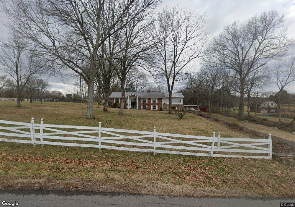
135 Neals Ln Gallatin, TN 37066
Estimated Value: $572,000 - $794,000
--
Bed
3
Baths
1,540
Sq Ft
$446/Sq Ft
Est. Value
About This Home
This home is located at 135 Neals Ln, Gallatin, TN 37066 and is currently estimated at $687,000, approximately $446 per square foot. 135 Neals Ln is a home located in Sumner County with nearby schools including Station Camp High School.
Ownership History
Date
Name
Owned For
Owner Type
Purchase Details
Closed on
Oct 31, 2022
Sold by
Adams Regina Spears
Bought by
Elizondo Family Living Trust
Current Estimated Value
Purchase Details
Closed on
Jun 13, 2022
Sold by
Spears Adams Regina
Bought by
Elizondo Family Living Trust
Home Financials for this Owner
Home Financials are based on the most recent Mortgage that was taken out on this home.
Original Mortgage
$487,500
Interest Rate
4.57%
Mortgage Type
New Conventional
Purchase Details
Closed on
Jun 5, 2019
Sold by
Spears Eugene
Bought by
Adams Regina Spears and Spears Gregory Lee
Purchase Details
Closed on
Sep 30, 2011
Sold by
Shaw Dawn Burns and Church Brenda
Bought by
Spears Eugene and Spears Elizabeth F
Create a Home Valuation Report for This Property
The Home Valuation Report is an in-depth analysis detailing your home's value as well as a comparison with similar homes in the area
Home Values in the Area
Average Home Value in this Area
Purchase History
| Date | Buyer | Sale Price | Title Company |
|---|---|---|---|
| Elizondo Family Living Trust | $199,900 | -- | |
| Elizondo Family Living Trust | $199,900 | None Listed On Document | |
| Elizondo Family Living Trust | $750,000 | Donoho Taylor & Taylor | |
| Adams Regina Spears | -- | None Available | |
| Spears Eugene | $46,000 | None Available | |
| Spears Eugene | $194,000 | None Available |
Source: Public Records
Mortgage History
| Date | Status | Borrower | Loan Amount |
|---|---|---|---|
| Previous Owner | Elizondo Family Living Trust | $487,500 |
Source: Public Records
Tax History Compared to Growth
Tax History
| Year | Tax Paid | Tax Assessment Tax Assessment Total Assessment is a certain percentage of the fair market value that is determined by local assessors to be the total taxable value of land and additions on the property. | Land | Improvement |
|---|---|---|---|---|
| 2024 | $2,046 | $143,950 | $61,550 | $82,400 |
| 2023 | $3,153 | $103,300 | $67,275 | $36,025 |
| 2022 | $2,337 | $103,300 | $67,275 | $36,025 |
| 2021 | $3,164 | $103,300 | $67,275 | $36,025 |
| 2020 | $3,164 | $103,300 | $67,275 | $36,025 |
| 2019 | $2,701 | $0 | $0 | $0 |
| 2018 | $2,606 | $0 | $0 | $0 |
| 2017 | $2,606 | $0 | $0 | $0 |
| 2016 | $1,867 | $0 | $0 | $0 |
| 2015 | -- | $0 | $0 | $0 |
| 2014 | -- | $0 | $0 | $0 |
Source: Public Records
Map
Nearby Homes
- 1386 Long Hollow Pike
- 1616 Long Hollow Pike
- 330 Triple Crown Cir
- 1670 Long Hollow Pike
- 540 Triple Crown
- 378 Triple Crown Cir
- 516 Triple Crown Cir
- 512 Triple Crown Cir
- 508 Triple Crown Cir
- 491 Triple Crown Cir
- 487 Triple Crown Cir
- The Cleveland Plan at Kensington Downs - Single Family
- The Sutherland Plan at Kensington Downs - Single Family
- The Heartland Plan at Kensington Downs - Single Family
- 483 Triple Crown Cir
- 479 Triple Crown Cir
- 420 Triple Crown Cir
- 471 Triple Crown Cir
- 500 Triple Crown Cir
- 467 Triple Crown Cir
- 201 Neals Ln
- 103 Neals Ln
- 1508 Long Hollow Pike
- 1522 Long Hollow Pike
- 1528 Long Hollow Pike
- 245 Neals Ln
- 1534 Long Hollow Pike
- 265 Neals Ln
- 771 Long Hollow Pike
- 2350 Long Hollow Pike
- 695 Saint Blaise Rd
- 696 Saint Blaise Rd
- 1554 Long Hollow Pike
- 1408 Long Hollow Pike
- 1527 Long Hollow Pike
- 356 Neals Ln Unit C
- 356 Neals Ln Unit B
- 1511 Long Hollow Pike
- 692 Saint Blaise Rd
- 1529 Long Hollow Pike