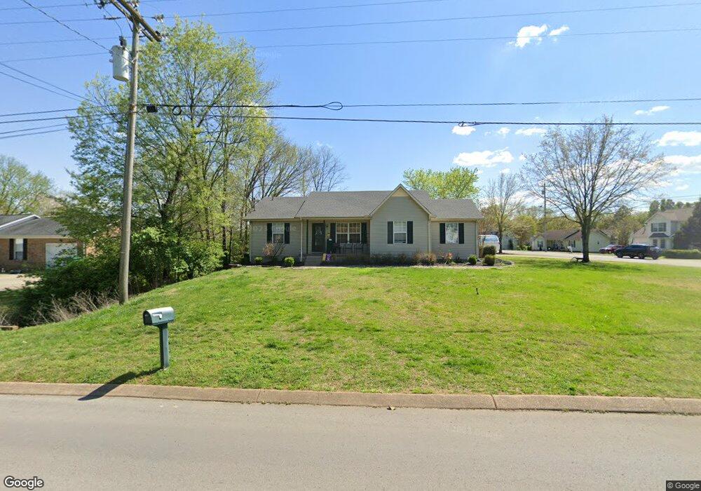
135 Noel Ln Smyrna, TN 37167
Estimated Value: $306,977 - $322,000
--
Bed
2
Baths
1,166
Sq Ft
$270/Sq Ft
Est. Value
About This Home
This home is located at 135 Noel Ln, Smyrna, TN 37167 and is currently estimated at $314,994, approximately $270 per square foot. 135 Noel Ln is a home located in Rutherford County with nearby schools including David Youree Elementary School, Rocky Fork Middle School, and Smyrna High School.
Ownership History
Date
Name
Owned For
Owner Type
Purchase Details
Closed on
Jan 29, 2014
Sold by
Reed And Waller Properties
Bought by
Waller Properties Ii Llc
Current Estimated Value
Purchase Details
Closed on
May 23, 2007
Sold by
Reed & Waller Partnership
Bought by
Reed & Waller Properties Gp
Home Financials for this Owner
Home Financials are based on the most recent Mortgage that was taken out on this home.
Original Mortgage
$108,000
Interest Rate
6.16%
Purchase Details
Closed on
May 22, 2007
Sold by
Waller George M
Bought by
Reed & Waller Properties
Home Financials for this Owner
Home Financials are based on the most recent Mortgage that was taken out on this home.
Original Mortgage
$108,000
Interest Rate
6.16%
Purchase Details
Closed on
May 10, 2005
Sold by
Stephanie Scott
Bought by
Hud
Create a Home Valuation Report for This Property
The Home Valuation Report is an in-depth analysis detailing your home's value as well as a comparison with similar homes in the area
Home Values in the Area
Average Home Value in this Area
Purchase History
| Date | Buyer | Sale Price | Title Company |
|---|---|---|---|
| Waller Properties Ii Llc | -- | -- | |
| Reed & Waller Properties Gp | -- | -- | |
| Waller George M | $108,000 | -- | |
| Reed & Waller Properties | -- | -- | |
| Reed Steve M | $108,000 | -- | |
| Hud | $101,139 | -- |
Source: Public Records
Mortgage History
| Date | Status | Borrower | Loan Amount |
|---|---|---|---|
| Previous Owner | Hud | $108,000 | |
| Previous Owner | Hud | $108,000 |
Source: Public Records
Tax History Compared to Growth
Tax History
| Year | Tax Paid | Tax Assessment Tax Assessment Total Assessment is a certain percentage of the fair market value that is determined by local assessors to be the total taxable value of land and additions on the property. | Land | Improvement |
|---|---|---|---|---|
| 2025 | $1,485 | $61,825 | $13,750 | $48,075 |
| 2024 | $1,485 | $61,825 | $13,750 | $48,075 |
| 2023 | $1,485 | $61,825 | $13,750 | $48,075 |
| 2022 | $1,324 | $61,825 | $13,750 | $48,075 |
| 2021 | $1,239 | $42,450 | $8,750 | $33,700 |
| 2020 | $1,239 | $42,450 | $8,750 | $33,700 |
| 2019 | $1,239 | $42,450 | $8,750 | $33,700 |
| 2018 | $1,188 | $42,450 | $0 | $0 |
| 2017 | $1,006 | $28,225 | $0 | $0 |
| 2016 | $1,006 | $28,225 | $0 | $0 |
| 2015 | $1,006 | $28,225 | $0 | $0 |
| 2014 | $702 | $28,225 | $0 | $0 |
| 2013 | -- | $26,050 | $0 | $0 |
Source: Public Records
Map
Nearby Homes
- 304 Short Ct
- 143 Stokes Dr
- 107 Irish Place
- 105 Pleasant Dr
- 104 Pleasant Dr
- 101 Annleeken Dr
- 4344 Spregan Way
- 4372 Spregan Way
- 400 Highland Ave
- 806 Enon Springs Rd W
- 726 Mason Tucker Dr
- Caroline Plan at Spring Branch - Townhomes
- Bruckner Plan at Spring Branch - Townhomes
- Mozart Plan at Spring Branch - Townhomes
- 1102 Forestwood Ct
- 1226 Bronte Dr Unit 23D
- 1222 Bronte Dr Unit 23C
- 1226 Bronte Dr
- 4018 Gaskill Dr
- 630 Rock Springs Rd
- 133 Noel Ln
- 596 Mason Tucker Dr
- 134 Noel Ln
- 597 Mason Tucker Dr
- 201 Noel Ln
- 131 Noel Ln
- 301 Summer Dr
- 594 Mason Tucker Dr
- 595 Mason Tucker Dr
- 101 Pacific Ct
- 103 Pacific Ct
- 200 Noel Ln
- 129 Noel Ln
- 593 Mason Tucker Dr
- 203 Noel Ln
- 303 Summer Dr
- 602 Mason Tucker Dr
- 592 Mason Tucker Dr
- 130 Noel Ln
- 202 Noel Ln