Estimated Value: $837,000 - $1,667,000
2
Beds
1
Bath
2,364
Sq Ft
$517/Sq Ft
Est. Value
About This Home
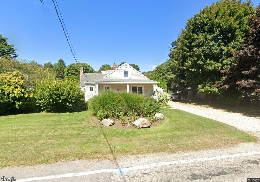
This home is located at 135 Perkins Rd, Rye, NH 03870 and is currently estimated at $1,222,194, approximately $517 per square foot. 135 Perkins Rd is a home located in Rockingham County with nearby schools including Rye Elementary School, Rye Junior High School, and Rye Country Day School.
Ownership History
Date
Name
Owned For
Owner Type
Purchase Details
Closed on
Dec 15, 2015
Sold by
Perkins Road Rt and Keane
Bought by
Mary Jane Keane Lt and Keane
Current Estimated Value
Purchase Details
Closed on
Jan 29, 2010
Sold by
Letendre Gerard R
Bought by
Perkins Road Rt and Keane
Home Financials for this Owner
Home Financials are based on the most recent Mortgage that was taken out on this home.
Original Mortgage
$100,000
Interest Rate
5.12%
Mortgage Type
Unknown
Create a Home Valuation Report for This Property
The Home Valuation Report is an in-depth analysis detailing your home's value as well as a comparison with similar homes in the area
Home Values in the Area
Average Home Value in this Area
Purchase History
| Date | Buyer | Sale Price | Title Company |
|---|---|---|---|
| Mary Jane Keane Lt | -- | -- | |
| Perkins Road Rt | $297,500 | -- |
Source: Public Records
Mortgage History
| Date | Status | Borrower | Loan Amount |
|---|---|---|---|
| Previous Owner | Perkins Road Rt | $100,000 | |
| Previous Owner | Perkins Road Rt | $100,000 |
Source: Public Records
Tax History
| Year | Tax Paid | Tax Assessment Tax Assessment Total Assessment is a certain percentage of the fair market value that is determined by local assessors to be the total taxable value of land and additions on the property. | Land | Improvement |
|---|---|---|---|---|
| 2024 | $6,718 | $775,800 | $480,400 | $295,400 |
| 2023 | $6,230 | $775,800 | $480,400 | $295,400 |
| 2022 | $5,415 | $775,800 | $480,400 | $295,400 |
| 2021 | $6,419 | $628,100 | $418,000 | $210,100 |
| 2020 | $6,419 | $628,100 | $418,000 | $210,100 |
| 2019 | $6,419 | $628,100 | $418,000 | $210,100 |
| 2018 | $5,047 | $628,100 | $418,000 | $210,100 |
| 2017 | $6,350 | $628,100 | $418,000 | $210,100 |
| 2016 | $4,432 | $480,100 | $270,000 | $210,100 |
| 2015 | $5,233 | $480,100 | $270,000 | $210,100 |
| 2013 | $5,267 | $480,100 | $270,000 | $210,100 |
Source: Public Records
Map
Nearby Homes
- 4 Mclaughlin Dr
- 160 Perkins Rd
- 150 Perkins Rd
- 146 Perkins Rd
- 130 Perkins Rd
- 129 Perkins Rd
- 2 Mclaughlin Dr
- 136 Perkins Rd
- 125 Perkins Rd
- 6 Mclaughlin Dr
- 149 Perkins Rd
- 3 Mclaughlin Dr
- 120 Perkins Rd
- 8 Mclaughlin Dr
- 153 Perkins Rd
- 5 Mclaughlin Dr
- 1 Mclaughlin Dr
- 2 Foster Ln
- 156 Perkins Rd
- 115 Perkins Rd
Your Personal Tour Guide
Ask me questions while you tour the home.