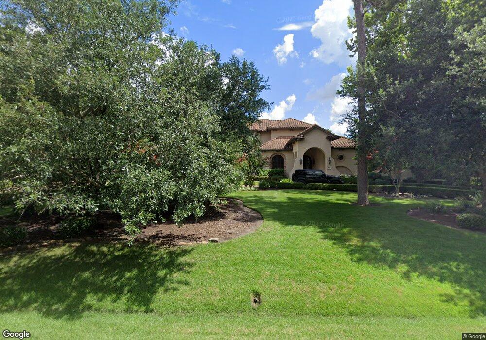
135 S Tranquil Path the Woodlands, TX 77380
Grogan's Mill NeighborhoodEstimated Value: $1,845,609 - $2,103,000
5
Beds
8
Baths
6,686
Sq Ft
$293/Sq Ft
Est. Value
About This Home
This home is located at 135 S Tranquil Path, the Woodlands, TX 77380 and is currently estimated at $1,961,536, approximately $293 per square foot. 135 S Tranquil Path is a home located in Montgomery County with nearby schools including Hailey Elementary School, W.D Wilkerson Intermediate School, and Knox J High School.
Ownership History
Date
Name
Owned For
Owner Type
Purchase Details
Closed on
Dec 16, 2011
Sold by
Cali Homes Inc
Bought by
Shell Timothy A and Shell Jeannette S
Current Estimated Value
Home Financials for this Owner
Home Financials are based on the most recent Mortgage that was taken out on this home.
Original Mortgage
$1,060,500
Outstanding Balance
$726,150
Interest Rate
4.03%
Mortgage Type
New Conventional
Estimated Equity
$1,235,386
Purchase Details
Closed on
Jan 11, 2008
Sold by
The Woodlands Land Development Co Lp
Bought by
Calli Homes Inc
Create a Home Valuation Report for This Property
The Home Valuation Report is an in-depth analysis detailing your home's value as well as a comparison with similar homes in the area
Home Values in the Area
Average Home Value in this Area
Purchase History
| Date | Buyer | Sale Price | Title Company |
|---|---|---|---|
| Shell Timothy A | -- | Stewart Title Of Montgomery | |
| Shell Timothy A | -- | Stewart Title Of Montgomery | |
| Calli Homes Inc | -- | Stewart Title Of Montgomery |
Source: Public Records
Mortgage History
| Date | Status | Borrower | Loan Amount |
|---|---|---|---|
| Open | Shell Timothy A | $1,060,500 | |
| Closed | Shell Timothy A | $1,060,500 |
Source: Public Records
Tax History Compared to Growth
Tax History
| Year | Tax Paid | Tax Assessment Tax Assessment Total Assessment is a certain percentage of the fair market value that is determined by local assessors to be the total taxable value of land and additions on the property. | Land | Improvement |
|---|---|---|---|---|
| 2025 | $28,356 | $1,700,000 | $300,000 | $1,400,000 |
| 2024 | $26,184 | $1,721,000 | $300,000 | $1,421,000 |
| 2023 | $26,184 | $1,585,000 | $300,000 | $1,285,000 |
| 2022 | $32,030 | $1,585,000 | $300,000 | $1,285,000 |
| 2021 | $31,720 | $1,453,970 | $64,890 | $1,389,080 |
| 2020 | $33,266 | $1,460,340 | $64,890 | $1,395,450 |
| 2019 | $32,959 | $1,400,000 | $64,890 | $1,335,110 |
| 2018 | $30,554 | $1,400,000 | $64,890 | $1,335,110 |
| 2017 | $40,071 | $1,681,200 | $64,890 | $1,616,310 |
| 2016 | $40,071 | $1,681,200 | $64,890 | $1,616,310 |
| 2015 | $36,433 | $1,618,170 | $64,890 | $1,553,280 |
| 2014 | $36,433 | $1,515,790 | $64,890 | $1,477,510 |
Source: Public Records
Map
Nearby Homes
- 118 Angel Leaf Rd
- 1237 Pruitt Rd
- 193 Grogans Point Rd
- 205 Grogans Point Rd
- 50 Dew Fall Ct
- 36 N Rain Forest Ct
- 1231 Pruitt Rd
- 52 S High Oaks Cir
- 98 Northgate Dr
- 27 Misty Grove Cir
- 25225 Liberty Mill Dr
- 25234 Calhoun Creek Dr
- 71 Timberspire Ln
- 40 N Morningwood Ct
- 56 N Morningwood Ct
- 6 Misty Point
- 198 Velvet Leaf Place
- 30 Halfmoon Ct
- 98 S Dreamweaver Cir
- 4001 Lonesome Pine Rd
- 127 S Tranquil Path
- 127 S Tranquil Path Dr
- 143 S Tranquil Path
- 123 S Tranquil Path Dr
- 142 S Tranquil Path
- 134 S Tranquil Path Dr
- 119 S Tranquil Path
- 126 S Tranquil Path
- 115 S Tranquil Path Dr
- 111 S Tranquil Path
- 114 S Tranquil Path Dr
- 110 S Tranquil Path Dr
- 163 S Tranquil Path Dr
- 163 S Tranquil Path
- 239 Starlight Place
- 107 S Tranquil Path
- 203 N Tranquil Path
- 167 N Tranquil Path Dr
- 199 N Tranquil Path Dr
- 235 Starlight Place