Estimated Value: $586,000 - $628,000
3
Beds
2
Baths
3,071
Sq Ft
$196/Sq Ft
Est. Value
About This Home
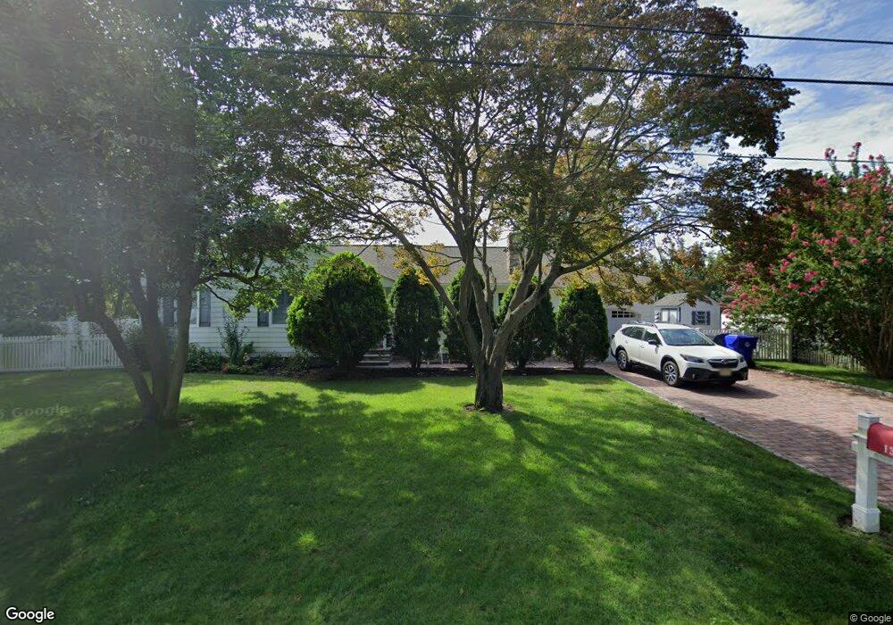
This home is located at 135 Taylor Blvd, Brick, NJ 08724 and is currently estimated at $602,179, approximately $196 per square foot. 135 Taylor Blvd is a home located in Ocean County with nearby schools including Midstreams Elementary School, Veterans Memorial Middle School, and Brick Township Memorial High School.
Ownership History
Date
Name
Owned For
Owner Type
Purchase Details
Closed on
Jun 30, 2003
Sold by
Grimm Joel J
Bought by
Martin Kenneth L
Current Estimated Value
Home Financials for this Owner
Home Financials are based on the most recent Mortgage that was taken out on this home.
Original Mortgage
$200,000
Outstanding Balance
$85,094
Interest Rate
5.27%
Estimated Equity
$517,085
Create a Home Valuation Report for This Property
The Home Valuation Report is an in-depth analysis detailing your home's value as well as a comparison with similar homes in the area
Home Values in the Area
Average Home Value in this Area
Purchase History
| Date | Buyer | Sale Price | Title Company |
|---|---|---|---|
| Martin Kenneth L | $279,900 | -- |
Source: Public Records
Mortgage History
| Date | Status | Borrower | Loan Amount |
|---|---|---|---|
| Open | Martin Kenneth L | $200,000 |
Source: Public Records
Tax History Compared to Growth
Tax History
| Year | Tax Paid | Tax Assessment Tax Assessment Total Assessment is a certain percentage of the fair market value that is determined by local assessors to be the total taxable value of land and additions on the property. | Land | Improvement |
|---|---|---|---|---|
| 2025 | $7,835 | $300,200 | $144,000 | $156,200 |
| 2024 | $7,436 | $300,200 | $144,000 | $156,200 |
| 2023 | $7,328 | $300,200 | $144,000 | $156,200 |
| 2022 | $7,328 | $300,200 | $144,000 | $156,200 |
| 2021 | $6,845 | $300,200 | $144,000 | $156,200 |
| 2020 | $7,082 | $300,200 | $144,000 | $156,200 |
| 2019 | $6,956 | $300,200 | $144,000 | $156,200 |
| 2018 | $6,797 | $300,200 | $144,000 | $156,200 |
| 2017 | $6,613 | $300,200 | $144,000 | $156,200 |
| 2016 | $6,577 | $300,200 | $144,000 | $156,200 |
| 2015 | $6,406 | $300,200 | $144,000 | $156,200 |
| 2014 | $6,331 | $299,200 | $144,000 | $155,200 |
Source: Public Records
Map
Nearby Homes
- 141 Taylor Blvd
- 17 Brant Dr
- 24 Mayapple Dr
- 7 Brant Dr
- 2 Brant Dr Unit Lot 5.01
- 24 Laurelhurst Dr
- 80 Robbins Ct
- 65 Sleepy Hollow Dr
- 27 Greenhill Dr
- 16 Wayside Dr
- 123 Bruce St
- 241 Old Squan Rd
- 16 Mallard Dr
- 5 Fieldcrest Ln
- 17 Mallard Dr
- 3 C Trail
- 91 Princeton Ave
- 11 B Trail
- 5 B Trail
- 103 Sleepy Hollow Dr
- 105 Lewis Ln
- 138 Besante Blvd
- 142 Besante Blvd
- 101 Lewis Ln
- 136 Taylor Blvd
- 140 Taylor Blvd
- 132 Taylor Blvd
- 145 Taylor Blvd
- 144 Besante Blvd
- 141 Lewis Ln
- 137 Besante Blvd
- 104 Lewis Ln
- 144 Taylor Blvd
- 135 Kieser Blvd
- 141 Besante Blvd
- 126 Besante Blvd
- 141 Kieser Blvd
- 128 Taylor Blvd
- 95 Lewis Ln
- 149 Taylor Blvd