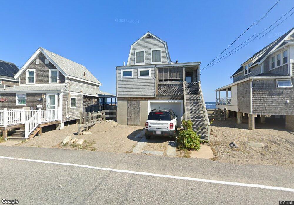
135 Turner Rd Scituate, MA 02066
Estimated Value: $806,516 - $871,000
2
Beds
2
Baths
954
Sq Ft
$864/Sq Ft
Est. Value
About This Home
This home is located at 135 Turner Rd, Scituate, MA 02066 and is currently estimated at $824,379, approximately $864 per square foot. 135 Turner Rd is a home located in Plymouth County with nearby schools including Jenkins Elementary School, Lester J. Gates Middle School, and Scituate High School.
Ownership History
Date
Name
Owned For
Owner Type
Purchase Details
Closed on
May 31, 1996
Sold by
Curran William A and Curran Joanne M
Bought by
Newcomb Dexter A and Bitzer Ann M
Current Estimated Value
Home Financials for this Owner
Home Financials are based on the most recent Mortgage that was taken out on this home.
Original Mortgage
$135,000
Interest Rate
7.91%
Mortgage Type
Purchase Money Mortgage
Create a Home Valuation Report for This Property
The Home Valuation Report is an in-depth analysis detailing your home's value as well as a comparison with similar homes in the area
Home Values in the Area
Average Home Value in this Area
Purchase History
| Date | Buyer | Sale Price | Title Company |
|---|---|---|---|
| Newcomb Dexter A | $150,000 | -- |
Source: Public Records
Mortgage History
| Date | Status | Borrower | Loan Amount |
|---|---|---|---|
| Open | Newcomb Dexter A | $50,000 | |
| Open | Newcomb Dexter A | $110,000 | |
| Closed | Newcomb Dexter A | $135,000 |
Source: Public Records
Tax History Compared to Growth
Tax History
| Year | Tax Paid | Tax Assessment Tax Assessment Total Assessment is a certain percentage of the fair market value that is determined by local assessors to be the total taxable value of land and additions on the property. | Land | Improvement |
|---|---|---|---|---|
| 2025 | $8,157 | $816,500 | $678,400 | $138,100 |
| 2024 | $7,082 | $683,600 | $548,200 | $135,400 |
| 2023 | $6,016 | $618,800 | $498,400 | $120,400 |
| 2022 | $6,016 | $476,700 | $374,300 | $102,400 |
| 2021 | $5,949 | $446,300 | $356,500 | $89,800 |
| 2020 | $5,837 | $432,400 | $342,700 | $89,700 |
| 2019 | $6,140 | $446,900 | $358,400 | $88,500 |
| 2018 | $6,411 | $459,600 | $367,500 | $92,100 |
| 2017 | $6,339 | $449,900 | $357,800 | $92,100 |
| 2016 | $6,183 | $437,300 | $348,200 | $89,100 |
| 2015 | $5,854 | $446,900 | $357,800 | $89,100 |
Source: Public Records
Map
Nearby Homes
- 105 Turner Rd
- 32 Barker Rd Unit 3
- 12 Richfield Rd
- 23 Lois Ann Ct Unit 23
- 148 Tilden Rd
- 23 Sunset Rd
- 209 Hatherly Rd
- 30 Irving Rd
- 74 Tilden Rd
- 91 Front St Unit 106
- 76 A Brook St
- 76 A Brook St Unit 1
- 55 Seaside Rd
- 50 First Parish Rd
- 7 Borden Rd
- 355 Tilden Rd
- 378 Tilden Rd
- 18 James Way
- 22 Kings Way
- 2 Windward Ln
- 137 Turner Rd
- 133 Turner Rd
- 133 Turner Rd Unit 1
- 131 Turner Rd
- 131 Turner Rd Unit 1
- 139 Turner Rd
- 132 Turner Rd
- 136 Turner Rd
- 129 Turner Rd
- 134 Turner Rd
- 138 Turner Rd
- 143 Turner Rd
- 127 Turner Rd
- 126 Turner Rd
- 140 Turner Rd
- 125 Turner Rd
- 125 Turner Rd Unit 1
- 145 Turner Rd
- 124 Turner Rd
- 123 Turner Rd