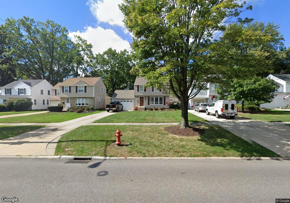
1350 Brainard Rd Cleveland, OH 44124
Estimated Value: $199,000 - $250,000
3
Beds
1
Bath
1,620
Sq Ft
$142/Sq Ft
Est. Value
About This Home
This home is located at 1350 Brainard Rd, Cleveland, OH 44124 and is currently estimated at $230,586, approximately $142 per square foot. 1350 Brainard Rd is a home located in Cuyahoga County with nearby schools including Sunview Elementary School, Greenview Upper Elementary School, and Memorial Junior High School.
Ownership History
Date
Name
Owned For
Owner Type
Purchase Details
Closed on
Apr 3, 1985
Sold by
Peppard Thomas R
Bought by
Peppard Thomas R
Current Estimated Value
Purchase Details
Closed on
Oct 10, 1978
Sold by
Schustrich Robert
Bought by
Peppard Thomas R
Purchase Details
Closed on
Jun 1, 1977
Sold by
Powalski Helen
Bought by
Schustrich Robert
Purchase Details
Closed on
Jan 27, 1977
Sold by
Powalski Edward J and H J
Bought by
Powalski Helen
Purchase Details
Closed on
Jan 1, 1975
Bought by
Powalski Edward J and H J
Create a Home Valuation Report for This Property
The Home Valuation Report is an in-depth analysis detailing your home's value as well as a comparison with similar homes in the area
Home Values in the Area
Average Home Value in this Area
Purchase History
| Date | Buyer | Sale Price | Title Company |
|---|---|---|---|
| Peppard Thomas R | -- | -- | |
| Peppard Thomas R | $68,500 | -- | |
| Schustrich Robert | $58,500 | -- | |
| Powalski Helen | -- | -- | |
| Powalski Edward J | -- | -- |
Source: Public Records
Tax History Compared to Growth
Tax History
| Year | Tax Paid | Tax Assessment Tax Assessment Total Assessment is a certain percentage of the fair market value that is determined by local assessors to be the total taxable value of land and additions on the property. | Land | Improvement |
|---|---|---|---|---|
| 2024 | $3,864 | $64,085 | $11,235 | $52,850 |
| 2023 | $4,132 | $56,810 | $10,150 | $46,660 |
| 2022 | $4,867 | $56,810 | $10,150 | $46,660 |
| 2021 | $4,825 | $56,810 | $10,150 | $46,660 |
| 2020 | $4,524 | $46,590 | $8,330 | $38,260 |
| 2019 | $4,077 | $133,100 | $23,800 | $109,300 |
| 2018 | $3,058 | $46,590 | $8,330 | $38,260 |
| 2017 | $4,202 | $44,390 | $8,440 | $35,950 |
| 2016 | $4,170 | $44,390 | $8,440 | $35,950 |
| 2015 | $4,851 | $44,390 | $8,440 | $35,950 |
| 2014 | $4,851 | $45,290 | $8,610 | $36,680 |
Source: Public Records
Map
Nearby Homes
- 1307 Ford Rd
- 1291 Haverston Rd
- 1284 Haverston Rd
- 1391 Iroquois Ave
- 1433 Churchill Rd
- 1443 Churchill Rd
- 1151 Brainard Rd
- 1151 Croyden Rd
- 1213 Eastwood Ave
- 1192 Blanchester Rd
- 1363 Ranchland Dr
- 1218 Summit Dr
- 1233 Summit Dr
- 1120 Croyden Rd
- 1368 Irene Rd
- 1430 Belrose Rd
- 1548 Biltmore Rd
- 1201 Summit Dr
- 1590 Longwood Dr
- 1574 Hawthorne Dr
- 1354 Brainard Rd
- 1344 Brainard Rd
- 1360 Brainard Rd
- 1340 Brainard Rd
- 1364 Brainard Rd
- 1334 Brainard Rd
- 1345 Ford Rd
- 1353 Ford Rd
- 1359 Ford Rd
- 1339 Ford Rd
- 1370 Brainard Rd
- 1363 Ford Rd
- 1333 Ford Rd
- 1349 Brainard Rd
- 1353 Brainard Rd
- 1343 Brainard Rd
- 1359 Brainard Rd
- 1374 Brainard Rd
- 1339 Brainard Rd
- 1363 Brainard Rd