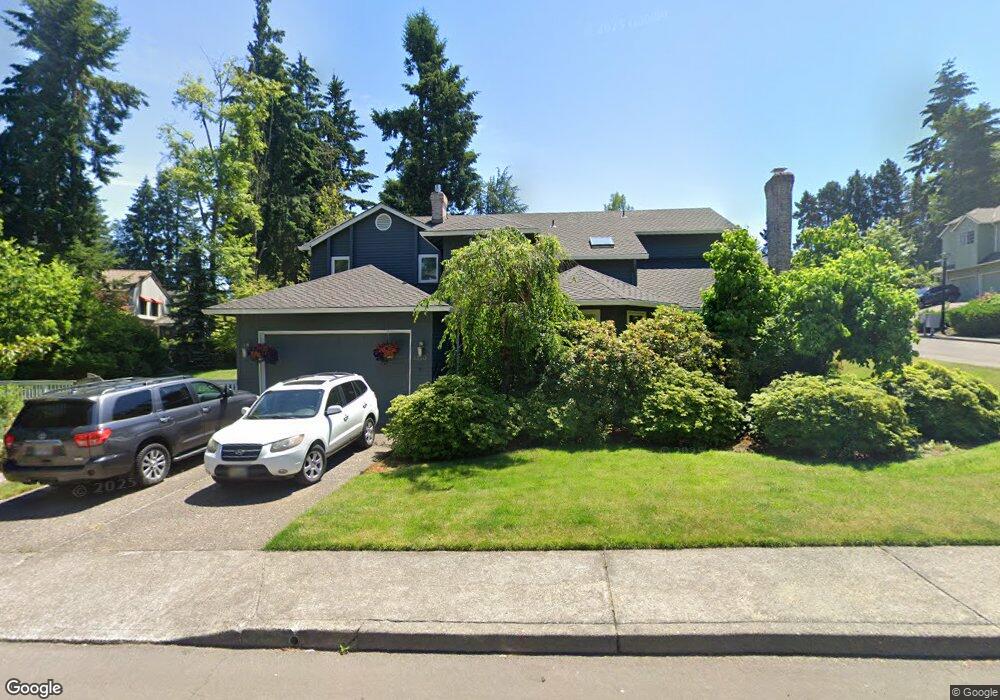
1350 Stonehaven Dr West Linn, OR 97068
Marylhurst NeighborhoodEstimated Value: $875,190 - $1,061,000
4
Beds
3
Baths
3,248
Sq Ft
$299/Sq Ft
Est. Value
About This Home
This home is located at 1350 Stonehaven Dr, West Linn, OR 97068 and is currently estimated at $970,298, approximately $298 per square foot. 1350 Stonehaven Dr is a home located in Clackamas County with nearby schools including Stafford Primary School, West Linn High School, and Harmony Academy.
Ownership History
Date
Name
Owned For
Owner Type
Purchase Details
Closed on
Jun 17, 1999
Sold by
Fuller Richard M and Fuller Kim M
Bought by
Milner Olmsted Bess and Olmsted Christopher L
Current Estimated Value
Home Financials for this Owner
Home Financials are based on the most recent Mortgage that was taken out on this home.
Original Mortgage
$225,000
Outstanding Balance
$58,184
Interest Rate
7.05%
Estimated Equity
$912,114
Create a Home Valuation Report for This Property
The Home Valuation Report is an in-depth analysis detailing your home's value as well as a comparison with similar homes in the area
Home Values in the Area
Average Home Value in this Area
Purchase History
| Date | Buyer | Sale Price | Title Company |
|---|---|---|---|
| Milner Olmsted Bess | $300,000 | First American Title Co |
Source: Public Records
Mortgage History
| Date | Status | Borrower | Loan Amount |
|---|---|---|---|
| Open | Milner Olmsted Bess | $225,000 |
Source: Public Records
Tax History Compared to Growth
Tax History
| Year | Tax Paid | Tax Assessment Tax Assessment Total Assessment is a certain percentage of the fair market value that is determined by local assessors to be the total taxable value of land and additions on the property. | Land | Improvement |
|---|---|---|---|---|
| 2025 | $10,415 | $540,437 | -- | -- |
| 2024 | $10,025 | $524,697 | -- | -- |
| 2023 | $10,025 | $509,415 | $0 | $0 |
| 2022 | $9,463 | $494,578 | $0 | $0 |
| 2021 | $8,688 | $480,173 | $0 | $0 |
| 2020 | $8,617 | $466,188 | $0 | $0 |
| 2019 | $8,252 | $452,610 | $0 | $0 |
| 2018 | $7,852 | $439,427 | $0 | $0 |
| 2017 | $7,612 | $426,628 | $0 | $0 |
| 2016 | $7,305 | $414,202 | $0 | $0 |
| 2015 | $6,955 | $402,138 | $0 | $0 |
| 2014 | $6,580 | $390,425 | $0 | $0 |
Source: Public Records
Map
Nearby Homes
- 1611 Arran Ct
- 1397 Skye Pkwy
- 2167 Marylwood Ct
- 1321 Troon Dr
- 1384 Celtic Ct
- 2041 Marylhurst Dr
- 1354 Skye Pkwy
- 1777 Skyland Dr
- 2455 College Hill Place
- 19640 Kapteyns St
- 19661 Sun Cir
- 17833 Marylcreek Dr
- 17514 Brookhurst Dr
- 655 Rosemont Rd
- 17634 Brookhurst Dr
- 17623 Brookhurst Dr
- 17900 Crestline Dr
- 18300 S Whitten Ln
- 2636 Maria Ct
- 18194 Shady Hollow Way
- 1590 Skye Pkwy
- 1507 Braemar Ct
- 1592 Skye Pkwy
- 1499 Braemar Dr
- 1500 Braemar Ct
- 1498 Skye Pkwy
- 1341 Stonehaven Dr
- 1594 Skye Pkwy
- 1505 Braemar Ct
- 1497 Braemar Dr
- 1504 Braemar Ct
- 1496 Skye Parkwayre-List
- 1496 Skye Pkwy
- 1338 Stonehaven Dr
- 1496 Braemar Dr
- 1591 Skye Pkwy
- 1596 Skye Pkwy
- 1336 Stonehaven Dr
- 1339 Stonehaven Dr
- 1495 Braemar Dr