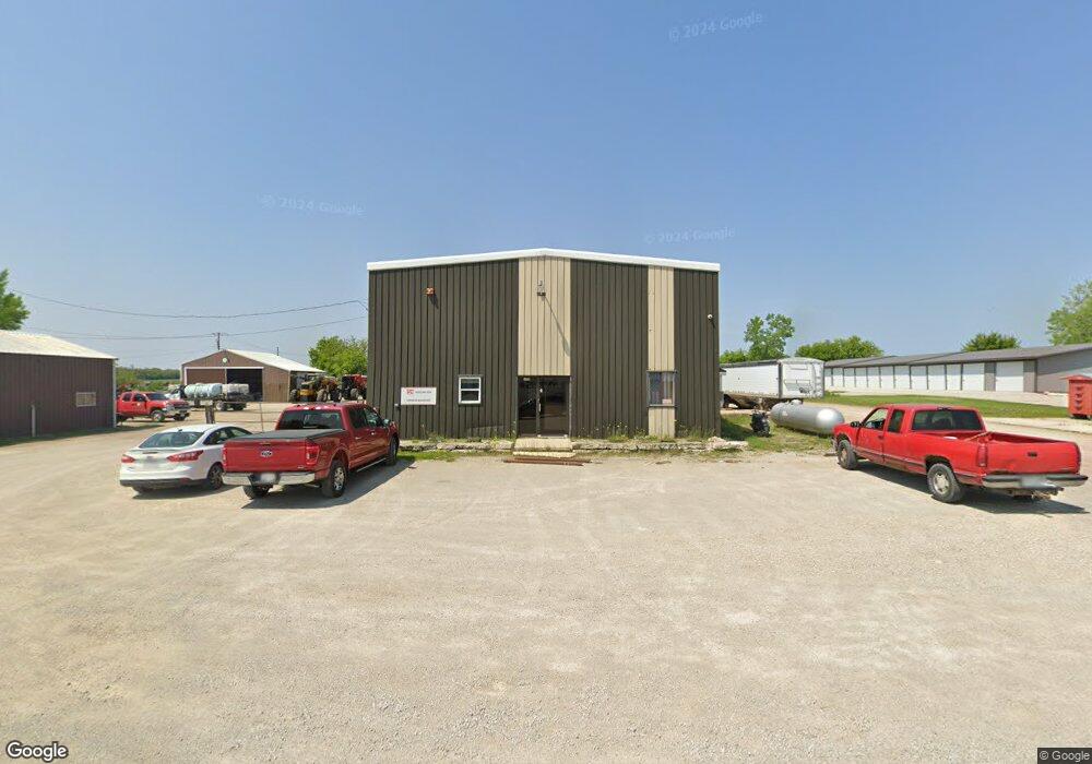
1350 W Brown St Waupun, WI 53963
Estimated Value: $295,044
--
Bed
--
Bath
--
Sq Ft
2.48
Acres
About This Home
This home is located at 1350 W Brown St, Waupun, WI 53963 and is currently estimated at $295,044. 1350 W Brown St is a home located in Dodge County with nearby schools including Meadow View Primary School, Rock River Intermediate School, and Waupun Area Junior High School.
Ownership History
Date
Name
Owned For
Owner Type
Purchase Details
Closed on
Dec 2, 2010
Sold by
Wisconsin Products Llc
Bought by
Farmers Elevator Co
Current Estimated Value
Home Financials for this Owner
Home Financials are based on the most recent Mortgage that was taken out on this home.
Original Mortgage
$132,500
Outstanding Balance
$87,540
Interest Rate
4.22%
Mortgage Type
Commercial
Estimated Equity
$207,504
Purchase Details
Closed on
May 28, 2008
Sold by
Wisconsin Products Llc
Bought by
Badge Mini Storage Of Waupun Llc
Home Financials for this Owner
Home Financials are based on the most recent Mortgage that was taken out on this home.
Original Mortgage
$80,000
Interest Rate
6.09%
Mortgage Type
Future Advance Clause Open End Mortgage
Create a Home Valuation Report for This Property
The Home Valuation Report is an in-depth analysis detailing your home's value as well as a comparison with similar homes in the area
Home Values in the Area
Average Home Value in this Area
Purchase History
| Date | Buyer | Sale Price | Title Company |
|---|---|---|---|
| Farmers Elevator Co | $132,500 | -- | |
| Badge Mini Storage Of Waupun Llc | $80,000 | None Available |
Source: Public Records
Mortgage History
| Date | Status | Borrower | Loan Amount |
|---|---|---|---|
| Open | Farmers Elevator Co | $132,500 | |
| Previous Owner | Badge Mini Storage Of Waupun Llc | $80,000 |
Source: Public Records
Tax History Compared to Growth
Tax History
| Year | Tax Paid | Tax Assessment Tax Assessment Total Assessment is a certain percentage of the fair market value that is determined by local assessors to be the total taxable value of land and additions on the property. | Land | Improvement |
|---|---|---|---|---|
| 2024 | $3,065 | $176,500 | $46,500 | $130,000 |
| 2023 | $2,950 | $176,500 | $46,500 | $130,000 |
| 2022 | $2,851 | $176,500 | $46,500 | $130,000 |
| 2021 | $7,077 | $333,600 | $43,500 | $290,100 |
| 2020 | $7,250 | $333,600 | $43,500 | $290,100 |
| 2019 | $3,134 | $149,500 | $43,500 | $106,000 |
| 2018 | $3,143 | $149,500 | $43,500 | $106,000 |
| 2017 | $3,597 | $163,000 | $49,600 | $113,400 |
| 2016 | $3,428 | $163,000 | $49,600 | $113,400 |
Source: Public Records
Map
Nearby Homes
- 806 Rock River Ave
- 17.92 Ac Pattee Dr
- 736 Fern St
- 295 Harmsen Ave
- 517 W Jefferson St
- 608 Beekman St
- 25 W Franklin St
- 315 E Main St
- 327 Carrington St
- 614 Carrington St
- 231 Woodland Dr
- 516 E Lincoln St
- 516 Doty St
- 134 N Watertown St
- 380 Fond du Lac St
- 395 Fond du Lac St
- 18 Pluim Dr Unit 16
- 18 Pluim Dr Unit 13
- 12649 W State Road 49 Rd
- 307 E Washington St
- 1120 W Main St
- 0 Hwy 49
- 1037 Maple Ave
- 1033 Maple Ave
- 1029 Maple Ave
- 1040 Maple Ave
- 1025 Maple Ave
- 1036 Maple Ave
- 934 W Brown St
- 934 W Brown St Unit 3A
- 1032 Maple Ave
- 1021 Maple Ave
- 21 County Park Rd
- 1017 Maple Ave
- 101 S Harris Ave Unit 1
- 101 S Harris Ave Unit A
- 101 S Harris Ave Unit B
- 101 S Harris Ave
- 1109 Rock Ave
- 1024 Maple Ave