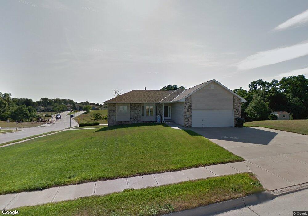
13501 Fornoff Ave Bellevue, NE 68123
Estimated Value: $355,000 - $434,571
3
Beds
3
Baths
2,029
Sq Ft
$197/Sq Ft
Est. Value
About This Home
This home is located at 13501 Fornoff Ave, Bellevue, NE 68123 and is currently estimated at $400,143, approximately $197 per square foot. 13501 Fornoff Ave is a home located in Sarpy County with nearby schools including Bellevue Elementary School, Lewis & Clark Middle School, and Bellevue West High School.
Ownership History
Date
Name
Owned For
Owner Type
Purchase Details
Closed on
Sep 14, 2025
Sold by
Sis Michael J and Sis Cathy M
Bought by
Sis Michael J and Sis Cathy M
Current Estimated Value
Purchase Details
Closed on
Apr 27, 2001
Sold by
Back Street Investments Llc
Bought by
Sis Michael J and Sis Cathy M
Purchase Details
Closed on
Dec 21, 2000
Sold by
Sis Michael J and Collison Cathy M
Bought by
Backstreet Investments Llc
Purchase Details
Closed on
Oct 25, 2000
Sold by
Fox Ridge Llc
Bought by
Sis Michael J and Collison Cathy M
Create a Home Valuation Report for This Property
The Home Valuation Report is an in-depth analysis detailing your home's value as well as a comparison with similar homes in the area
Home Values in the Area
Average Home Value in this Area
Purchase History
| Date | Buyer | Sale Price | Title Company |
|---|---|---|---|
| Sis Michael J | -- | None Listed On Document | |
| Sis Michael J | -- | -- | |
| Backstreet Investments Llc | $28,000 | -- | |
| Sis Michael J | $28,000 | -- |
Source: Public Records
Tax History Compared to Growth
Tax History
| Year | Tax Paid | Tax Assessment Tax Assessment Total Assessment is a certain percentage of the fair market value that is determined by local assessors to be the total taxable value of land and additions on the property. | Land | Improvement |
|---|---|---|---|---|
| 2025 | $7,284 | $426,671 | $58,000 | $368,671 |
| 2024 | $8,424 | $419,813 | $52,000 | $367,813 |
| 2023 | $8,424 | $398,962 | $48,000 | $350,962 |
| 2022 | $7,899 | $367,053 | $46,000 | $321,053 |
| 2021 | $7,339 | $337,404 | $46,000 | $291,404 |
| 2020 | $7,216 | $330,706 | $46,000 | $284,706 |
| 2019 | $7,552 | $322,672 | $46,000 | $276,672 |
| 2018 | $7,028 | $306,272 | $32,000 | $274,272 |
| 2017 | $6,963 | $297,564 | $32,000 | $265,564 |
| 2016 | $6,448 | $279,959 | $32,000 | $247,959 |
| 2015 | $6,085 | $264,703 | $32,000 | $232,703 |
| 2014 | $6,087 | $264,443 | $30,000 | $234,443 |
| 2012 | -- | $258,408 | $30,000 | $228,408 |
Source: Public Records
Map
Nearby Homes
- 3716 Lookingglass Dr
- 3508 Jason Cir
- 13602 S 36th St
- 3504 Sheridan Cir
- 3728 Schuemann Dr
- 3738 Falcon Dr
- 3309 Lookingglass Dr
- 3506 Lynnwood Dr
- 13609 S 42nd Ave
- 4411 Schilling Dr
- 13717 S 42nd Ave
- 14010 S 35th St
- 4369 Lookingglass Dr
- 12741 Ridgeview Cir
- 13069 S 42nd Ave Unit Lot 49
- 13809 S 42nd Ave
- 13065 S 42nd Ave Unit Lot 50
- 14013 S 35th St
- 12750 Forestdale Dr
- 13061 S 42nd Ave Unit Lot 51
- 13406 S 37th Cir
- 13505 Fornoff Ave
- 3707 Sheridan Rd
- 13405 S 38th Cir
- 13507 Fornoff Ave
- 3706 Helwig Ave
- 3709 Sheridan Rd
- 13403 S 38th Cir
- 13509 Fornoff Ave
- 3711 Sheridan Rd
- 3708 Helwig Ave
- 13402 S 37th Cir
- 13401 S 37th Cir
- 13601 Fornoff Ave
- 3710 Helwig Ave
- 3713 Sheridan Rd
- 13408 S 38th St
- 13401 S 38th Cir
- 13408 S 38th Cir
- 4712 Sheridan Rd