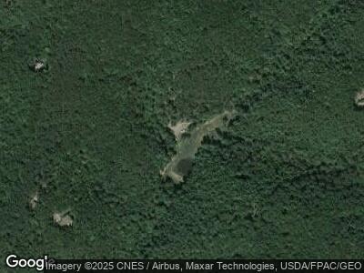
13502 Crossover Rd NE Flintstone, MD 21530
Estimated Value: $144,000 - $173,000
--
Bed
1
Bath
945
Sq Ft
$166/Sq Ft
Est. Value
About This Home
This home is located at 13502 Crossover Rd NE, Flintstone, MD 21530 and is currently estimated at $156,823, approximately $165 per square foot. 13502 Crossover Rd NE is a home located in Allegany County with nearby schools including Flintstone Elementary School, Washington Middle School, and Fort Hill High School.
Ownership History
Date
Name
Owned For
Owner Type
Purchase Details
Closed on
May 12, 2014
Sold by
Jackson Carl E and Loveless Roxanne L
Bought by
Dawson Mark E and Dawson Lisa M
Current Estimated Value
Purchase Details
Closed on
Dec 2, 1993
Sold by
Snyder Roy M
Bought by
Jackson Carl E
Purchase Details
Closed on
Feb 3, 1983
Sold by
Wadsworth Grace Potts
Bought by
Snyder Roy M
Home Financials for this Owner
Home Financials are based on the most recent Mortgage that was taken out on this home.
Original Mortgage
$36,000
Interest Rate
13.1%
Create a Home Valuation Report for This Property
The Home Valuation Report is an in-depth analysis detailing your home's value as well as a comparison with similar homes in the area
Home Values in the Area
Average Home Value in this Area
Purchase History
| Date | Buyer | Sale Price | Title Company |
|---|---|---|---|
| Dawson Mark E | $94,430 | Premier Settlements & Title | |
| Jackson Carl E | $60,000 | -- | |
| Snyder Roy M | $35,000 | -- |
Source: Public Records
Mortgage History
| Date | Status | Borrower | Loan Amount |
|---|---|---|---|
| Open | Dawson Mark E | $76,800 | |
| Closed | Dawson Mark E | $40,000 | |
| Previous Owner | Snyder Roy M | $36,000 |
Source: Public Records
Tax History Compared to Growth
Tax History
| Year | Tax Paid | Tax Assessment Tax Assessment Total Assessment is a certain percentage of the fair market value that is determined by local assessors to be the total taxable value of land and additions on the property. | Land | Improvement |
|---|---|---|---|---|
| 2024 | $1,057 | $97,200 | $97,200 | $0 |
| 2023 | $1,025 | $94,267 | $0 | $0 |
| 2022 | $993 | $91,333 | $0 | $0 |
| 2021 | $952 | $88,400 | $88,400 | $0 |
| 2020 | $958 | $88,133 | $0 | $0 |
| 2019 | $955 | $87,867 | $0 | $0 |
| 2018 | $952 | $87,600 | $87,600 | $0 |
| 2017 | $953 | $87,600 | $0 | $0 |
| 2016 | $955 | $87,600 | $0 | $0 |
| 2015 | $1,093 | $87,600 | $0 | $0 |
| 2014 | $1,093 | $100,100 | $0 | $0 |
Source: Public Records
Map
Nearby Homes
- 0 Creek Rd Unit PABD2002558
- 12005 Albin Ln NE
- 0 Green Ridge Rd Unit MDAL2010948
- 18.87 Acres Elbinsville Rd NE
- 32902 National Pike NE
- 0 Old Cumberland Rd Unit MDAL2010314
- 10406 Black Sulphur Rd NE
- 331 Silver Mills Rd
- 24200 E Hancock Rd
- 11119 Stotlemeyer Rd SE
- 12814 Appel Rd SE
- 31207 Gold Plains Rd SE
- 13507 Black Valley Rd NE
- 1482 Clingerman Rd
- 11749 Town Creek Rd NE
- 326 Doe Gully Rd
- 0 Town Creek Rd Unit MDAL2010760
- 194 Chickory Ln
- 0 Exline Rd Unit MDWA2022196
- 0 Porter's Ln
