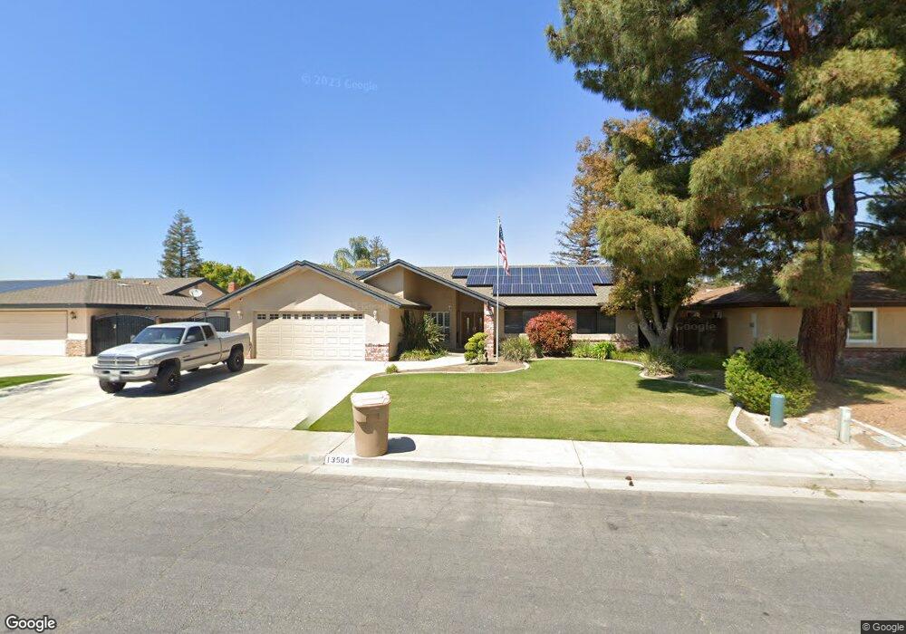
13504 Brogan Ave Bakersfield, CA 93314
Estimated Value: $415,000 - $451,000
3
Beds
2
Baths
1,770
Sq Ft
$243/Sq Ft
Est. Value
About This Home
This home is located at 13504 Brogan Ave, Bakersfield, CA 93314 and is currently estimated at $430,834, approximately $243 per square foot. 13504 Brogan Ave is a home located in Kern County with nearby schools including Del Rio Elementary School, Rosedale Middle School, and Liberty High School.
Ownership History
Date
Name
Owned For
Owner Type
Purchase Details
Closed on
Oct 7, 2002
Sold by
Delrio Nicholas R
Bought by
Delrio Nicholas R and Delrio Mary Anne
Current Estimated Value
Home Financials for this Owner
Home Financials are based on the most recent Mortgage that was taken out on this home.
Original Mortgage
$98,200
Interest Rate
5.99%
Purchase Details
Closed on
Jun 1, 1999
Sold by
Delrio Michael A
Bought by
Delrio Nicholas R
Create a Home Valuation Report for This Property
The Home Valuation Report is an in-depth analysis detailing your home's value as well as a comparison with similar homes in the area
Home Values in the Area
Average Home Value in this Area
Purchase History
| Date | Buyer | Sale Price | Title Company |
|---|---|---|---|
| Delrio Nicholas R | -- | First American Title | |
| Delrio Nicholas R | $500 | -- |
Source: Public Records
Mortgage History
| Date | Status | Borrower | Loan Amount |
|---|---|---|---|
| Closed | Delrio Nicholas R | $98,200 | |
| Closed | Delrio Nicholas R | $21,500 |
Source: Public Records
Tax History Compared to Growth
Tax History
| Year | Tax Paid | Tax Assessment Tax Assessment Total Assessment is a certain percentage of the fair market value that is determined by local assessors to be the total taxable value of land and additions on the property. | Land | Improvement |
|---|---|---|---|---|
| 2025 | $2,797 | $197,287 | $46,962 | $150,325 |
| 2024 | $2,729 | $193,420 | $46,042 | $147,378 |
| 2023 | $2,729 | $189,629 | $45,140 | $144,489 |
| 2022 | $2,668 | $185,911 | $44,255 | $141,656 |
| 2021 | $2,549 | $182,267 | $43,388 | $138,879 |
| 2020 | $2,495 | $180,399 | $42,944 | $137,455 |
| 2019 | $2,449 | $180,399 | $42,944 | $137,455 |
| 2018 | $2,393 | $173,395 | $41,277 | $132,118 |
| 2017 | $2,354 | $169,996 | $40,468 | $129,528 |
| 2016 | $2,224 | $166,664 | $39,675 | $126,989 |
| 2015 | $2,184 | $164,162 | $39,080 | $125,082 |
| 2014 | $2,133 | $160,947 | $38,315 | $122,632 |
Source: Public Records
Map
Nearby Homes
- 13408 Frenchglen Ave
- 13900 San Lazaro Ave
- 501 Reed St
- 601 Las Arenas Ct
- 14004 San Lazaro Ave
- 13301 Birkenfeld Ave
- 15829 Cole Brook Ct
- 13506 Morocco Ave
- 201 El Paso Rd
- 306 Portola Ct
- 13904 Las Entradas
- 14008 Las Entradas
- 14016 Las Entradas
- 14308 San Jose Ave
- 418 Spirea St Unit 1
- 304 Calle Lechuga
- 14607 Checkerbloom Dr
- 14601 Beach Aster Dr
- 14603 Yellow Lupine Dr
- 205 Calle Avenida
- 13500 Brogan Ave
- 13508 Brogan Ave
- 13605 Unity Ct
- 13600 Brogan Ave
- 13601 Unity Ct
- 13609 Unity Ct
- 13505 Brogan Ave
- 13509 Brogan Ave
- 13501 Brogan Ave
- 13604 Brogan Ave
- 13613 Unity Ct
- 512 Kingwood St
- 508 Kingwood St
- 13413 Brogan Ave
- 504 Kingwood St
- 601 Harrisburg St
- 13409 Brogan Ave
- 500 Kingwood St
- 13617 Unity Ct
- 605 Harrisburg St