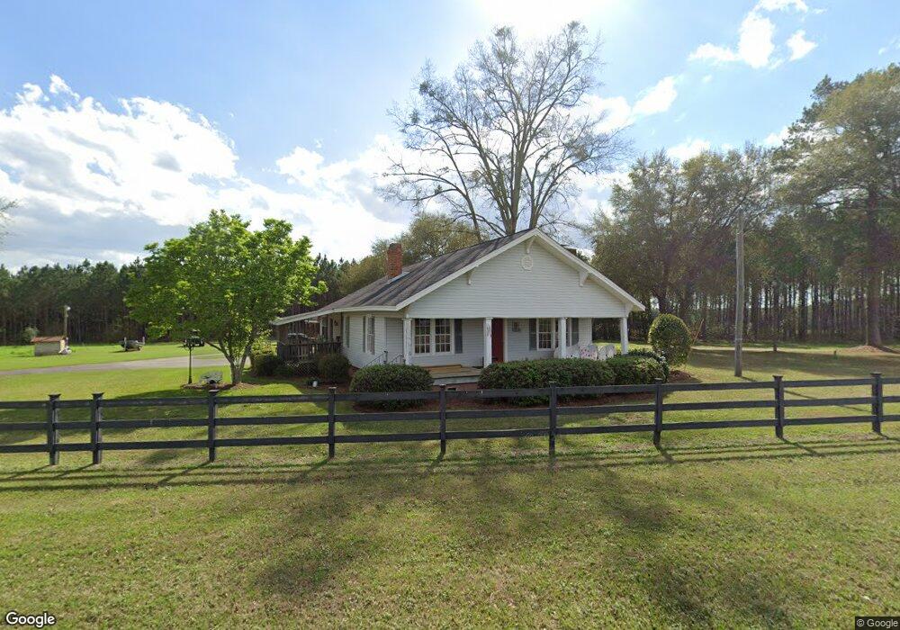
13504 State Route 188 Coolidge, GA 31738
Estimated Value: $189,753 - $357,000
2
Beds
1
Bath
1,632
Sq Ft
$152/Sq Ft
Est. Value
About This Home
This home is located at 13504 State Route 188, Coolidge, GA 31738 and is currently estimated at $247,688, approximately $151 per square foot. 13504 State Route 188 is a home located in Thomas County with nearby schools including Hand in Hand Primary School, Cross Creek Elementary School, and Garrison-Pilcher Elementary School.
Ownership History
Date
Name
Owned For
Owner Type
Purchase Details
Closed on
Dec 22, 2008
Sold by
Brown Kenneth L
Bought by
Murphy Richard W
Current Estimated Value
Purchase Details
Closed on
Mar 1, 2005
Sold by
Barrett Dennis E
Bought by
Brown Kenneth L and Brown Brow Jean Flynn
Home Financials for this Owner
Home Financials are based on the most recent Mortgage that was taken out on this home.
Original Mortgage
$89,600
Interest Rate
5.6%
Mortgage Type
New Conventional
Purchase Details
Closed on
Jun 15, 1988
Bought by
Barrett Dennis E
Create a Home Valuation Report for This Property
The Home Valuation Report is an in-depth analysis detailing your home's value as well as a comparison with similar homes in the area
Purchase History
| Date | Buyer | Sale Price | Title Company |
|---|---|---|---|
| Murphy Richard W | $125,000 | -- | |
| Brown Kenneth L | $112,000 | -- | |
| Barrett Dennis E | $48,100 | -- |
Source: Public Records
Mortgage History
| Date | Status | Borrower | Loan Amount |
|---|---|---|---|
| Previous Owner | Brown Kenneth L | $89,600 |
Source: Public Records
Tax History
| Year | Tax Paid | Tax Assessment Tax Assessment Total Assessment is a certain percentage of the fair market value that is determined by local assessors to be the total taxable value of land and additions on the property. | Land | Improvement |
|---|---|---|---|---|
| 2024 | $1,285 | $62,267 | $20,613 | $41,654 |
| 2023 | $1,122 | $55,701 | $16,490 | $39,211 |
| 2022 | $1,142 | $51,358 | $16,490 | $34,868 |
| 2021 | $1,100 | $44,932 | $14,340 | $30,592 |
| 2020 | $1,131 | $45,024 | $14,340 | $30,684 |
| 2019 | $1,143 | $45,024 | $14,340 | $30,684 |
| 2018 | $1,167 | $45,056 | $14,340 | $30,716 |
| 2017 | $1,198 | $45,544 | $14,340 | $31,204 |
| 2016 | $1,214 | $45,815 | $14,340 | $31,476 |
| 2015 | $1,158 | $43,027 | $14,340 | $28,688 |
| 2014 | $1,147 | $42,424 | $14,340 | $28,085 |
| 2013 | -- | $42,424 | $14,339 | $28,084 |
Source: Public Records
Map
Nearby Homes
- 2069 Baker Rd
- 5081-CG S Pine St
- 112 Morgan Place
- 110 Morgan Place
- 100 Morgan Place
- 102 Morgan Place
- 0 Georgia 202
- 785 Glynn Willis Rd
- 00 Drury Ln
- 3007 Zion Grove Church Rd
- 801 Vinson Rd
- 963 Vinson Rd
- 475 Longwood Dr
- 168 Lunsford St
- 8805 Georgia 202
- 171 Longwood Dr
- 250 Knoll Rd
- 0 Big Pond Ln
- 106 Spiral Rd
- 223 W Shore Dr
- 13504 Ga Highway 188
- 1875 Carlton Rd
- 13746 Ga Highway 188
- 1584 Carlton Rd
- 14173 State Route 188
- 13948 Ga Highway 188
- 13555 Ga Highway 188
- 200 Canopy Oak Ln
- 14173 Ga Highway 188
- 14264 State Route 188
- 270 Canopy Oak Ln
- 1262 Carlton Rd
- 14300 Ga Highway 188
- 14272 State Route 188
- 14272 Ga Highway 188
- 1250 Carlton Rd
- 2285 Rocky Ford Rd
- 14326 Ga Highway 188
- 14327 Ga Highway 188
- 4300 Bee Line Rd