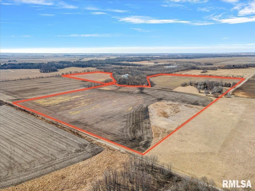
13505 W Long Point Rd Niantic Township, IL 62551
Estimated payment $9,645/month
Total Views
14,463
163.49
Acres
$10,700
Price per Acre
7,121,624
Sq Ft Lot
About This Lot
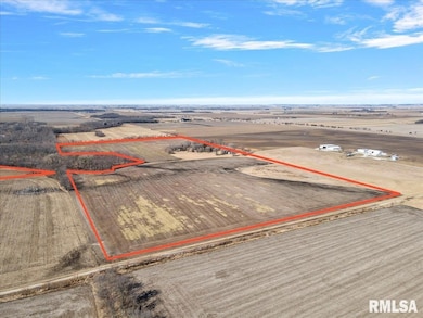
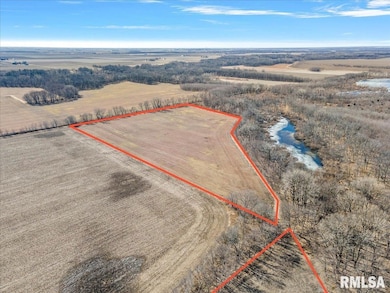
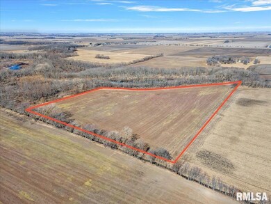
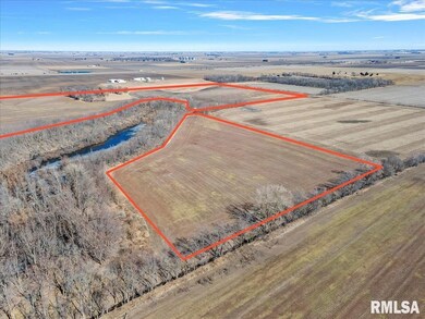
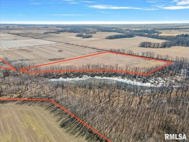
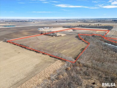
Located just South of I72, this farm ground features 3 parcels totaling 163.49 surveyed acres, 130.50 of that are tillable acres just north of the Sangamon River. Long Point Rd and Swinging Bridge Road make up the NE Corner of this farm. Soil types include Sawmill Silty Clay Loam, Huntsville Silt Loam, Tice Silty Clay Loam, Sparta Loamy Sand, Wabash Silt Clay, Proctor Silt Loam, Broadwell Silt Loam and Elburn Silt Loam. Leased for 2025
Listing Agent
Jennifer Franklin
The Real Estate Group Listed on: 09/29/2025
Listing Provided By

Property Details
Property Type
- Land
Est. Annual Taxes
- $4,878
Lot Details
- Waterfront
- Irregular Lot
- Current uses include agriculture, agribusiness
- Potential uses include agriculture, residential multi-family, residential single, for development
Map
Create a Home Valuation Report for This Property
The Home Valuation Report is an in-depth analysis detailing your home's value as well as a comparison with similar homes in the area
Home Values in the Area
Average Home Value in this Area
Tax History
| Year | Tax Paid | Tax Assessment Tax Assessment Total Assessment is a certain percentage of the fair market value that is determined by local assessors to be the total taxable value of land and additions on the property. | Land | Improvement |
|---|---|---|---|---|
| 2024 | $4,878 | $61,253 | $59,333 | $1,920 |
| 2023 | $4,467 | $57,152 | $55,234 | $1,918 |
| 2022 | $4,306 | $53,150 | $51,236 | $1,914 |
| 2021 | $4,139 | $49,645 | $47,734 | $1,911 |
| 2020 | $3,696 | $43,782 | $41,924 | $1,858 |
| 2019 | $3,696 | $43,782 | $41,924 | $1,858 |
| 2018 | $3,429 | $40,521 | $38,663 | $1,858 |
| 2017 | $3,319 | $38,534 | $36,676 | $1,858 |
| 2016 | $3,196 | $36,677 | $34,819 | $1,858 |
| 2015 | $2,996 | $34,825 | $32,967 | $1,858 |
| 2014 | $2,813 | $33,609 | $31,751 | $1,858 |
| 2013 | $2,835 | $31,197 | $29,339 | $1,858 |
Source: Public Records
Property History
| Date | Event | Price | List to Sale | Price per Sq Ft |
|---|---|---|---|---|
| 10/30/2025 10/30/25 | Price Changed | $1,749,343 | -4.5% | -- |
| 02/21/2025 02/21/25 | For Sale | $1,831,950 | -- | -- |
Nearby Homes
- 120 8th St Unit 1
- 709 Louisa St
- 420 6th St
- 414 5th St
- 116 N Moore St Unit 1
- 1359 S Bridge Rd
- 113 Prairie Run
- 0 Bill Wall Dr
- 116 E Center St
- 1955 E 2700 Rd N
- 275 N Camp St
- 7625 W William St
- 0 W Wood St
- 0 W Harristown Blvd Unit 6251050
- 3247 Nevada Rd
- 3335 Nevada Rd
- 5595 W Main St
- 5180 W Cantrell St
- 210 N Kiick St
- 445 S Wyckles Rd
- 2474 N Florian Ave
- 1160 N Summit Ave
- 1405 W Wood St
- 1174 W King St
- 3707 N Northhaven Ct
- 1076 W Main St
- 1061 W Decatur St
- 1852 N Gulick Ave
- 979 W King St
- 917 W King St
- 816 W William St
- 809 W Eldorado St
- 313 N Washington St
- 701 W Grand Ave
- 1505 N Monroe St
- 1691 N Edward St Unit 3
- 552 S Church St
- 238 W Peoria Ave
- 1035 S Main St
- 185 W Imboden Dr Unit Studio