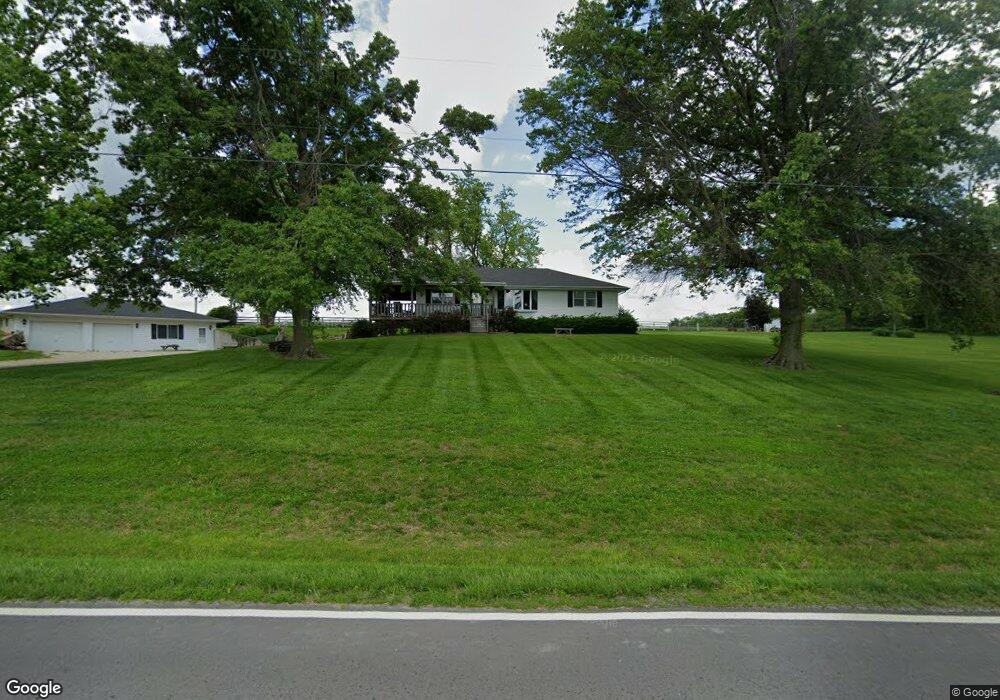
13508 State Route E SE Agency, MO 64401
Estimated Value: $219,240 - $349,000
Studio
--
Bath
1,400
Sq Ft
$210/Sq Ft
Est. Value
About This Home
This home is located at 13508 State Route E SE, Agency, MO 64401 and is currently estimated at $293,560, approximately $209 per square foot. 13508 State Route E SE is a home located in Buchanan County with nearby schools including East Buchanan Middle School and East Buchanan High School.
Ownership History
Date
Name
Owned For
Owner Type
Purchase Details
Closed on
Apr 12, 2019
Sold by
Aebersold Gary D
Bought by
Pasley Dillon Francis and Pasley Makayla Valeria
Current Estimated Value
Home Financials for this Owner
Home Financials are based on the most recent Mortgage that was taken out on this home.
Original Mortgage
$176,700
Outstanding Balance
$155,033
Interest Rate
4.3%
Mortgage Type
New Conventional
Estimated Equity
$138,527
Purchase Details
Closed on
Aug 9, 2005
Sold by
Aebersold Gary D and Aebersold Ladonna K
Bought by
Aebersold Gary D and Aebersold Ladonna K
Create a Home Valuation Report for This Property
The Home Valuation Report is an in-depth analysis detailing your home's value as well as a comparison with similar homes in the area
Purchase History
| Date | Buyer | Sale Price | Title Company |
|---|---|---|---|
| Pasley Dillon Francis | -- | None Available | |
| Aebersold Gary D | -- | None Available |
Source: Public Records
Mortgage History
| Date | Status | Borrower | Loan Amount |
|---|---|---|---|
| Open | Pasley Dillon Francis | $176,700 |
Source: Public Records
Tax History
| Year | Tax Paid | Tax Assessment Tax Assessment Total Assessment is a certain percentage of the fair market value that is determined by local assessors to be the total taxable value of land and additions on the property. | Land | Improvement |
|---|---|---|---|---|
| 2025 | $1,787 | $24,900 | $4,530 | $20,370 |
| 2024 | $1,708 | $23,480 | $4,530 | $18,950 |
| 2023 | $1,708 | $23,480 | $4,530 | $18,950 |
| 2022 | $1,534 | $23,480 | $4,530 | $18,950 |
| 2021 | $1,520 | $23,480 | $4,530 | $18,950 |
| 2020 | $1,390 | $21,200 | $1,900 | $19,300 |
| 2019 | $1,385 | $21,200 | $1,900 | $19,300 |
| 2018 | $1,381 | $21,200 | $1,900 | $19,300 |
| 2017 | $1,390 | $21,200 | $0 | $0 |
| 2015 | $2 | $21,200 | $0 | $0 |
| 2014 | $1,406 | $21,200 | $0 | $0 |
Source: Public Records
Map
Nearby Homes
- 0 S East 95th Rd
- 15500 70th Rd SE
- 703 Judith Ave
- 0 Highway 169
- 316 Gregory Dr
- 327 Lincoln Dr
- 328 Matthews Ln
- 332 Matthews Ln
- 325 Matthews Ln
- 406 Frederick Dr
- 511 Santa fe Dr
- 7693 SE Benner Lake Rd
- 12120 SE West Rd
- 27 Partridge Dr
- 2 Tara Ln
- 14960 SE 43rd Service Rd
- 0 Elm St
- 63 Houseman St
- 0 3rd St
- 104 Ac Graves Ln
- 0 State Rout H Hwy Unit HMS2452816
- 13507 State Route E SE
- 13600 State Route E SE
- 13751 State Route E SE
- 10733 State Route H SE
- 10501 Crabapple Rd SE
- 13851 State Route E SE
- 10215 Crabapple Rd SE
- 11000 State Route H SE
- 10508 Johnson Rd SE
- 0 Crabapple Rd Unit 2106781
- 0 Crabapple Rd Unit 1419623
- 13992 State Route E SE
- 10100 Johnson Rd SE
- 10501 Johnson Rd SE
- 10891 Crabapple Rd SE
- 10700 Crabapple Rd SE
- 10051 Crabapple Rd SE
- 10790 Walkup Rd SE
- 10400 Crabapple Rd SE
Your Personal Tour Guide
Ask me questions while you tour the home.