Estimated Value: $976,000 - $1,057,000
4
Beds
3
Baths
1,763
Sq Ft
$571/Sq Ft
Est. Value
About This Home
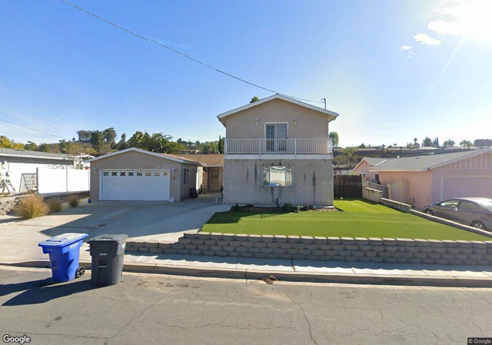
This home is located at 13509 Powers Rd, Poway, CA 92064 and is currently estimated at $1,006,820, approximately $571 per square foot. 13509 Powers Rd is a home located in San Diego County with nearby schools including Pomerado Elementary, Meadowbrook Middle, and Poway High.
Ownership History
Date
Name
Owned For
Owner Type
Purchase Details
Closed on
Oct 28, 2016
Sold by
Crosby Thomas W and Crosby Sandra J
Bought by
Crosby Thomas W and Crosby Sandra J
Current Estimated Value
Purchase Details
Closed on
Oct 19, 1993
Sold by
Koegel Norman P and Koegel Joan F
Bought by
Crosby Thomas W and Crosby Sandra J
Home Financials for this Owner
Home Financials are based on the most recent Mortgage that was taken out on this home.
Original Mortgage
$141,000
Interest Rate
6.74%
Mortgage Type
VA
Create a Home Valuation Report for This Property
The Home Valuation Report is an in-depth analysis detailing your home's value as well as a comparison with similar homes in the area
Home Values in the Area
Average Home Value in this Area
Purchase History
| Date | Buyer | Sale Price | Title Company |
|---|---|---|---|
| Crosby Thomas W | -- | None Available | |
| Crosby Thomas W | $141,000 | Union Land Title Co |
Source: Public Records
Mortgage History
| Date | Status | Borrower | Loan Amount |
|---|---|---|---|
| Closed | Crosby Thomas W | $141,000 |
Source: Public Records
Tax History
| Year | Tax Paid | Tax Assessment Tax Assessment Total Assessment is a certain percentage of the fair market value that is determined by local assessors to be the total taxable value of land and additions on the property. | Land | Improvement |
|---|---|---|---|---|
| 2025 | $3,602 | $325,774 | $64,991 | $260,783 |
| 2024 | $3,602 | $319,387 | $63,717 | $255,670 |
| 2023 | $3,525 | $313,125 | $62,468 | $250,657 |
| 2022 | $3,466 | $306,987 | $61,244 | $245,743 |
| 2021 | $3,420 | $300,969 | $60,044 | $240,925 |
| 2020 | $3,375 | $297,884 | $59,429 | $238,455 |
| 2019 | $3,287 | $292,044 | $58,264 | $233,780 |
| 2018 | $3,195 | $286,319 | $57,122 | $229,197 |
| 2017 | $3,110 | $280,705 | $56,002 | $224,703 |
| 2016 | $3,045 | $275,202 | $54,904 | $220,298 |
| 2015 | $3,000 | $271,069 | $54,080 | $216,989 |
| 2014 | $2,930 | $265,760 | $53,021 | $212,739 |
Source: Public Records
Map
Nearby Homes
- 13442 Mountainside Dr
- 13254 Powers Ct
- 12450 Robison Blvd
- 12614 Orohaven Ln
- 13824 Powers Rd
- 12719 Robison Blvd Unit 18
- 12739 Papago Dr
- 12851 Papago Dr
- 13641 Carriage Rd
- 12875 Carriage Heights Way Unit 12875
- 12939 Cree Ct
- 12741 Liberty Way
- 12311 Witt Rd
- 12953 Carriage Rd
- 12665 Oak Knoll Rd
- 12701 Oak Knoll Rd
- 12709 Oak Knoll Rd
- 0 Dorathea Terrace
- 12811 Beeler Creek Trail
- 12608 Tustin St
- 13503 Powers Rd
- 13515 Powers Rd
- 13510 Frame Rd
- 13504 Frame Rd
- 13516 Frame Rd
- 13521 Powers Rd
- 13508 Powers Rd
- 13502 Powers Rd
- 13514 Powers Rd
- 13522 Frame Rd
- 13437 Powers Rd
- 13527 Powers Rd
- 13520 Powers Rd
- 13438 Frame Rd
- 13528 Frame Rd
- 13436 Powers Rd
- 13431 Powers Rd
- 13526 Powers Rd
- 13533 Powers Rd
- 13432 Frame Rd
Your Personal Tour Guide
Ask me questions while you tour the home.