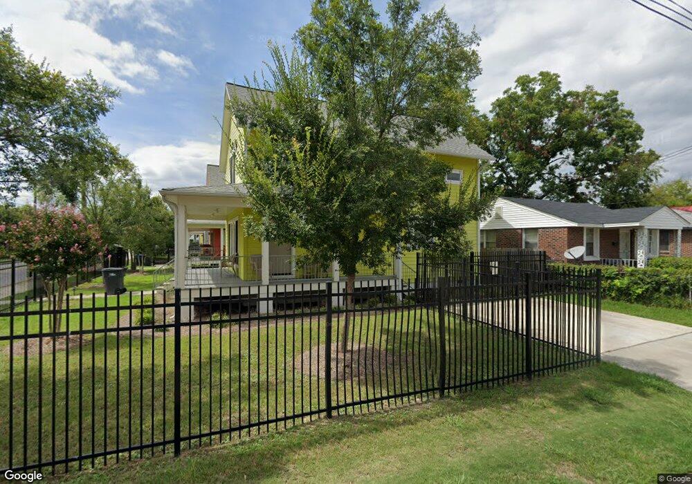
1351 12th St Augusta, GA 30901
Laney Walker NeighborhoodEstimated Value: $119,000 - $125,233
2
Beds
2
Baths
1,470
Sq Ft
$83/Sq Ft
Est. Value
About This Home
This home is located at 1351 12th St, Augusta, GA 30901 and is currently estimated at $121,558, approximately $82 per square foot. 1351 12th St is a home located in Richmond County with nearby schools including W.S. Hornsby School, W.S. Hornsby Elementary School, and Johnson Magnet.
Ownership History
Date
Name
Owned For
Owner Type
Purchase Details
Closed on
May 3, 2012
Sold by
Augusta Georgia Land Bank Authority
Bought by
United House Of Prayer For All People Of
Current Estimated Value
Purchase Details
Closed on
Oct 11, 2010
Sold by
Reid James M and Reid Mary L
Bought by
Augusta Ga Land Bank Authority
Purchase Details
Closed on
Nov 14, 1994
Sold by
Gross Willie Bell Marshall Gross Wil
Bought by
Reid James M Reid Mary L
Purchase Details
Closed on
Oct 19, 1994
Sold by
Gross Willie Bell M
Bought by
Reid James M
Create a Home Valuation Report for This Property
The Home Valuation Report is an in-depth analysis detailing your home's value as well as a comparison with similar homes in the area
Home Values in the Area
Average Home Value in this Area
Purchase History
We collect this data history from publicly available records. To have your information removed, we recommend requesting removal directly through your county’s website.
| Date | Buyer | Sale Price | Title Company |
|---|---|---|---|
| United House Of Prayer For All People Of | -- | -- | |
| Augusta Ga Land Bank Authority | -- | -- | |
| Augusta Georgia Land Bank Authority | $32,000 | -- | |
| Reid James M Reid Mary L | -- | -- | |
| Reid James M | $23,800 | -- |
Source: Public Records
Tax History
| Year | Tax Paid | Tax Assessment Tax Assessment Total Assessment is a certain percentage of the fair market value that is determined by local assessors to be the total taxable value of land and additions on the property. | Land | Improvement |
|---|---|---|---|---|
| 2025 | $1,318 | $37,561 | $6,000 | $31,561 |
| 2024 | $1,318 | $33,516 | $6,000 | $27,516 |
| 2023 | $1,076 | $33,612 | $6,000 | $27,612 |
| 2022 | $1,080 | $38,044 | $6,000 | $32,044 |
| 2021 | $984 | $42,353 | $6,000 | $36,353 |
| 2020 | $950 | $42,353 | $6,000 | $36,353 |
| 2019 | $1,149 | $42,353 | $6,000 | $36,353 |
| 2018 | $1,156 | $42,353 | $6,000 | $36,353 |
| 2017 | $1,146 | $42,353 | $6,000 | $36,353 |
| 2016 | $1,590 | $42,353 | $6,000 | $36,353 |
| 2015 | $1,766 | $42,670 | $6,000 | $36,670 |
| 2014 | $36 | $1,000 | $1,000 | $0 |
Source: Public Records
Map
Nearby Homes
- 1151 Davidson Ln
- 1126 Florence St
- 1440 1 2 Chestnut St
- 1305 10th St
- 1303 10th St
- 1542 Chestnut St
- 1540 Mill St
- 1628 Chestnut St
- 1621 12th St
- 1630 Old Savannah Rd
- 1411 Maple St
- 33 Gregg St
- 1106 12th St
- 1342 Conklin Ave
- 1428 Augusta Ave
- 1102 Phillips St
- 1115 Hopkins St
- 1108 Dugas St
- 1424 Brown St
- 1551 Holley St
- 1203 Wrightsboro Rd
- 1205 Wrightsboro Rd
- 1349 12th St
- 1352 12th St
- 1347 12th St
- 1207 Wrightsboro Rd
- 1345 12th St
- 1350 12th St
- 1348 12th St
- 1208 Wrightsboro Rd Unit C
- 1208 Wrightsboro Rd Unit A
- 1210 Wrightsboro Rd
- 1346 12th St
- 1211 Wrightsboro Rd
- 1410 12th St
- 1138 Wrightsboro Rd
- 1344 12th St
- 1412 12th St
- 1213 Wrightsboro Rd
- 1133 Wrightsboro Rd
Your Personal Tour Guide
Ask me questions while you tour the home.