Estimated Value: $299,914 - $322,000
3
Beds
2
Baths
1,028
Sq Ft
$302/Sq Ft
Est. Value
About This Home
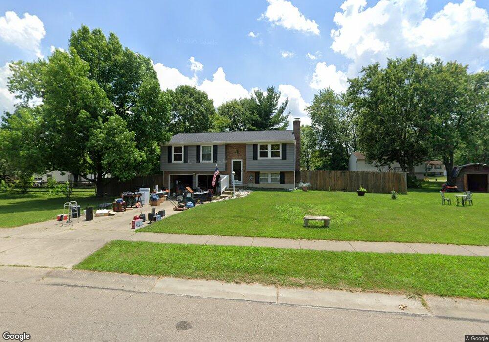
This home is located at 1351 Firethorn Dr, Mason, OH 45040 and is currently estimated at $310,729, approximately $302 per square foot. 1351 Firethorn Dr is a home located in Warren County with nearby schools including Mason Intermediate Elementary School, Mason Middle School, and William Mason High School.
Ownership History
Date
Name
Owned For
Owner Type
Purchase Details
Closed on
May 8, 1998
Sold by
Cooper Daniel L
Bought by
Lundy Robert and Lundy Pamela K
Current Estimated Value
Home Financials for this Owner
Home Financials are based on the most recent Mortgage that was taken out on this home.
Original Mortgage
$111,299
Outstanding Balance
$18,780
Interest Rate
7.2%
Mortgage Type
FHA
Estimated Equity
$291,949
Purchase Details
Closed on
Jun 18, 1992
Sold by
Sanford Donald R and Sanford Kath
Bought by
Cooper and Cooper Daniel L
Purchase Details
Closed on
Aug 1, 1983
Sold by
Ryland Group & Inc
Bought by
Sanford and Sanford Donald R
Purchase Details
Closed on
Jun 1, 1983
Sold by
P Development Company
Bought by
Ryland Group & Inc.
Purchase Details
Closed on
Apr 12, 1983
Sold by
Iti Corporation
Bought by
P Development Company
Purchase Details
Closed on
Jun 20, 1980
Sold by
Iti Corporation
Create a Home Valuation Report for This Property
The Home Valuation Report is an in-depth analysis detailing your home's value as well as a comparison with similar homes in the area
Home Values in the Area
Average Home Value in this Area
Purchase History
We collect this data history from publicly available records. To have your information removed, we recommend requesting removal directly through your county’s website.
| Date | Buyer | Sale Price | Title Company |
|---|---|---|---|
| Lundy Robert | $112,000 | -- | |
| Cooper | $88,900 | -- | |
| Sanford | $70,900 | -- | |
| Ryland Group & Inc. | $12,300 | -- | |
| P Development Company | -- | -- | |
| -- | -- | -- |
Source: Public Records
Mortgage History
We collect this data history from publicly available records. To have your information removed, we recommend requesting removal directly through your county’s website.
| Date | Status | Borrower | Loan Amount |
|---|---|---|---|
| Open | Lundy Robert | $111,299 |
Source: Public Records
Tax History
| Year | Tax Paid | Tax Assessment Tax Assessment Total Assessment is a certain percentage of the fair market value that is determined by local assessors to be the total taxable value of land and additions on the property. | Land | Improvement |
|---|---|---|---|---|
| 2025 | $3,159 | $77,830 | $24,500 | $53,330 |
| 2024 | $3,159 | $77,830 | $24,500 | $53,330 |
| 2023 | $2,788 | $58,037 | $10,762 | $47,274 |
| 2022 | $2,752 | $58,037 | $10,763 | $47,275 |
| 2021 | $2,607 | $58,037 | $10,763 | $47,275 |
| 2020 | $2,472 | $47,184 | $8,750 | $38,434 |
| 2019 | $2,272 | $47,184 | $8,750 | $38,434 |
| 2018 | $2,280 | $47,184 | $8,750 | $38,434 |
| 2017 | $2,104 | $40,646 | $8,274 | $32,372 |
| 2016 | $2,167 | $40,646 | $8,274 | $32,372 |
| 2015 | $2,172 | $40,646 | $8,274 | $32,372 |
| 2014 | $2,176 | $37,990 | $7,730 | $30,250 |
| 2013 | $2,181 | $42,990 | $8,750 | $34,240 |
Source: Public Records
Map
Nearby Homes
- 6673 Fernshire Ct
- 6668 Ashley Ct Unit 20
- 6362 Chimney Ct Unit 6362
- 785 Forsythe Place
- 1371 Windward Dr
- 6390 Coverage Ct
- 6386 Coverage Ct
- 6382 Coverage Ct
- 6378 Coverage Ct
- 6374 Coverage Ct
- 6364 Coverage Ct
- 6370 Coverage Ct
- 6191 Nicholas Way
- 6179 Nicholas Way
- 6175 Nicholas Way
- 6171 Nicholas Way
- 6206 Nicholas Way
- 6210 Nicholas Way
- 6214 Nicholas Way
- 6160 Nicholas Way
- 1383 Fishhawk Ct
- 1381 Fishhawk Ct
- 1385 Fishhawk Ct
- 608 Jeffery Ct
- 610 Jeffery Ct
- 1376 Fishhawk Ct
- 1379 Fishhawk Ct
- 733 Anthony Ln
- 1387 Fishhawk Ct
- 1378 Fishhawk Ct
- 1374 Fishhawk Ct
- 729 Anthony Ln
- 604 Jeffery Ct
- 1389 Fishhawk Ct
- 1380 Fishhawk Ct
- 737 Anthony Ln
- 1353 Firethorn Dr
- 1353 Firethorne Dr
- 1377 Fishhawk Ct
- 1355 Firethorne Dr
Your Personal Tour Guide
Ask me questions while you tour the home.