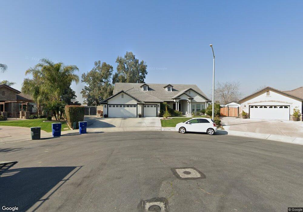
13510 Induran Dr Unit 1 Bakersfield, CA 93314
Estimated Value: $627,000 - $714,114
4
Beds
3
Baths
2,623
Sq Ft
$254/Sq Ft
Est. Value
About This Home
This home is located at 13510 Induran Dr Unit 1, Bakersfield, CA 93314 and is currently estimated at $665,779, approximately $253 per square foot. 13510 Induran Dr Unit 1 is a home located in Kern County with nearby schools including Independence Elementary School, Rosedale Middle School, and Liberty High School.
Ownership History
Date
Name
Owned For
Owner Type
Purchase Details
Closed on
Apr 6, 2006
Sold by
Joe Roberson Homes
Bought by
Brassfield Steven M and Brassfield Melanie
Current Estimated Value
Home Financials for this Owner
Home Financials are based on the most recent Mortgage that was taken out on this home.
Original Mortgage
$407,584
Outstanding Balance
$239,460
Interest Rate
6.75%
Mortgage Type
Fannie Mae Freddie Mac
Estimated Equity
$426,319
Create a Home Valuation Report for This Property
The Home Valuation Report is an in-depth analysis detailing your home's value as well as a comparison with similar homes in the area
Home Values in the Area
Average Home Value in this Area
Purchase History
| Date | Buyer | Sale Price | Title Company |
|---|---|---|---|
| Brassfield Steven M | $509,500 | Fidelity National Title Co |
Source: Public Records
Mortgage History
| Date | Status | Borrower | Loan Amount |
|---|---|---|---|
| Open | Brassfield Steven M | $407,584 |
Source: Public Records
Tax History Compared to Growth
Tax History
| Year | Tax Paid | Tax Assessment Tax Assessment Total Assessment is a certain percentage of the fair market value that is determined by local assessors to be the total taxable value of land and additions on the property. | Land | Improvement |
|---|---|---|---|---|
| 2025 | $8,219 | $646,000 | $162,000 | $484,000 |
| 2024 | $8,163 | $614,000 | $154,000 | $460,000 |
| 2023 | $8,163 | $613,000 | $153,000 | $460,000 |
| 2022 | $7,436 | $547,000 | $137,000 | $410,000 |
| 2021 | $6,547 | $473,000 | $118,000 | $355,000 |
| 2020 | $5,980 | $426,000 | $107,000 | $319,000 |
| 2019 | $5,958 | $425,000 | $106,000 | $319,000 |
| 2018 | $5,698 | $406,000 | $102,000 | $304,000 |
| 2017 | $5,697 | $406,000 | $102,000 | $304,000 |
| 2016 | $5,561 | $416,000 | $104,000 | $312,000 |
| 2015 | $5,637 | $425,000 | $106,000 | $319,000 |
| 2014 | $5,111 | $379,000 | $95,000 | $284,000 |
Source: Public Records
Map
Nearby Homes
- 13418 Giro Dr
- 13417 Hinault Dr Unit 1
- 13214 Giro Dr
- 2639 Jenkins Rd
- 13754 Rosedale Hwy
- 13300 Coco Palm Ct
- 13306 Monarch Palm Ave
- 14035 Rosedale Hwy Unit 137
- 14035 Rosedale Hwy Unit 162
- 14035 Rosedale Hwy Unit 87
- 14035 Rosedale Hwy Unit 108
- 14035 Rosedale Hwy Unit 112
- 14035 Rosedale Hwy Unit 69
- 14035 Rosedale Hwy Unit 72
- 14035 Rosedale Hwy Unit 82
- 13019 Queen Palm Ct
- 2612 Van Buren Place
- 13013 Tyler Ct
- 13207 Phoenix Palm Ct
- 13604 Providence Place
- 13507 Induran Dr Unit 1
- 13506 Induran Dr Unit 1
- 13503 Induran Dr
- 13502 Induran Dr
- 13504 Giro Dr Unit 1
- 13421 Induran Dr
- 13420 Induran Dr Unit 1
- 13500 Giro Dr
- 2364 Jenkins Rd
- 13417 Induran Dr
- 13416 Induran Dr
- 13508 Giro Dr
- 2326 Jenkins Rd
- 13414 Giro Dr
- 2344 Jenkins Rd
- 13413 Induran Dr Unit 1
- 13412 Induran Dr
- 13505 Giro Dr Unit 1
- 2408 Jenkins Rd
- 13410 Giro Dr