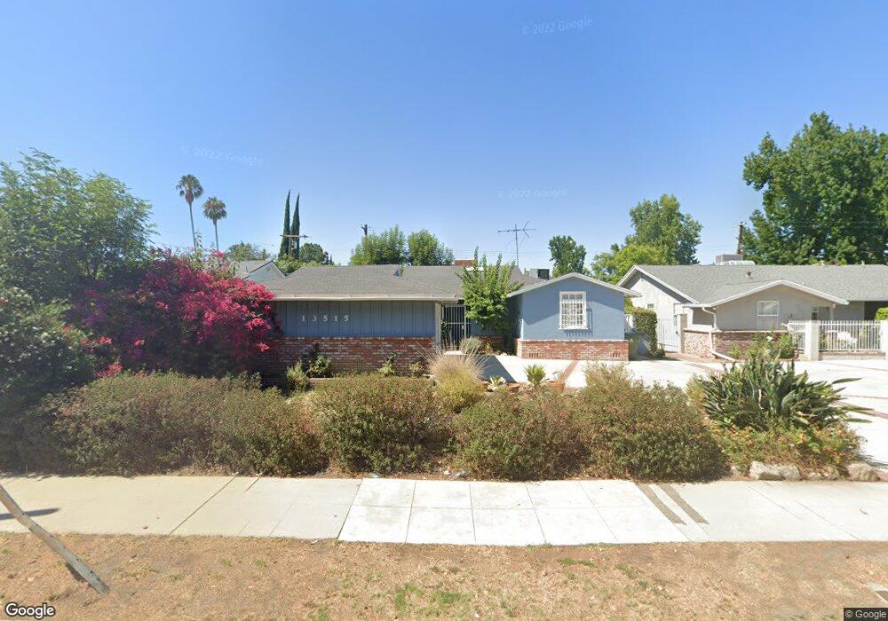
13515 Magnolia Blvd Sherman Oaks, CA 91423
Estimated Value: $1,409,019 - $1,627,000
5
Beds
2
Baths
1,873
Sq Ft
$812/Sq Ft
Est. Value
About This Home
This home is located at 13515 Magnolia Blvd, Sherman Oaks, CA 91423 and is currently estimated at $1,521,005, approximately $812 per square foot. 13515 Magnolia Blvd is a home located in Los Angeles County with nearby schools including Ulysses S. Grant Senior High School, Riverside Drive Charter Elementary School, and Louis D. Armstrong Middle School.
Ownership History
Date
Name
Owned For
Owner Type
Purchase Details
Closed on
Dec 17, 1998
Sold by
Trust Taylor Sol And Pearl Trs Taylor Fa
Bought by
Taylor Sol
Current Estimated Value
Home Financials for this Owner
Home Financials are based on the most recent Mortgage that was taken out on this home.
Original Mortgage
$220,000
Interest Rate
6.91%
Create a Home Valuation Report for This Property
The Home Valuation Report is an in-depth analysis detailing your home's value as well as a comparison with similar homes in the area
Home Values in the Area
Average Home Value in this Area
Purchase History
| Date | Buyer | Sale Price | Title Company |
|---|---|---|---|
| Taylor Sol | -- | Progressive Title Company |
Source: Public Records
Mortgage History
| Date | Status | Borrower | Loan Amount |
|---|---|---|---|
| Closed | Taylor Sol | $220,000 |
Source: Public Records
Tax History Compared to Growth
Tax History
| Year | Tax Paid | Tax Assessment Tax Assessment Total Assessment is a certain percentage of the fair market value that is determined by local assessors to be the total taxable value of land and additions on the property. | Land | Improvement |
|---|---|---|---|---|
| 2025 | $4,040 | $322,649 | $116,207 | $206,442 |
| 2024 | $4,040 | $316,324 | $113,929 | $202,395 |
| 2023 | $3,965 | $310,123 | $111,696 | $198,427 |
| 2022 | $3,785 | $304,043 | $109,506 | $194,537 |
| 2021 | $3,730 | $298,082 | $107,359 | $190,723 |
| 2019 | $3,620 | $289,243 | $104,176 | $185,067 |
| 2018 | $3,508 | $283,573 | $102,134 | $181,439 |
| 2016 | $3,333 | $272,564 | $98,169 | $174,395 |
| 2015 | $3,285 | $268,471 | $96,695 | $171,776 |
| 2014 | $3,302 | $263,213 | $94,801 | $168,412 |
Source: Public Records
Map
Nearby Homes
- 13521 Magnolia Blvd
- 5305 Allott Ave
- 5110 Greenbush Ave
- 5263 Buffalo Ave
- 5056 Greenbush Ave
- 13541 Chandler Blvd
- 5417 Allott Ave
- 5449 Allott Ave
- 4947 Varna Ave
- 5450 Buffalo Ave
- 13807 Magnolia Blvd
- 13232 Magnolia Blvd
- 5109 Longridge Ave
- 4925 Greenbush Ave
- 13530 Morrison St
- 13536 Morrison St
- 4951 Nagle Ave
- 5503 Ventura Canyon Ave
- 13221 Hesby St
- 13845 Magnolia Blvd
- 13509 Magnolia Blvd
- 13521 W Magnolia Blvd
- 13525 Magnolia Blvd
- 5223 Sunnyslope Ave
- 13503 Magnolia Blvd
- 5218 Allott Ave
- 5210 Allott Ave
- 5229 Sunnyslope Ave
- 5224 Allott Ave
- 5230 Allott Ave
- 5235 Sunnyslope Ave
- 13466 Mccormick St
- 5234 Allott Ave
- 13463 Magnolia Blvd
- 5241 Sunnyslope Ave
- 13460 Mccormick St
- 5217 Allott Ave
- 5211 Allott Ave
- 5240 Allott Ave
- 5223 Allott Ave