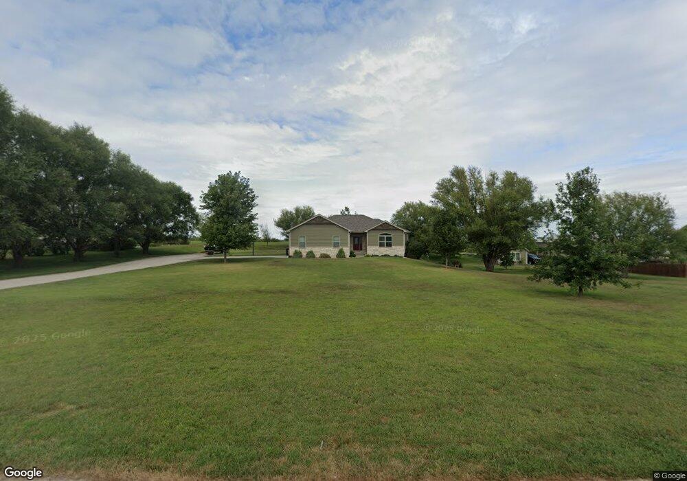
13517 Megan Ln Wamego, KS 66547
Estimated Value: $339,000 - $462,000
3
Beds
2
Baths
1,704
Sq Ft
$246/Sq Ft
Est. Value
About This Home
This home is located at 13517 Megan Ln, Wamego, KS 66547 and is currently estimated at $419,009, approximately $245 per square foot. 13517 Megan Ln is a home located in Pottawatomie County with nearby schools including Rock Creek Junior/Senior High School.
Ownership History
Date
Name
Owned For
Owner Type
Purchase Details
Closed on
Jul 2, 2012
Sold by
Braley Construction Inc
Bought by
Hickey Curtis and Hickey Susan
Current Estimated Value
Home Financials for this Owner
Home Financials are based on the most recent Mortgage that was taken out on this home.
Original Mortgage
$211,200
Interest Rate
3%
Mortgage Type
Adjustable Rate Mortgage/ARM
Purchase Details
Closed on
Feb 17, 2012
Sold by
Ebert Neil and Ebert Laura
Bought by
Braley Construction Inc
Create a Home Valuation Report for This Property
The Home Valuation Report is an in-depth analysis detailing your home's value as well as a comparison with similar homes in the area
Home Values in the Area
Average Home Value in this Area
Purchase History
| Date | Buyer | Sale Price | Title Company |
|---|---|---|---|
| Hickey Curtis | -- | None Available | |
| Braley Construction Inc | -- | None Available |
Source: Public Records
Mortgage History
| Date | Status | Borrower | Loan Amount |
|---|---|---|---|
| Previous Owner | Hickey Curtis | $211,200 |
Source: Public Records
Tax History Compared to Growth
Tax History
| Year | Tax Paid | Tax Assessment Tax Assessment Total Assessment is a certain percentage of the fair market value that is determined by local assessors to be the total taxable value of land and additions on the property. | Land | Improvement |
|---|---|---|---|---|
| 2025 | $4,069 | $43,192 | $7,664 | $35,528 |
| 2024 | $41 | $42,036 | $7,319 | $34,717 |
| 2023 | $4,034 | $39,997 | $7,319 | $32,678 |
| 2022 | $3,265 | $35,907 | $7,104 | $28,803 |
| 2021 | $3,265 | $31,786 | $6,920 | $24,866 |
| 2020 | $3,265 | $32,154 | $6,901 | $25,253 |
| 2019 | $4,108 | $32,744 | $6,345 | $26,399 |
| 2018 | $4,157 | $32,275 | $6,230 | $26,045 |
| 2017 | $3,669 | $31,214 | $5,825 | $25,389 |
| 2016 | $3,441 | $29,797 | $4,967 | $24,830 |
| 2015 | -- | $29,243 | $3,876 | $25,367 |
| 2014 | -- | $30,257 | $3,416 | $26,841 |
Source: Public Records
Map
Nearby Homes
- 13000 Anthony Dr
- 13495 Wildridge Dr
- 4225 Rockenham Rd
- 13318 Woodland Dr
- 13880 Berry Ln
- 4075 Rockenham Cir
- 14362 Prairie W
- 14344 Prairie W
- 14226 Prairie W
- 00000 Prairie Trail (Lot #3)
- 00000 Prairie Trail
- 14205 Prairie Trail
- 00000 Wildwood Cir
- 14416 Wildwood Cir
- 14391 Prairie Trail
- 14409 Wildwood Cir
- 14380 Prairie Trail
- 14434 Wildwood Cir
- 14470 Wildwood Cir
- 14373 Prairie Trail
- 13539 Megan Ln
- 4675 Reid Dr
- 13496 Megan Ln
- 13524 Megan Ln
- 13560 Megan Ln
- 13548 Megan Ln
- 4637 Reid Dr
- 4656 Reid Dr
- 4688 Reid Dr
- 4579 Reid Dr
- 13559 Anthony Cir
- 4620 Reid Dr
- 13535 Anthony Cir
- 13573 Anthony Cir
- 4592 Reid Dr
- 13441 Anthony Dr
- 13542 Anthony Cir
- 4810 Wildridge Cir
- 4825 Wildridge Cir
- 13575 Gillaspie Rd