Estimated Value: $606,396
--
Bed
--
Bath
2,460
Sq Ft
$247/Sq Ft
Est. Value
About This Home
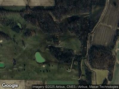
This home is located at 13518 State Route 49, Edon, OH 43518 and is currently estimated at $606,396, approximately $246 per square foot. 13518 State Route 49 is a home located in Williams County with nearby schools including Edon Elementary School and Edon Elementary School.
Ownership History
Date
Name
Owned For
Owner Type
Purchase Details
Closed on
Oct 20, 2020
Sold by
R & L Land Company Llc
Bought by
Hake Travis C and Hake Marissa A
Current Estimated Value
Purchase Details
Closed on
Jun 26, 2018
Sold by
B&B Hug Inc
Bought by
R & L Land Co Llc
Purchase Details
Closed on
Jan 10, 2000
Sold by
Hug William L and Hug Barbara J
Bought by
B&B Hug Inc
Purchase Details
Closed on
Apr 24, 1992
Bought by
Hug William L and Hug Barbara J
Create a Home Valuation Report for This Property
The Home Valuation Report is an in-depth analysis detailing your home's value as well as a comparison with similar homes in the area
Home Values in the Area
Average Home Value in this Area
Purchase History
| Date | Buyer | Sale Price | Title Company |
|---|---|---|---|
| Hake Travis C | $435,000 | None Available | |
| R & L Land Co Llc | $300,000 | Preservation Title Ltd | |
| B&B Hug Inc | -- | -- | |
| Hug William L | $38,000 | -- |
Source: Public Records
Tax History Compared to Growth
Tax History
| Year | Tax Paid | Tax Assessment Tax Assessment Total Assessment is a certain percentage of the fair market value that is determined by local assessors to be the total taxable value of land and additions on the property. | Land | Improvement |
|---|---|---|---|---|
| 2024 | $3,678 | $176,580 | $156,030 | $20,550 |
| 2023 | $3,678 | $101,720 | $87,120 | $14,600 |
| 2022 | $5,331 | $149,460 | $87,120 | $62,340 |
| 2021 | $7,838 | $149,460 | $87,120 | $62,340 |
| 2020 | $9,562 | $184,390 | $87,120 | $97,270 |
| 2019 | $9,871 | $184,390 | $87,120 | $97,270 |
| 2018 | $10,490 | $184,390 | $87,120 | $97,270 |
| 2017 | $11,666 | $222,810 | $97,090 | $125,720 |
| 2016 | $11,076 | $222,810 | $97,090 | $125,720 |
| 2015 | $11,090 | $222,810 | $97,090 | $125,720 |
| 2014 | $11,090 | $222,810 | $97,090 | $125,720 |
| 2013 | $11,001 | $222,810 | $97,090 | $125,720 |
Source: Public Records
Map
Nearby Homes
- 00 Ohio 49
- 3170 S 800 E
- 202 N Main St
- 305 Walz St
- 104 S Summit St
- 709 W Indiana St
- 201 W Franklin St
- 801 W Indiana St
- 202 Woodville St
- 188 Hiawatha Trail
- 8007 County Road 8m
- 100 Bay St
- 4028 County Road H
- County Road E 600
- 1228-1230 Manitou Trail
- 615 Manito Trail
- 8711 W Territorial Rd
- 1150-1152 Iroquois Trail
- 460 Seneca Dr
- 0 Cr81 and Cr G Unit 11434036
