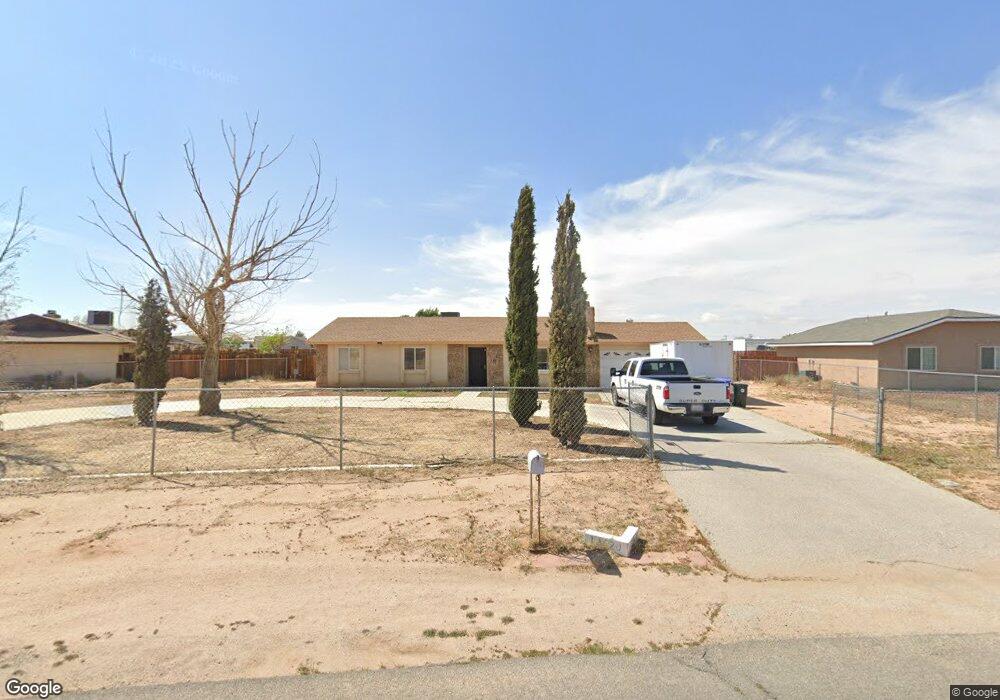
13520 Pauhaska Rd Apple Valley, CA 92308
High Desert NeighborhoodEstimated Value: $376,000 - $397,000
3
Beds
2
Baths
1,346
Sq Ft
$286/Sq Ft
Est. Value
About This Home
This home is located at 13520 Pauhaska Rd, Apple Valley, CA 92308 and is currently estimated at $384,928, approximately $285 per square foot. 13520 Pauhaska Rd is a home located in San Bernardino County with nearby schools including Rancho Verde Elementary School and Granite Hills High School.
Ownership History
Date
Name
Owned For
Owner Type
Purchase Details
Closed on
Jul 8, 2020
Sold by
Lesh James R and Lesh Arlene
Bought by
Young Raymond Mark
Current Estimated Value
Home Financials for this Owner
Home Financials are based on the most recent Mortgage that was taken out on this home.
Original Mortgage
$182,400
Outstanding Balance
$162,040
Interest Rate
3.2%
Mortgage Type
New Conventional
Estimated Equity
$222,888
Purchase Details
Closed on
Feb 27, 2015
Sold by
Lesh James R
Bought by
The James & Arlene Lesh Family Trust
Purchase Details
Closed on
Nov 18, 2014
Sold by
Lesh Thomas A and Lesh James R
Bought by
Lesh Thomas A and Lesh James R
Purchase Details
Closed on
Feb 6, 1995
Sold by
Lesh Arthur J and Lesh Phyllis W
Bought by
Lesh Arthur J and Lesh Phyllis W
Create a Home Valuation Report for This Property
The Home Valuation Report is an in-depth analysis detailing your home's value as well as a comparison with similar homes in the area
Home Values in the Area
Average Home Value in this Area
Purchase History
| Date | Buyer | Sale Price | Title Company |
|---|---|---|---|
| Young Raymond Mark | $228,000 | Provident Title Company | |
| The James & Arlene Lesh Family Trust | -- | None Available | |
| Lesh Thomas A | -- | None Available | |
| Lesh Arthur J | -- | -- |
Source: Public Records
Mortgage History
| Date | Status | Borrower | Loan Amount |
|---|---|---|---|
| Open | Young Raymond Mark | $182,400 |
Source: Public Records
Tax History Compared to Growth
Tax History
| Year | Tax Paid | Tax Assessment Tax Assessment Total Assessment is a certain percentage of the fair market value that is determined by local assessors to be the total taxable value of land and additions on the property. | Land | Improvement |
|---|---|---|---|---|
| 2025 | $2,809 | $246,794 | $21,648 | $225,146 |
| 2024 | $2,809 | $241,955 | $21,224 | $220,731 |
| 2023 | $2,784 | $237,211 | $20,808 | $216,403 |
| 2022 | $2,742 | $232,560 | $20,400 | $212,160 |
| 2021 | $2,680 | $228,000 | $20,000 | $208,000 |
| 2020 | $1,621 | $131,442 | $31,569 | $99,873 |
| 2019 | $1,591 | $128,865 | $30,950 | $97,915 |
| 2018 | $1,552 | $126,338 | $30,343 | $95,995 |
| 2017 | $1,530 | $123,861 | $29,748 | $94,113 |
| 2016 | $1,447 | $121,433 | $29,165 | $92,268 |
| 2015 | $1,425 | $119,609 | $28,727 | $90,882 |
| 2014 | $1,406 | $117,266 | $28,164 | $89,102 |
Source: Public Records
Map
Nearby Homes
- 13615 Pauhaska Rd
- 13492 Central Rd
- 22764 Powhatan Rd
- 22725 Anoka Rd
- 0 Tenaya Rd Unit SR25199662
- 13267 Setancket Rd
- 22325 Us Hwy 18 Unit 32
- 22325 US Highway 18 Unit 7
- 13252 Setancket Rd
- 22449 Ottawa Rd
- 33 Mesquite Rd
- 0 Malaki Rd
- 1 Malaki Rd
- 0 Headquarters Dr
- 13422 Nicola Rd
- 0 Powhatan Rd Unit HD25124154
- 0 Powhatan Rd Unit 25560013
- 13483 Nicola Rd
- 0 Eyota Rd
- 0 Nomwaket Rd
- 22574 Powhatan Rd
- 13536 Pauhaska Rd
- 22558 Powhatan Rd
- 13552 Pauhaska Rd
- 22620 Powhatan Rd
- 13537 Pauhaska Rd
- 13549 Niabi Rd Unit D
- 13549 Niabi Rd Unit B
- 13549 Niabi Rd Unit A
- 13549 Niabi Rd Unit C
- 13549 Niabi Rd Unit A-D
- 13549 Niabi Rd
- 13488 Pauhaska Rd
- 22542 Powhatan Rd
- 13568 Pauhaska Rd
- 13483 Pauhaska Rd
- 13478 Pauhaska Rd
- 22526 Powhatan Rd
- 13537 Niabi Rd
- 22640 Powhatan Rd