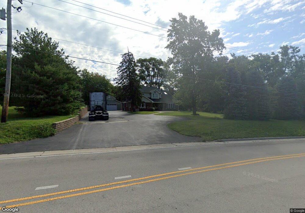
13529 Smith Rd Lockport, IL 60441
Big Run NeighborhoodEstimated Value: $358,000 - $597,000
Studio
--
Bath
2,848
Sq Ft
$163/Sq Ft
Est. Value
About This Home
This home is located at 13529 Smith Rd, Lockport, IL 60441 and is currently estimated at $463,846, approximately $162 per square foot. 13529 Smith Rd is a home located in Will County with nearby schools including Ludwig Elementary School, Walsh Elementary School, and Reed Elementary School.
Ownership History
Date
Name
Owned For
Owner Type
Purchase Details
Closed on
Jun 25, 2003
Sold by
Diventi Frank Vincent
Bought by
Chrobak Marian and Chrobak Maria
Current Estimated Value
Home Financials for this Owner
Home Financials are based on the most recent Mortgage that was taken out on this home.
Original Mortgage
$273,600
Interest Rate
5.69%
Mortgage Type
Purchase Money Mortgage
Purchase Details
Closed on
Jan 3, 2002
Sold by
Diventi Cathy Ellen
Bought by
Diventi Frank Vincent
Create a Home Valuation Report for This Property
The Home Valuation Report is an in-depth analysis detailing your home's value as well as a comparison with similar homes in the area
Home Values in the Area
Average Home Value in this Area
Purchase History
| Date | Buyer | Sale Price | Title Company |
|---|---|---|---|
| Chrobak Marian | $304,000 | Premier Title | |
| Diventi Frank Vincent | -- | Premier Title |
Source: Public Records
Mortgage History
| Date | Status | Borrower | Loan Amount |
|---|---|---|---|
| Previous Owner | Chrobak Marian | $273,600 |
Source: Public Records
Tax History
| Year | Tax Paid | Tax Assessment Tax Assessment Total Assessment is a certain percentage of the fair market value that is determined by local assessors to be the total taxable value of land and additions on the property. | Land | Improvement |
|---|---|---|---|---|
| 2024 | $7,811 | $127,936 | $35,783 | $92,153 |
| 2023 | $7,811 | $115,968 | $32,436 | $83,532 |
| 2022 | $6,058 | $94,553 | $20,444 | $74,109 |
| 2021 | $5,737 | $89,581 | $19,369 | $70,212 |
| 2020 | $5,745 | $86,285 | $18,656 | $67,629 |
| 2019 | $5,552 | $83,006 | $17,947 | $65,059 |
| 2018 | $5,441 | $80,181 | $17,741 | $62,440 |
| 2017 | $5,330 | $77,936 | $17,244 | $60,692 |
| 2016 | $5,201 | $75,337 | $16,669 | $58,668 |
| 2015 | $4,898 | $72,509 | $16,043 | $56,466 |
| 2014 | $4,898 | $71,010 | $15,711 | $55,299 |
| 2013 | $4,898 | $71,010 | $15,711 | $55,299 |
Source: Public Records
Map
Nearby Homes
- 16701 135th St
- 13748 S Archer Ave
- 13740 S Archer Ave
- 1400 Smith Rd
- 1365 Gordon Ln
- 15976 132nd St
- 16590 Kayla Dr
- 16580 Kayla Dr
- 16560 Kayla Dr
- 16551 Kayla Dr
- 16541 Kayla Dr
- 16441 Kayla Dr
- 12656 Brighton Dr
- 14029 Cokes Rd
- 14319 High Rd
- 16446 W 147th Place
- 3.1 Acres Archer Ave
- 1.7 Acres Archer Ave
- 1365 State St
- 5 Melissa Dr
- 13515 Smith Rd
- 13608 S Star Ln
- 13619 Smith Rd
- 13530 Star Ln
- 13631 Smith Rd
- 16751 135th St
- 16729 135th St
- 13632 S Star Ln
- 13632 S Star Ln
- 13518 S Star Ln
- 13565 S Star Ln
- 7 W 135th St
- 13545 S Star Ln
- 13649 S Smith Rd
- 13637 S Star Ln
- 16665 135th St
- 13648 S Star Ln
- 1400 Smith Rd
- 16331 W 135th St
- 16353 W 135th St
Your Personal Tour Guide
Ask me questions while you tour the home.