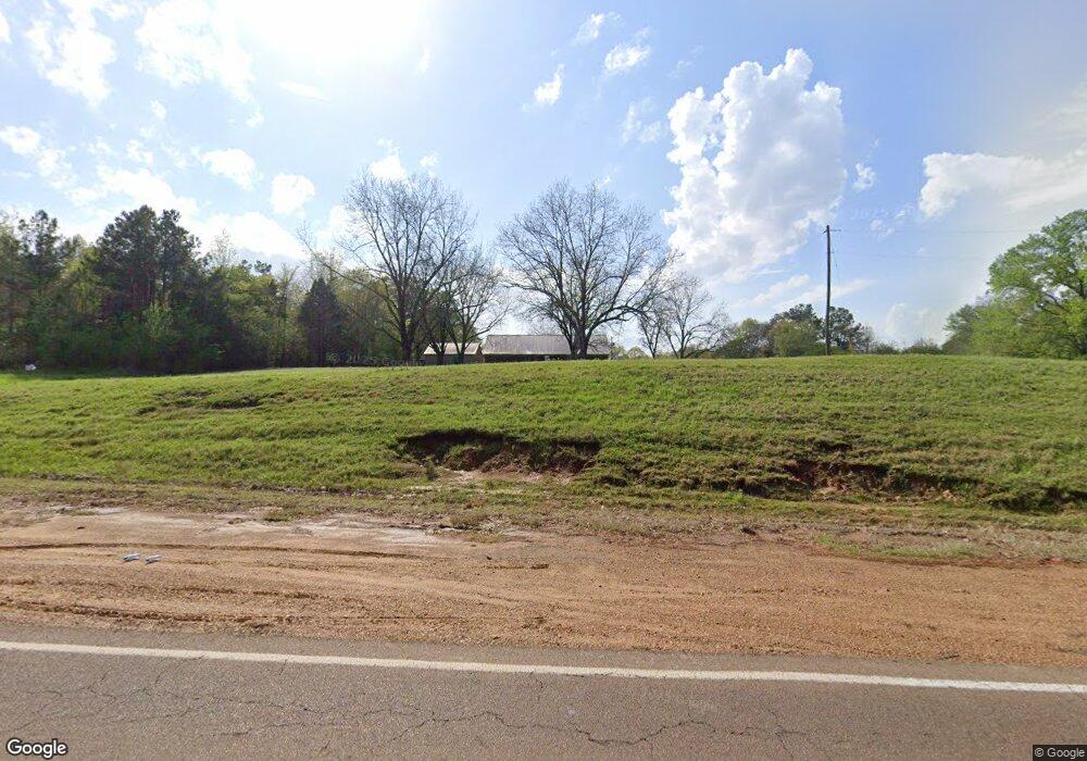
1353 Highway 305 N Olive Branch, MS 38654
Lewisburg NeighborhoodEstimated Value: $410,000 - $574,000
3
Beds
2
Baths
2,921
Sq Ft
$157/Sq Ft
Est. Value
About This Home
This home is located at 1353 Highway 305 N, Olive Branch, MS 38654 and is currently estimated at $459,353, approximately $157 per square foot. 1353 Highway 305 N is a home located in DeSoto County with nearby schools including Lewisburg Primary School, Lewisburg Elementary School, and Lewisburg Middle School.
Ownership History
Date
Name
Owned For
Owner Type
Purchase Details
Closed on
May 19, 2022
Sold by
Lee Albert Roger
Bought by
Albert Roger Lee and Brooks Carla F
Current Estimated Value
Purchase Details
Closed on
Mar 15, 2017
Sold by
Wampler William A and Dillehay Candelarie
Bought by
Albert Roger L and Albert Ellen B
Home Financials for this Owner
Home Financials are based on the most recent Mortgage that was taken out on this home.
Original Mortgage
$329,862
Interest Rate
4.15%
Mortgage Type
VA
Purchase Details
Closed on
Dec 10, 2010
Sold by
Nelson Bennie L and Nelson Barbara L
Bought by
Wampler William A
Home Financials for this Owner
Home Financials are based on the most recent Mortgage that was taken out on this home.
Original Mortgage
$127,209
Interest Rate
4.31%
Mortgage Type
FHA
Create a Home Valuation Report for This Property
The Home Valuation Report is an in-depth analysis detailing your home's value as well as a comparison with similar homes in the area
Home Values in the Area
Average Home Value in this Area
Purchase History
| Date | Buyer | Sale Price | Title Company |
|---|---|---|---|
| Albert Roger Lee | -- | None Listed On Document | |
| Albert Roger L | -- | None Available | |
| Wampler William A | -- | None Available |
Source: Public Records
Mortgage History
| Date | Status | Borrower | Loan Amount |
|---|---|---|---|
| Previous Owner | Albert Roger L | $329,862 | |
| Previous Owner | Wampler William A | $127,209 |
Source: Public Records
Tax History Compared to Growth
Tax History
| Year | Tax Paid | Tax Assessment Tax Assessment Total Assessment is a certain percentage of the fair market value that is determined by local assessors to be the total taxable value of land and additions on the property. | Land | Improvement |
|---|---|---|---|---|
| 2024 | $1,732 | $17,147 | $2,500 | $14,647 |
| 2023 | $1,732 | $17,147 | $0 | $0 |
| 2022 | $974 | $17,147 | $2,500 | $14,647 |
| 2021 | $974 | $17,147 | $2,500 | $14,647 |
| 2020 | $974 | $17,147 | $2,500 | $14,647 |
| 2019 | $974 | $17,147 | $2,500 | $14,647 |
| 2017 | $1,408 | $31,080 | $16,790 | $14,290 |
| 2016 | $1,408 | $16,790 | $2,500 | $14,290 |
| 2015 | $1,708 | $31,080 | $16,790 | $14,290 |
| 2014 | $1,408 | $16,790 | $0 | $0 |
| 2013 | $566 | $16,790 | $0 | $0 |
Source: Public Records
Map
Nearby Homes
- 1615 Highway 305 N
- 0 Bethel Rd Unit 4096893
- 9278 Bethel Rd
- 443 Highway 305 N
- 2275 Highway 305 N
- 9100 E Broadway Rd
- 8900 Elizabeth Cove
- 8785 Robertson Ln N
- 268 Bonnie Blue Cove
- 1970 Planter's Dr
- 2763 Fall Spring Dr
- 5293 Borden Creek Dr
- 5291 Borden Creek Dr
- 9278 Woolsey Rd
- 7198 Harrier Dr E
- 10203 Woolsey Rd
- 2835 S Cypress Lake Dr
- 252 Shinpoch Ln
- 7189 Bethel Rd
- 8279 Dunn Ln E
- 1353 Highway 305 N
- 1353 Highway 305 N Unit 305
- 1385 Highway 305 N
- 1385 Highway 305 N
- 1385 Highway 305 N Unit 305
- 1385 Highway Unit 305
- 8811 Cole Rd
- 8951 Cole Rd
- 8889 Cole Rd
- 8889 Cole Rd
- 1206 Highway 305 N
- 1250 Highway 305 N
- Lot 2 Cole Rd
- 8800 Cole Rd
- 1509 Highway 305 N
- 0 Cole Rd
- 1301 Ms-305
- 8771 Cole Rd
- 1115 Highway 305 N
- 1118 Highway 305 N
