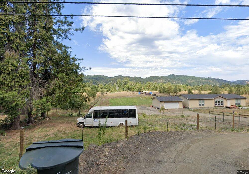
1353 Southside Rd Sutherlin, OR 97479
Estimated Value: $395,356 - $519,000
3
Beds
2
Baths
1,512
Sq Ft
$300/Sq Ft
Est. Value
About This Home
This home is located at 1353 Southside Rd, Sutherlin, OR 97479 and is currently estimated at $454,339, approximately $300 per square foot. 1353 Southside Rd is a home located in Douglas County with nearby schools including East Sutherlin Primary School, West Sutherlin Intermediate School, and Sutherlin Middle School.
Ownership History
Date
Name
Owned For
Owner Type
Purchase Details
Closed on
Dec 12, 2011
Sold by
Black Brent and Black Melinda
Bought by
Niedert Wayne A
Current Estimated Value
Home Financials for this Owner
Home Financials are based on the most recent Mortgage that was taken out on this home.
Original Mortgage
$186,423
Outstanding Balance
$126,902
Interest Rate
4.06%
Mortgage Type
VA
Estimated Equity
$327,437
Purchase Details
Closed on
Jun 15, 2006
Sold by
Black Bobby J and Black Judith C
Bought by
Black Brent and Black Melinda
Purchase Details
Closed on
Apr 24, 2006
Sold by
Youngman Donald L and Youngman Donna J
Bought by
Cook Michael James
Create a Home Valuation Report for This Property
The Home Valuation Report is an in-depth analysis detailing your home's value as well as a comparison with similar homes in the area
Home Values in the Area
Average Home Value in this Area
Purchase History
| Date | Buyer | Sale Price | Title Company |
|---|---|---|---|
| Niedert Wayne A | $182,500 | First American Title Ins Co | |
| Black Brent | $200,000 | Accommodation | |
| Cook Michael James | $56,326 | First American Title Ins Co |
Source: Public Records
Mortgage History
| Date | Status | Borrower | Loan Amount |
|---|---|---|---|
| Open | Niedert Wayne A | $186,423 |
Source: Public Records
Tax History Compared to Growth
Tax History
| Year | Tax Paid | Tax Assessment Tax Assessment Total Assessment is a certain percentage of the fair market value that is determined by local assessors to be the total taxable value of land and additions on the property. | Land | Improvement |
|---|---|---|---|---|
| 2025 | $1,980 | $252,117 | -- | -- |
| 2024 | $1,922 | $244,774 | -- | -- |
| 2023 | $1,866 | $237,645 | $0 | $0 |
| 2022 | $1,812 | $230,724 | $0 | $0 |
| 2021 | $1,759 | $224,004 | $0 | $0 |
| 2020 | $974 | $124,000 | $0 | $0 |
| 2019 | $1,658 | $120,391 | $0 | $0 |
| 2018 | $1,610 | $204,997 | $0 | $0 |
| 2017 | $1,692 | $199,027 | $0 | $0 |
| 2016 | $1,644 | $193,231 | $0 | $0 |
| 2015 | $1,603 | $187,603 | $0 | $0 |
| 2014 | $1,555 | $182,139 | $0 | $0 |
| 2013 | -- | $176,834 | $0 | $0 |
Source: Public Records
Map
Nearby Homes
- 895 Valley Vista St
- 1000 E Central Ave Unit 21
- 1000 E Central Ave
- 1200 E Central Ave Unit 80
- 1200 E Central Ave Unit 139
- 1200 E Central Ave Unit 62
- 1200 E Central Ave Unit 128
- 1316 Sunny Ct
- 662 Brooks Loop
- 664 Brooks Loop
- 635 Valley Vista St
- 845 Forest Heights St
- 253 S Grove Ln
- 1204 E Second Ave
- 416 Glen Ave
- 229 N Grove Ln
- 550 S State St Unit 139
- 550 S State St Unit 115
- 776 E Fourth Ave
- 1234 E Fourth Ave
- 1071 Southside Rd
- 1055 Southside Rd
- 1445 Southside Rd
- 436 Crestview Ct Unit L 16
- 436 Crestview Ct
- 1215 Southside Rd
- 952 Shore St
- 950 Shore St
- 1099 Southside Rd
- 946 Shore St
- 1229 Southside Rd
- 440 Crestview Ct Unit 15
- 440 Crestview Ct
- 440 Crestview Ct Unit 15
- 1109 Southside Rd Unit 112
- 1235 Southside Rd
- 427 Crestview Ct
- 944 Shore St
- 427 Crestview Ct Unit L 13
- 885 Valley Vista St Unit 20