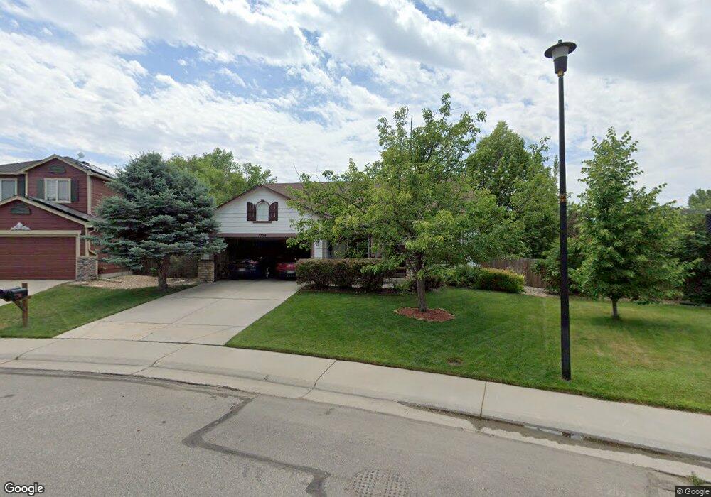
1354 Lambert Cir Lafayette, CO 80026
Estimated Value: $691,000 - $740,000
3
Beds
2
Baths
1,249
Sq Ft
$570/Sq Ft
Est. Value
About This Home
This home is located at 1354 Lambert Cir, Lafayette, CO 80026 and is currently estimated at $711,682, approximately $569 per square foot. 1354 Lambert Cir is a home located in Boulder County with nearby schools including Lafayette Elementary School, Angevine Middle School, and Centaurus High School.
Ownership History
Date
Name
Owned For
Owner Type
Purchase Details
Closed on
Apr 8, 2019
Sold by
Mitchell John D
Bought by
Mitchell John and Mitchell Yvonne
Current Estimated Value
Purchase Details
Closed on
Jan 24, 1997
Sold by
Kaufman & Broad Of Colorado Inc
Bought by
Mitchell John D
Home Financials for this Owner
Home Financials are based on the most recent Mortgage that was taken out on this home.
Original Mortgage
$70,000
Interest Rate
7.73%
Create a Home Valuation Report for This Property
The Home Valuation Report is an in-depth analysis detailing your home's value as well as a comparison with similar homes in the area
Home Values in the Area
Average Home Value in this Area
Purchase History
| Date | Buyer | Sale Price | Title Company |
|---|---|---|---|
| Mitchell John | -- | None Available | |
| Mitchell John D | $182,497 | -- |
Source: Public Records
Mortgage History
| Date | Status | Borrower | Loan Amount |
|---|---|---|---|
| Closed | Mitchell John D | $70,000 |
Source: Public Records
Tax History Compared to Growth
Tax History
| Year | Tax Paid | Tax Assessment Tax Assessment Total Assessment is a certain percentage of the fair market value that is determined by local assessors to be the total taxable value of land and additions on the property. | Land | Improvement |
|---|---|---|---|---|
| 2025 | $3,808 | $47,906 | $16,625 | $31,281 |
| 2024 | $3,808 | $47,906 | $16,625 | $31,281 |
| 2023 | $3,743 | $49,674 | $18,378 | $34,981 |
| 2022 | $3,149 | $40,477 | $13,782 | $26,695 |
| 2021 | $3,115 | $41,641 | $14,178 | $27,463 |
| 2020 | $2,716 | $36,865 | $12,441 | $24,424 |
| 2019 | $2,678 | $36,865 | $12,441 | $24,424 |
| 2018 | $2,079 | $29,974 | $13,608 | $16,366 |
| 2017 | $2,024 | $33,137 | $15,044 | $18,093 |
| 2016 | $2,066 | $30,463 | $12,577 | $17,886 |
| 2015 | $1,936 | $21,763 | $8,836 | $12,927 |
| 2014 | $1,194 | $21,763 | $8,836 | $12,927 |
Source: Public Records
Map
Nearby Homes
- 1160 Devonshire Ct
- 1140 Devonshire Ct
- 1125 Somerset St
- 1376 Lambert Cir
- 1140 Dorset Ct
- 718 Julian Cir
- 725 Julian Cir
- 561 Homestead St Unit 561
- 490 E Sutton Cir
- 200 S Carr Ave
- 736 Gateway Cir
- 372 S Carr Ave
- 925 Sparta Dr
- 880 Orion Dr
- 805 Argos Cir
- 2-Story Alley Load Duplex - Butterfly Plan at Silver Creek
- 82 Goldhill Dr
- 1422 Haystack Way Unit 1422
- 2005 Aster Ln
- 411 Levi Ln
- 1350 Lambert Cir
- 1358 Lambert Cir
- 158 Zenith Ave
- 1225 Devonshire Ct
- 1225 W Devonshire St
- 154 Zenith Ave
- 162 Zenith Ave
- 1348 Lambert Cir
- 1362 Lambert Cir
- 1351 Lambert Cir
- 1215 W Devonshire St
- 150 Zenith Ave
- 215 W Cornwall Ct
- 225 W Cornwall Ct
- 1361 Lambert Cir
- 1220 Devonshire Ct
- 1220 W Devonshire St
- 166 Zenith Ave
- 1366 Lambert Cir
- 1210 W Devonshire St