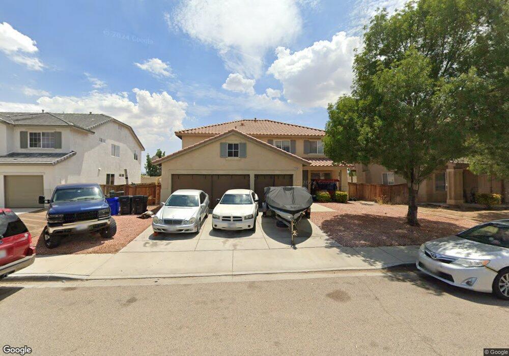
13547 Silversand St Victorville, CA 92394
Mesa Linda NeighborhoodEstimated Value: $507,794 - $567,000
5
Beds
4
Baths
3,331
Sq Ft
$163/Sq Ft
Est. Value
About This Home
This home is located at 13547 Silversand St, Victorville, CA 92394 and is currently estimated at $542,199, approximately $162 per square foot. 13547 Silversand St is a home located in San Bernardino County with nearby schools including West Creek Elementary School and Adelanto High School.
Ownership History
Date
Name
Owned For
Owner Type
Purchase Details
Closed on
Feb 19, 2008
Sold by
Park Stewart C and Park Stella H
Bought by
Park Stewart C and Park Stella H
Current Estimated Value
Purchase Details
Closed on
May 3, 2004
Sold by
Kb Home Greater Los Angeles Inc
Bought by
Park Stewart C and Park Stella H
Home Financials for this Owner
Home Financials are based on the most recent Mortgage that was taken out on this home.
Original Mortgage
$206,900
Interest Rate
5.62%
Mortgage Type
Purchase Money Mortgage
Create a Home Valuation Report for This Property
The Home Valuation Report is an in-depth analysis detailing your home's value as well as a comparison with similar homes in the area
Home Values in the Area
Average Home Value in this Area
Purchase History
| Date | Buyer | Sale Price | Title Company |
|---|---|---|---|
| Park Stewart C | -- | None Available | |
| Park Stewart C | -- | None Available | |
| Park Stewart C | $296,000 | Fidelity-Riverside |
Source: Public Records
Mortgage History
| Date | Status | Borrower | Loan Amount |
|---|---|---|---|
| Previous Owner | Park Stewart C | $206,900 |
Source: Public Records
Tax History Compared to Growth
Tax History
| Year | Tax Paid | Tax Assessment Tax Assessment Total Assessment is a certain percentage of the fair market value that is determined by local assessors to be the total taxable value of land and additions on the property. | Land | Improvement |
|---|---|---|---|---|
| 2025 | $4,760 | $412,603 | $69,697 | $342,906 |
| 2024 | $4,760 | $404,512 | $68,330 | $336,182 |
| 2023 | $4,713 | $396,580 | $66,990 | $329,590 |
| 2022 | $4,626 | $388,803 | $65,676 | $323,127 |
| 2021 | $4,888 | $381,179 | $64,388 | $316,791 |
| 2020 | $4,577 | $358,200 | $71,400 | $286,800 |
| 2019 | $4,503 | $347,700 | $69,300 | $278,400 |
| 2018 | $4,639 | $347,700 | $69,300 | $278,400 |
| 2017 | $4,287 | $323,500 | $64,500 | $259,000 |
| 2016 | $3,982 | $299,500 | $59,700 | $239,800 |
| 2015 | $3,586 | $276,000 | $55,000 | $221,000 |
| 2014 | $3,180 | $223,000 | $45,000 | $178,000 |
Source: Public Records
Map
Nearby Homes
- 13551 Western Meadows Ln
- 14964 Butler Peak Ct
- 13651 Gold Stone Place
- 14991 Mandalay Ln
- 15184 Brucite Rd
- 14766 Shetland Ct
- 15203 Zircon Dr
- 15134 Paseo Verde Place
- 13720 Dove Ct
- 15121 Sorrel Rd
- 15165 Bluffside Ln
- Residence 1310 Plan at Dawson Pointe at West Creek
- Residence 1583 Plan at Dawson Pointe at West Creek
- Residence 2057 Plan at Dawson Pointe at West Creek
- Residence 2260 Plan at Dawson Pointe at West Creek
- Residence 1816 Plan at Dawson Pointe at West Creek
- 15255 Sunray Ct
- 0 Diamond Rd
- 0 Brucite Rd Unit HD24249241
- 13509 Seneca Rd
- 13535 Silversand St
- 13559 Silversand St
- 13525 Silversand St
- 13571 Silversand St
- 13548 Silversand St
- 13536 Silversand St
- 13560 Silversand St
- 13515 Silversand St
- 13581 Silversand St
- 13526 Silversand St
- 13572 Silversand St
- 13516 Silversand St
- 13593 Silversand St
- 13503 Silversand St
- 13582 Silversand St
- 13547 Copper St
- 13535 Copper St
- 13559 Copper St
- 13525 Copper St
- 13504 Silversand St