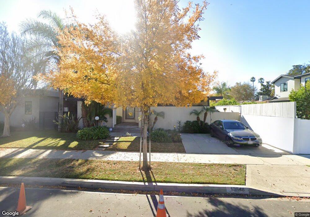
13548 Morrison St Sherman Oaks, CA 91423
Estimated Value: $1,343,000 - $1,704,000
2
Beds
2
Baths
1,944
Sq Ft
$781/Sq Ft
Est. Value
About This Home
This home is located at 13548 Morrison St, Sherman Oaks, CA 91423 and is currently estimated at $1,517,399, approximately $780 per square foot. 13548 Morrison St is a home located in Los Angeles County with nearby schools including Ulysses S. Grant Senior High School, Riverside Drive Charter Elementary School, and Dixie Canyon Avenue Elementary School.
Ownership History
Date
Name
Owned For
Owner Type
Purchase Details
Closed on
Jul 24, 2023
Sold by
Israel Laurance B and Israel Gulnur
Bought by
Israel Family Trust and Israel
Current Estimated Value
Purchase Details
Closed on
Sep 19, 1995
Sold by
Obrien Nancy Stern
Bought by
Israel Laurance B
Home Financials for this Owner
Home Financials are based on the most recent Mortgage that was taken out on this home.
Original Mortgage
$241,200
Interest Rate
7.97%
Create a Home Valuation Report for This Property
The Home Valuation Report is an in-depth analysis detailing your home's value as well as a comparison with similar homes in the area
Home Values in the Area
Average Home Value in this Area
Purchase History
| Date | Buyer | Sale Price | Title Company |
|---|---|---|---|
| Israel Family Trust | -- | None Listed On Document | |
| Israel Laurance B | $268,000 | Progressive Title Company |
Source: Public Records
Mortgage History
| Date | Status | Borrower | Loan Amount |
|---|---|---|---|
| Previous Owner | Israel Laurance B | $241,200 |
Source: Public Records
Tax History Compared to Growth
Tax History
| Year | Tax Paid | Tax Assessment Tax Assessment Total Assessment is a certain percentage of the fair market value that is determined by local assessors to be the total taxable value of land and additions on the property. | Land | Improvement |
|---|---|---|---|---|
| 2025 | $5,479 | $445,188 | $265,787 | $179,401 |
| 2024 | $5,479 | $436,460 | $260,576 | $175,884 |
| 2023 | $5,375 | $427,903 | $255,467 | $172,436 |
| 2022 | $5,128 | $419,513 | $250,458 | $169,055 |
| 2021 | $5,057 | $411,289 | $245,548 | $165,741 |
| 2019 | $10,744 | $399,092 | $238,266 | $160,826 |
| 2018 | $8,040 | $391,268 | $233,595 | $157,673 |
| 2016 | $4,570 | $376,076 | $224,525 | $151,551 |
| 2015 | $4,504 | $370,428 | $221,153 | $149,275 |
| 2014 | $4,524 | $363,172 | $216,821 | $146,351 |
Source: Public Records
Map
Nearby Homes
- 5003 Mammoth Ave
- 4710 Ventura Canyon Ave
- 5116 Sunnyslope Ave
- 5056 Greenbush Ave
- 5110 Greenbush Ave
- 13521 Magnolia Blvd
- 4627 Sunnyslope Ave
- 4616 Ventura Canyon Ave
- 5249 Ventura Canyon Ave
- 4546 Allott Ave
- 5109 Longridge Ave
- 14000 Morrison St
- 4702 Fulton Ave Unit 107
- 4702 Fulton Ave Unit 202
- 13925 Branton Place
- 4615 Fulton Ave
- 4477 Woodman Ave Unit 304
- 4512 Sunnyslope Ave
- 13232 Magnolia Blvd
- 36010 Ventura Canyon Ave
- 13542 Morrison St
- 4924 Ventura Canyon Ave
- 4918 Ventura Canyon Ave
- 13536 Morrison St
- 4912 Ventura Canyon Ave
- 13549 Huston St
- 13543 Huston St
- 13537 Huston St
- 4904 Ventura Canyon Ave
- 13549 Morrison St
- 13555 Morrison St
- 13543 Morrison St
- 13537 Morrison St
- 13531 Huston St
- 13561 Morrison St
- 13526 Morrison St
- 13533 Morrison St
- 13601 Huston St
- 13525 Huston St
- 13601 Morrison St